
Hide
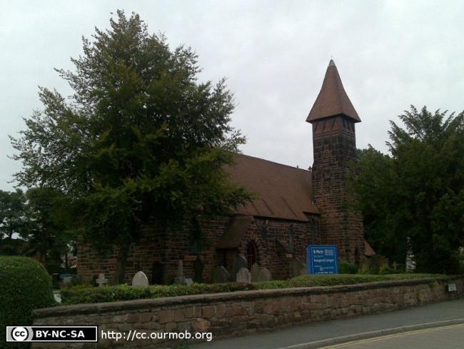
St Mary the Virgin, Partington, Church of England
hide
Hide
Hide
St Mary the Virgin,
Manchester Road,
Partington
Hide
It was founded in 1884.
Manchester Road.
Church History
Built in 1884 as the district church for Partington (previously in the chapelry of Carrington: St. George and the parish of Bowdon: St. Mary). The boundaries of "The District Chapel of Saint Mary, Partington" were described in the London Gazette on 10 March 1885:
"All that part of the parish of Bowdon in the county of Chester and in the diocese of Chester which forms part of the chapelry or conventional cure of Saint George Carrington, and which is co-extensive with the limits of the township of Partington."
Church Records
C = Christenings (Baptisms) ; M = Marriages ; B = Burials ; BTs = Bishop's Transcripts
| Original Registers | C 1874-1994 — Cheshire Archives (P 272). C from 1994 ; M from 1885 ; B from 1890 — Church |
| Bishop's Transcripts | 1891-1910 (microfilmed) — Cheshire Archives |
| Monumental Inscriptions | Published by the Family History Society of Cheshire (edited by G. Normansell), 1998 (partial) |
It is located at SJ7182391568 (Lat/Lon 53.420152, -2.425442). You can see this on maps provided by:
- OpenStreetMap
- Google Maps
- StreetMap (Current Ordnance Survey maps)
- Bing (was Multimap)
- Old Maps Online
- National Library of Scotland (Old Ordnance Survey maps)
- Vision of Britain (Click "Historical units & statistics" for administrative areas.)
- English Jurisdictions in 1851 (Unfortunately the LDS have removed the facility to enable us to specify a starting location, you will need to search yourself on their map.)
- Magic (Geographic information) (Click + on map if it doesn't show)
- GeoHack (Links to on-line maps and location specific services.)