
Hide
St Luke the Evangelist, Brinnington, Church of England
hide
Hide
Hide
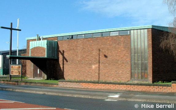
St Luke the Evangelist,
Brinnington Road/Northumberland Road,
Brinnington
Hide
It was founded in 1959.
Brinnington Road/Northumberland Road
Church History
Opened in 1959 as a chapel to Bredbury: St. Mark. On 11 April 1963 it became the district church for Brinnington (previously served by Bredbury: St. Mark and Portwood: St. Paul).
On 23 June 1971 the district was united with that of Portwood: St. Paul to form the combined district of "Brinnington with Portwood".
Church Records
C = Christenings (Baptisms) ; M = Marriages ; B = Burials ; BTs = Bishop's Transcripts
| Original Registers | C 1959-2006 ; M 1965-2006 — Cheshire Archives (P 339) C from 2006 ; M from 2006 — Church |
| Copies and Indexes | M 1965-2006 — Cheshire BMD (ST:ST1) |
| Notes | B — none |
It is located at SJ9128292273 (Lat/Lon 53.427174, -2.13266). You can see this on maps provided by:
- OpenStreetMap
- Google Maps
- StreetMap (Current Ordnance Survey maps)
- Bing (was Multimap)
- Old Maps Online
- National Library of Scotland (Old Ordnance Survey maps)
- Vision of Britain (Click "Historical units & statistics" for administrative areas.)
- English Jurisdictions in 1851 (Unfortunately the LDS have removed the facility to enable us to specify a starting location, you will need to search yourself on their map.)
- Magic (Geographic information) (Click + on map if it doesn't show)
- GeoHack (Links to on-line maps and location specific services.)