
Hide
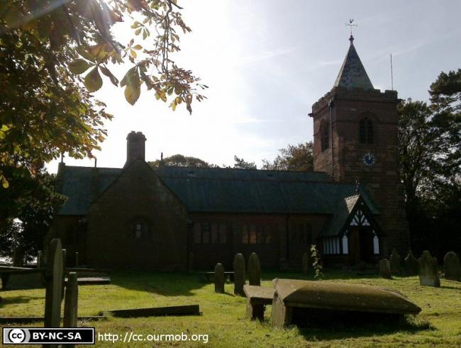
St Mary, Dodleston, Church of England
hide
Hide
Hide
St Mary,
Church Road,
Dodleston
Hide
It was founded in 1570.
Church History
An ancient parish church, serving the townships of Dodleston and Lower Kinnerton (Cheshire) and Higher Kinnerton (Flintshire).
Church Records
C = Christenings (Baptisms) ; M = Marriages ; B = Burials ; BTs = Bishop's Transcripts
| Original Registers | C 1570-1903 ; M 1570-1983 ; B 1570-1880 — Cheshire Archives (P 115) C from 1903 ; M from 1983 ; B from 1880 — Church |
| Microfilm Copies | C 1570-1903 ; M 1570-1983 ; B 1570-1880 — Cheshire Archives C 1570-1903 ; M 1570-1837 ; B 1570-1880— Manchester Archives & Local Studies ; Family History Society of Cheshire |
| Bishop's Transcripts | 1584, 1586, 1599-1601, 1604, 1608, 1611, 1613, 1617-18, 1624, 1629-33, 1638, 1641, 1662-63, 1668, 1670-78, 1680-83, 1685, 1687, 1689-90, 1694-98, 1712-16, 1718, 1720-28, 1730, 1732-35, 1737-41, 1743-86, 1788-1803,1805-47, 1851,1861-72 (microfilmed) — Cheshire Archives |
| Copies and Indexes | CMB 1570-1970 — published by Dodleston Local History Group and the Family History Society of Cheshire (3 vols.), 1997-99 CMB 1662-1724 (transcript by A. J. Farrington from BTs) — Cheshire Archives ;, Society of Genealogists' Library M 1570-1837 — Hayes M 1580-1837 (incomplete) — Bertram Merrell Marriage Index of Cheshire (1750-1836) M 1837-1958 — Cheshire BMD (CW:CE19) |
| Monumental Inscriptions | Published by Dodleston Local History Group and the Family History Society of Cheshire, 1996 |
| Notes | CMB 1646-1725 — omitted from registers (except for some CB 1718-1719) |
It is located at SJ3621260937 (Lat/Lon 53.141741, -2.955056). You can see this on maps provided by:
- OpenStreetMap
- Google Maps
- StreetMap (Current Ordnance Survey maps)
- Bing (was Multimap)
- Old Maps Online
- National Library of Scotland (Old Ordnance Survey maps)
- Vision of Britain (Click "Historical units & statistics" for administrative areas.)
- English Jurisdictions in 1851 (Unfortunately the LDS have removed the facility to enable us to specify a starting location, you will need to search yourself on their map.)
- Magic (Geographic information) (Click + on map if it doesn't show)
- GeoHack (Links to on-line maps and location specific services.)