Hide
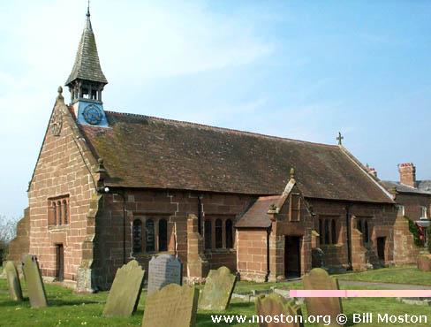
St Peter, Hargrave, Church of England
hide
Hide
Hide
St Peter,
Church Lane,
Hargrave
Hide
It was founded in 1627.
Church Lane, Foulk Stapleford.
Church History
An ancient chapel to Tarvin: St. Andrew. In 1878 it became the district church for the townships of Foulk Stapleford and Huxley (previously served by Tarvin: St. Andrew and Waverton: St. Peter). The London Gazette for 21 May 1878 set out the boundaries of "The Consolidated Chapelry of Saint Peter Hargrave" as follows:
"All that portion of the parish of Tarvin in the county of Chester and in the diocese of Chester which is comprised within and is co-extensive with the limits of the township of Foulk Stapleford otherwise called or known as the parochial chapelry of Hargrave"
"And also all that contiguous portion of the parish of Waverton in the county and diocese aforesaid which is comprised within and is co-extensive with the limits of the township of Huxley".
Church Records
C = Christenings (Baptisms) ; M = Marriages ; B = Burials ; BTs = Bishop's Transcripts
| Original Registers | C 1744-1979 ; M 1746-1749, 1841-2008 ; B 1744-1995 — Cheshire Archives (P 78) C from 1979 ; M from 1997 ; B from 1996 — Church |
| Microfilm Copies | C 1744-1979 ; M 1746-1749, 1841-1991 ; B 1744-1995 — Cheshire Archives C 1744-1883 ; M 1746-1749 ; B 1744-1813 — Family History Society of Cheshire |
| Bishop's Transcripts | 1632-35, 1637, 1639-41, 1666, 1668, 1671-2, 1676-78, 1680-85, 1806-49, 1851-69, 1883-89 (microfilmed) — Cheshire Archives |
| Copies and Indexes | M 1841-1958 — Cheshire BMD (CW:CE29) B 1744-1995 (transcript by Hargrave & Huxley History Group) — Cheshire Archives B 1744-1995 — National Burial Index |
| Monumental Inscriptions | Published by the Family History Society of Cheshire (edited by H. Jones), 1992 Transcript by Hargrave & Huxley History Group (edited by J. Whittle), 1998 — Cheshire Archives, Chester Library |
| Notes | CMB 1661-1744 — register(s) missing M 1749-1841 — see Tarvin: St. Andrew |
- OpenStreetMap
- Google Maps
- StreetMap (Current Ordnance Survey maps)
- Bing (was Multimap)
- Old Maps Online
- National Library of Scotland (Old Ordnance Survey maps)
- Vision of Britain (Click "Historical units & statistics" for administrative areas.)
- English Jurisdictions in 1851 (Unfortunately the LDS have removed the facility to enable us to specify a starting location, you will need to search yourself on their map.)
- Magic (Geographic information) (Click + on map if it doesn't show)
- GeoHack (Links to on-line maps and location specific services.)

