
Hide
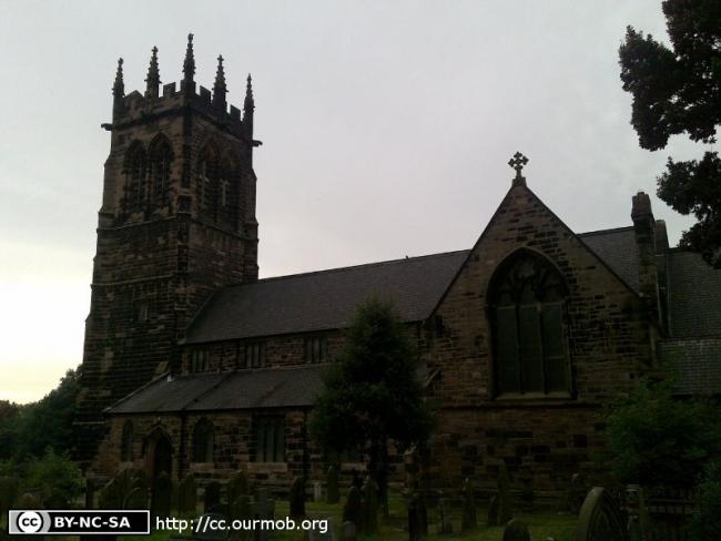
St Mary the Virgin, Lymm, Church of England
hide
Hide
Hide
St Mary the Virgin,
Church Road,
Lymm
Hide
It was founded in 1568.
Church History
An ancient parish church, serving the township of Lymm.
The district was affected by the following boundary changes:
- 1881 December 23 — reduced when part of the township of Lymm was transferred to Oughtrington: St. Peter.
Church Records
C = Christenings (Baptisms) ; M = Marriages ; B = Burials ; BTs = Bishop's Transcripts
| Original Registers | C 1568-1962 ; M 1568-1951 ; B 1568-1949 — Cheshire Archives (P 119) C from 1962 ; M from 1951 ; B from 1949 — Church |
| Microfilm Copies | C 1568-1920 ; M 1568-1905 ; B 1568-1909 — Cheshire Archives C 1568-1890 ; M 1568-1905 ; B 1568-1909 — Family History Society of Cheshire ; Manchester Archives & Local Studies ; Warrington Library |
| Bishop's Transcripts | 1600, 1610, 1613, 1617-18, 1621-25, 1627-33, 1636-41, 1658-60, 1663,1665-66, 1668-76, 1680-82, 1684-85, 1690-1703, 1706-39, 1741-50,1752-1880 (microfilmed) — Cheshire Archives (microfilmed) 1836-1880 (microfilmed) — Family History Society of Cheshire |
| Copies and Indexes | CMB 1568-1871 — Cheshire Parish Register Project M 1568-1812 — published in: Cheshire Parish Registers: Marriages, vol. 1 (Phillimore, 1909) M 1568-1837 — North & East Cheshire Marriage Index - may be viewable at subscription sites such as ancestry or findmypast M 1568-1837 (incomplete) — Bertram Merrell Marriage Index of Cheshire (1750-1836) M 1651-75, 1701-50, 1776-1812 — Boyd's Marriage Index - may be viewable on subscription sites such as ancestry and findmypast M 1837-1933 — Cheshire BMD (WA:C13) B 1568-1872 — National Burial Index |
| Monumental Inscriptions | Transcript by the British Mission Genealogical Board, 1947 (edited by W. J. McEntire) — Cheshire Archives Published by the Family History Society of Cheshire (compiled by Lymm Local History Society), 1990 (partial) |
It is located at SJ6823986821 (Lat/Lon 53.37728, -2.47889). You can see this on maps provided by:
- OpenStreetMap
- Google Maps
- StreetMap (Current Ordnance Survey maps)
- Bing (was Multimap)
- Old Maps Online
- National Library of Scotland (Old Ordnance Survey maps)
- Vision of Britain (Click "Historical units & statistics" for administrative areas.)
- English Jurisdictions in 1851 (Unfortunately the LDS have removed the facility to enable us to specify a starting location, you will need to search yourself on their map.)
- Magic (Geographic information) (Click + on map if it doesn't show)
- GeoHack (Links to on-line maps and location specific services.)