
Hide
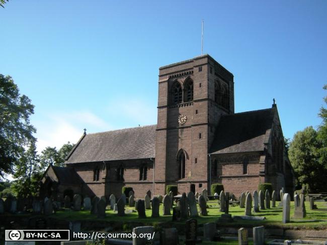
St John the Evangelist, Norley, Church of England
hide
Hide
Hide
St John the Evangelist,
Norley Road,
Norley
Hide
It was founded in 1833.
Norley Road
Church History
Founded in 1833 as a chapel to Frodsham: St. Lawrence. In 1861 it became the district church for the township of Norley.
The district was affected by the following boundary changes:
- 1872 April 23 — reduced when a detached part of the township of Norley was transferred to Crowton: Christ Church.
Church Records
C = Christenings (Baptisms) ; M = Marriages ; B = Burials ; BTs = Bishop's Transcripts
| Original Registers | C 1833-1923 ; M 1838-1979 ; B 1834-1962 — Cheshire Archives (P 314) C from 1923 ; M from 1979 ; B from 1962 — Church |
| Bishop's Transcripts | 1855-56, 1887-99 (microfilmed) — Cheshire Archives ; Family History Society of Cheshire |
| Copies and Indexes | M 1838-1973 — Cheshire BMD (CW:139) B 1899-1916 (copy register) — Cheshire Archives |
| Monumental Inscriptions | Published by the Family History Society of Cheshire (edited by M. Bullock), 1992 |
It is located at SJ5607872829 (Lat/Lon 53.250643, -2.659742). You can see this on maps provided by:
- OpenStreetMap
- Google Maps
- StreetMap (Current Ordnance Survey maps)
- Bing (was Multimap)
- Old Maps Online
- National Library of Scotland (Old Ordnance Survey maps)
- Vision of Britain (Click "Historical units & statistics" for administrative areas.)
- English Jurisdictions in 1851 (Unfortunately the LDS have removed the facility to enable us to specify a starting location, you will need to search yourself on their map.)
- Magic (Geographic information) (Click + on map if it doesn't show)
- GeoHack (Links to on-line maps and location specific services.)