
Hide
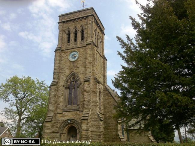
St Michael, North Rode, Church of England
hide
Hide
Hide
St Michael,
Church Lane/Manor Park Road,
North Rode
Hide
It was founded in 1846.
Church History
In 1846 it became the district church for the township of North Rode (previously served by Prestbury: St. Peter and Gawsworth: St. James).
Church Records
C = Christenings (Baptisms) ; M = Marriages ; B = Burials ; BTs = Bishop's Transcripts
| Original Registers | C 1846-2004 ; B 1846-2004 — Cheshire Archives (P 318) C from 2004 ; M from 2004 ; B from 1846 — Church |
| Bishop's Transcripts | 1846-61, 1879-89 (microfilmed) — Cheshire Archives |
| Copies and Indexes | M 1846-1993 — Cheshire BMD (CE:1067) |
| Monumental Inscriptions | Published by Macclesfield Ferrets/Graveyard Press, 1996 |
It is located at SJ8893066533 (Lat/Lon 53.195765, -2.16715). You can see this on maps provided by:
- OpenStreetMap
- Google Maps
- StreetMap (Current Ordnance Survey maps)
- Bing (was Multimap)
- Old Maps Online
- National Library of Scotland (Old Ordnance Survey maps)
- Vision of Britain (Click "Historical units & statistics" for administrative areas.)
- English Jurisdictions in 1851 (Unfortunately the LDS have removed the facility to enable us to specify a starting location, you will need to search yourself on their map.)
- Magic (Geographic information) (Click + on map if it doesn't show)
- GeoHack (Links to on-line maps and location specific services.)