
Hide
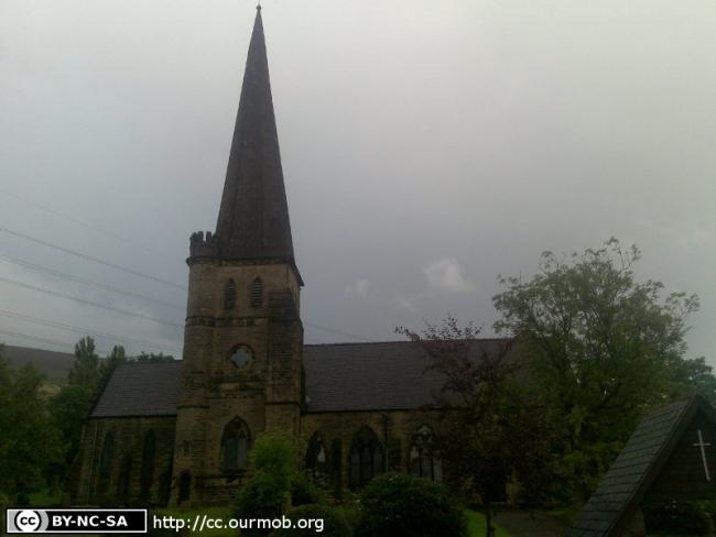
St James, Millbrook, Church of England
hide
Hide
Hide
St James,
Huddersfield Road,
Millbrook
Hide
It was founded in 1863.
Church History
In 1863 it became the district church for part of the township of Stayley (previously served by Stalybridge: St. Paul). The boundaries of "The District Chapelry of Saint James, Millbrook" were described in the London Gazette on 15 September 1863:
"All that part of the particular district of Saint Paul, Stalybridge, in the county of Chester, and in the diocese of Chester, wherein the present incumbent of such district now possesses the exclusive cure of souls, which is situate to the north of an imaginary line extending along the middle of Brushes Brook otherwise called 'Mear Brook'. "
The district was affected by the following boundary change:
- 1962 January 25 — reduced when the village of Micklehurst was transferred to Micklehurst: All Saints.
Church Records
C = Christenings (Baptisms) ; M = Marriages ; B = Burials ; BTs = Bishop's Transcripts
| Original Registers | C 1863-1967 ; M 1863-1990 ; B 1863-1997 — Cheshire Archives (P 168) C from 1967 ; M from 1990 ; B from 1997 — Church |
| Microfilm Copies | C 1863-1967 ; M 1863-1947 ; B 1863-1997 — Cheshire Archives |
| Bishop's Transcripts | 1873-1898 (microfilmed) — Cheshire Archives ; Tameside Local Studies |
| Copies and Indexes | M 1863-1990 — Cheshire BMD (TA:CE30) |
- OpenStreetMap
- Google Maps
- StreetMap (Current Ordnance Survey maps)
- Bing (was Multimap)
- Old Maps Online
- National Library of Scotland (Old Ordnance Survey maps)
- Vision of Britain (Click "Historical units & statistics" for administrative areas.)
- English Jurisdictions in 1851 (Unfortunately the LDS have removed the facility to enable us to specify a starting location, you will need to search yourself on their map.)
- Magic (Geographic information) (Click + on map if it doesn't show)
- GeoHack (Links to on-line maps and location specific services.)