
Hide
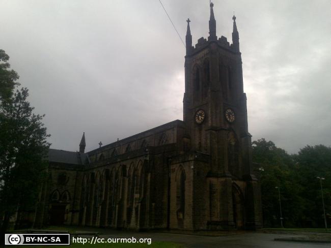
St Paul, Stalybridge, Church of England
hide
Hide
Hide
St Paul,
Huddersfield Road,
Stalybridge
Hide
It was founded in 1839.
Also known as: Stayley: St. Paul.
Huddersfield Road.
Church History
From 1840 a district church for the township of Stayley (previously served by Mottram In Longdendale: St. Michael).
The district was affected by the following boundary changes:
- 1848 August 17 — reduced when part of the township of Stayley was transferred to the Lancashire parish of Friezland: Christ Church (in the diocese of Manchester)
- 1863 September 15 — reduced when part of the township of Stayley was transferred to Millbrook: St. James.
- 1959 May 15 — reduced when the following area was transferred to Stalybridge: Holy Trinity: "All that part of the parish of Saint Paul, Stalybridge which lies to the southwest of an imaginary line commencing at a point on the boundary which divides the parish of Old Saint George's, Stalyibridge from the parish of Saint Paul, Stalybridge in the centre of the Staly Bridge and extending thence eastwards along the middle of the said Bridge to the northwestern end of Mottram Road, thence first eastwards then southeastwards along the middle of Mottram Road to a point opposite the middle of the eastern end of the roadway leading into Cheetham Park, thence southwestwards to then generally southwestwards along the middle of the last mentioned roadway to a point in the middle of Acres Brook on the boundary which divides the parish of Saint Paul, Stalybridge from the parish of Castle Hall".
Church Records
C = Christenings (Baptisms) ; M = Marriages ; B = Burials ; BTs = Bishop's Transcripts
| Original Registers | C 1839-1999 ; M 1841-1999 ; B 1839-1991 — Cheshire Archives (P 150) C from 1999 ; M from 1999 ; B from 1991 — Church |
| Microfilm Copies | C 1839-1944 ; M 1841-1965 ; B 1839-1991 — Cheshire Archives C 1839-1944 ; M 1841-1943 ; B 1839-1967 — Tameside Local Studies M 1841-1872 — Family History Society of Cheshire |
| Copies and Indexes | C 1839-1894 — Tameside Local Studies M 1841-1999 — Cheshire BMD (TA:CE35) B 1839-1889 — National Burial Index B 1839-1905 — North Cheshire Family History Society B 1839-1991 (transcript by G. Clark, 13 vols.) — Cheshire Archives ; Tameside Local Studies |
| Monumental Inscriptions | Transcript by G. Clark, 1991 — Cheshire Archives ; Tameside Local Studies |
It is located at SJ9714098716 (Lat/Lon 53.485153, -2.044575). You can see this on maps provided by:
- OpenStreetMap
- Google Maps
- StreetMap (Current Ordnance Survey maps)
- Bing (was Multimap)
- Old Maps Online
- National Library of Scotland (Old Ordnance Survey maps)
- Vision of Britain (Click "Historical units & statistics" for administrative areas.)
- English Jurisdictions in 1851 (Unfortunately the LDS have removed the facility to enable us to specify a starting location, you will need to search yourself on their map.)
- Magic (Geographic information) (Click + on map if it doesn't show)
- GeoHack (Links to on-line maps and location specific services.)