
Hide
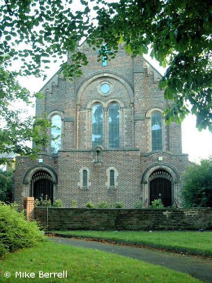
St Saviour, Stockport, Church of England
hide
Hide
Hide
St Saviour,
St Saviours Road, Great Moor,
Stockport
Hide
It was founded in 1879.
Buxton Road, Great Moor.
Church History
Founded in 1879 as a chapel to Stockport: St. George. A separate parish from 1934, including Stepping Hill: Hospital Chapel.
Church Records
C = Christenings (Baptisms) ; M = Marriages ; B = Burials ; BTs = Bishop's Transcripts
| Original Registers | C 1879-1974 ; M 1935-1970 — Cheshire Archives (P 245) C from 1974 ; M from 1970 — Church |
| Microfilm Copies | C 1879-1948 ; M 1935-1970 — Cheshire Archives |
| Copies and Indexes | M 1935-2013 — Cheshire BMD (ST:ST18) |
It is located at SJ9116787967 (Lat/Lon 53.388466, -2.134269). You can see this on maps provided by:
- OpenStreetMap
- Google Maps
- StreetMap (Current Ordnance Survey maps)
- Bing (was Multimap)
- Old Maps Online
- National Library of Scotland (Old Ordnance Survey maps)
- Vision of Britain (Click "Historical units & statistics" for administrative areas.)
- English Jurisdictions in 1851 (Unfortunately the LDS have removed the facility to enable us to specify a starting location, you will need to search yourself on their map.)
- Magic (Geographic information) (Click + on map if it doesn't show)
- GeoHack (Links to on-line maps and location specific services.)