
Hide
Aldingham
hide
Hide
hide
Hide
hide
Hide
Hide
ALDINGHAM, a parish in Ulverstone district, Lancashire; on Morecambe bay, 4 miles E of Furness Abbey r. station, and 5 S by W of Ulverstone. It includes the divisions of Gleaston and Leece. Post Town, Bardsea under Ulverstone. Acres, 4,694. Real property, £8,497. Pop., 1,011. Houses, 186. The property is much sub-divided. Much land formerly in the parish has been carried off by the sea. Gleaston Castle, now a ruin of three towers, with connecting walls, was a seat of the Flemings, and of the Duke of Suffolk, the father of Lady Jane Grey. The living is a rectory in the diocese of Carlisle. Value, £1,093.* Patron, the Crown. The church is very good. The p. curacy of Dendron is a separate benefice. Charities, £15.
John Marius Wilson, Imperial Gazetteer of England and Wales (1870-72)
Hide
Local studies information is held at Cumbria Record Office & Local Studies Library, Barrow.
Details about the census records, and indexes for Aldingham.
| Gleaston Congregational |
The Register Office covering the Aldingham area is Ulverston.
Aldingham parish from Mannix & Co., History, Topography and Directory of Westmorland, 1851.
The National Gazetteer of Great Britain and Ireland - 1868
"ALDINGHAM, a parish in the hundred of North Lonsdale, in the county palatine of Lancaster, 4 miles-to the S.E. of Dalton-in-Furness. It includes, besides the townships of Upper and Lower Aldingham, those of Gleaston and Leece, and the chapelry of Dendron. It is situated on the coast of Morecambe Bay. The sea has encroached and washed away a considerable part of the parish, so that the church is within reach of a high tide, although formerly it stood in the centre of the parish. On a spot now covered by the sea, once stood Aldingham Hall, an ancient seat of the family of the Flemings. The living is a rectory in the diocese of Carlisle, value £1,093, in the patronage of the crown. The church is dedicated to St. Cuthbert. In addition to the parish there is a district church at Dendron, which is a perpetual curacy, value £80, in the patronage of the rector. There is an endowed school founded by Dickenson. There are ruins of a castle in Gleaston township: Traces of two encampments, one circular, the other square, are found."
"DENDRON, a hamlet and chapelry in the parish of Aldingham, in the county of Lancaster, 3 miles S. of Dalton. The living is a perpetual curacy in the diocese of Chester, value £41, in the patronage of the Rector of Aldingham. The church was rebuilt at the commencement of the present century by Thomas Green, Esq."
"GLEASTON, a township in the parish of Aldingham, hundred of Lonsdale North of the Sands, county Lancaster, 3 miles S.E. of Dalton. Here are the ruins of Gleaston Castle, the old seat of the Flemings."
"LEECE, a village in the parish of Aldingham, county Lancashire, 3 miles S.E. of Dalton."
John Marius Wilson, Imperial Gazetteer of England and Wales - 1870-2
- Ask for a calculation of the distance from Aldingham to another place.
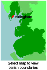
View a map of the boundaries of this town/parish.
You can see maps centred on OS grid reference SD266703 (Lat/Lon: 54.123383, -3.124092), Aldingham which are provided by:
- OpenStreetMap
- Google Maps
- StreetMap (Current Ordnance Survey maps)
- Bing (was Multimap)
- Old Maps Online
- National Library of Scotland (Old Ordnance Survey maps)
- Vision of Britain (Click "Historical units & statistics" for administrative areas.)
- English Jurisdictions in 1851 (Unfortunately the LDS have removed the facility to enable us to specify a starting location, you will need to search yourself on their map.)
- Magic (Geographic information) (Click + on map if it doesn't show)
- GeoHack (Links to on-line maps and location specific services.)
- All places within the same township/parish shown on an Openstreetmap map.
- Nearby townships/parishes shown on an Openstreetmap map.
- Nearby places shown on an Openstreetmap map.
For probate purposes prior to 1858, Aldingham was in the Archdeaconry of Richmond, in the Diocese of Chester. The original wills for the Archdeaconry of Richmond are held at the Lancashire Record Office.
You can also see Family History Societies covering the nearby area, plotted on a map. This facility is being developed, and is awaiting societies to enter information about the places they cover.