
Hide
Cave Browne Evangelical, Ashton in Makerfield
hide
Hide
Hide
Hide
The church was duly built and was known as 'Cave-Browne Protestant Institute'. The running of the church became the responsibility of a Church Council who were selected from the men who had committed themselves to the work. A church leader known as the Church President was appointed from this body of men. This organisation remains today with a Church Council and a Church Leader
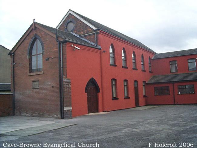
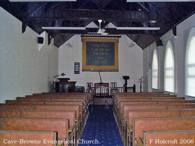
Apart from two extensions, the main body of the building remains the same as in 1882. Of course, the interior has changed a lot. The wooden pews have been replaced by modern, more comfortable seating and the facilities now include a fitted kitchen, lounge and a créche. The old 'bellows' organ has been replaced by an electronic machine that can almost talk! The Church banner which was carried through the streets on the annual 'walking day' now hangs at the front of the church proclaiming 'Jesus Said, I am the way, the truth, and the life'. The annual walk was accompanied by a brass band and ended with an open-air service on Ashton Heath. This was replaced by an 'Anniversary Day' many years ago.
This site provides historical information about churches, other places of worship and cemeteries. It has no connection with the churches themselves. For current information you should contact them directly.
- OpenStreetMap
- Google Maps
- StreetMap (Current Ordnance Survey maps)
- Bing (was Multimap)
- Old Maps Online
- National Library of Scotland (Old Ordnance Survey maps)
- Vision of Britain (Click "Historical units & statistics" for administrative areas.)
- English Jurisdictions in 1851 (Unfortunately the LDS have removed the facility to enable us to specify a starting location, you will need to search yourself on their map.)
- Magic (Geographic information) (Click + on map if it doesn't show)
- GeoHack (Links to on-line maps and location specific services.)