
Hide
Albion, Ashton under Lyne, Congregational
hide
Hide
Hide
Stamford Street,
Ashton under Lyne
Hide
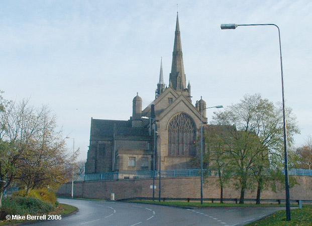
The Refuge Chapel became too small for its increased parishioners and in 1834 purchased a number of nearby cottages which, when rebuilt was named Albion Chapel.
By 1889 the Albion Chapel on Penny Meadow again became too small, its use being better served as an extension for the Day School, but a new site for the Chapel needed to be found.
The new church opened in 1895.
In 1972 the Congregational church joined with the English Presbyterian church to become the United Reformed Church. The Penny Meadow church was located
This site provides historical information about churches, other places of worship and cemeteries. It has no connection with the churches etc. themselves. For current information you should contact them directly.
- OpenStreetMap
- Google Maps
- StreetMap (Current Ordnance Survey maps)
- Bing (was Multimap)
- Old Maps Online
- National Library of Scotland (Old Ordnance Survey maps)
- Vision of Britain (Click "Historical units & statistics" for administrative areas.)
- English Jurisdictions in 1851 (Unfortunately the LDS have removed the facility to enable us to specify a starting location, you will need to search yourself on their map.)
- Magic (Geographic information) (Click + on map if it doesn't show)
- GeoHack (Links to on-line maps and location specific services.)