
Hide
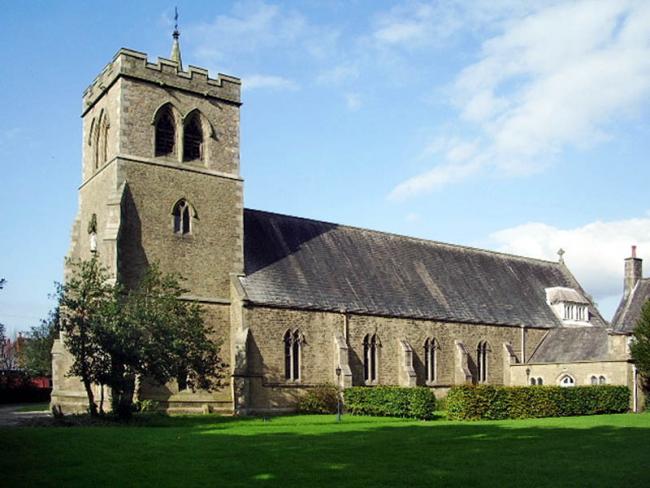
Bonds, St Mary and St Michael, Roman Catholic
hide
Hide
© Copyright Alexander P Kapp and licensed for reuse under this Creative Commons Licence
Hide
Hide
1857-2001
Transcript of monumental inscriptions 1857-2001 held by Lancashire Archives - Searchroom
It was founded in 1775.
This site provides historical information about churches, other places of worship and cemeteries. It has no connection with the churches etc. themselves. For current information you should contact them directly.
Whilst every effort has been made to record exact details of record office and library holdings
you are recommended to check with them before visiting to ensure that they do hold the records and years you
wish to examine. Similarly check with transcript publishers to ensure they cover the records and years
you require before making a purchase.
Original Registers
Baptisms
- 1788-1897 held by Lancashire Record Office RCG
- 1788-1897 held by Lancashire Record Office RCG
Marriages
- 1791-1855 held by Lancashire Record Office RCG
- 1791-1855 held by Lancashire Record Office RCG
Burials
- 1798-1799 held by Lancashire Record Office RCG
- 1798-1799 held by Lancashire Record Office RCG
- 1824-1825 held by Lancashire Record Office RCG
- 1824-1825 held by Lancashire Record Office RCG
- 1856-1914 held by Lancashire Record Office RCG
- 1856-1914 held by Lancashire Record Office RCG
Copies of Original Registers
Baptisms
- 1788-1824 Catholic Record Society held by Lancashire Record Office CRS 16 - Printed
- 1788-1824 Catholic Record Society held by Lancashire Record Office CRS 16 - Printed
- 1788-1897 held by Lancashire Record Office MF 9/236-237 - Microfilm
- 1788-1897 held by Lancashire Record Office MF 9/236-237 - Microfilm
Marriages
- 1791-1822 Catholic Record Society held by Lancashire Record Office CRS 16 - Printed
- 1791-1822 Catholic Record Society held by Lancashire Record Office CRS 16 - Printed
- 1791-1855 held by Lancashire Record Office MF 9/236-237 - Microfilm
- 1791-1855 held by Lancashire Record Office MF 9/236-237 - Microfilm
Burials
- 1798-1825 held by Lancashire Record Office MF 9/236-237 - Microfilm
- 1798-1825 Catholic Record Society held by Lancashire Record Office CRS 16 - Printed
- 1798-1825 held by Lancashire Record Office MF 9/236-237 - Microfilm
- 1798-1825 Catholic Record Society held by Lancashire Record Office CRS 16 - Printed
- 1856-1914 held by Lancashire Record Office MF 9/236-237 - Microfilm
- 1856-1914 held by Lancashire Record Office MF 9/236-237 - Microfilm
- 1857-1914 held by Lancashire Record Office MF 9/236-237 - Microfilm
- 1857-1914 held by Lancashire Record Office MF 9/236-237 - Microfilm
Register Transcripts
Baptisms
- 1788-1824 Catholic Record Society Volume 16
- 1788-1824 Catholic Record Society Volume 16
Marriages
- 1791-1822 Catholic Record Society Volume 16
- 1791-1822 Catholic Record Society Volume 16
Burials
- 1798-1825 Catholic Record Society Volume 16
- 1798-1825 Catholic Record Society Volume 16
MI
- 1857-2001 held by Lancashire Record Office Searchroom - Microfiche/
- 1857-2001 held by Lancashire Record Office Searchroom - Microfiche/
Indexes
Burials
- 1857-2001 held by Lancashire Record Office Searchroom - Microfiche/
- 1857-2001 held by Lancashire Record Office Searchroom - Microfiche/
Baptisms
1788-1824
Copy of Original Register of baptisms 1788-1824 held by Lancashire Archives - CRS 16
1788-1897
Original Registers of baptisms 1788-1897 held by Lancashire Archives - RCG
1788-1897
Copy of Original Register of baptisms 1788-1897 held by Lancashire Archives - MF 9/236-237
Marriages
1791-1822
Copy of Original Register of marriages 1791-1822 held by Lancashire Archives - CRS 16
1791-1855
Original Registers of marriages 1791-1855 held by Lancashire Archives - RCG
1791-1855
Copy of Original Register of marriages 1791-1855 held by Lancashire Archives - MF 9/236-237
1798-1825
Copy of Original Register of burials 1798-1825 held by Lancashire Archives - MF 9/236-237
1798-1825
Copy of Original Register of burials 1798-1825 held by Lancashire Archives - CRS 16
1824-1825
Original Registers of burials 1824-1825 held by Lancashire Archives - RCG
1856-1914
Original Registers of burials 1856-1914 held by Lancashire Archives - RCG
1856-1914
Copy of Original Register of burials 1856-1914 held by Lancashire Archives - MF 9/236-237
1857-1914
Copy of Original Register of burials 1857-1914 held by Lancashire Archives - MF 9/236-237
1857-2001
Index of burials 1857-2001 held by Lancashire Archives - Searchroom
It is located at SD4945044900 (Lat/Lon 53.897792, -2.770759). You can see this on maps provided by:
- OpenStreetMap
- Google Maps
- StreetMap (Current Ordnance Survey maps)
- Bing (was Multimap)
- Old Maps Online
- National Library of Scotland (Old Ordnance Survey maps)
- Vision of Britain (Click "Historical units & statistics" for administrative areas.)
- English Jurisdictions in 1851 (Unfortunately the LDS have removed the facility to enable us to specify a starting location, you will need to search yourself on their map.)
- Magic (Geographic information) (Click + on map if it doesn't show)
- GeoHack (Links to on-line maps and location specific services.)