
Hide
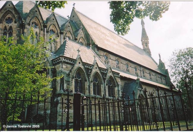
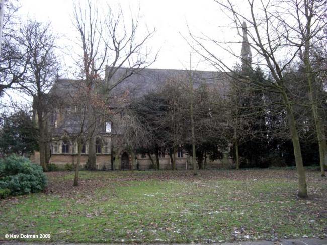
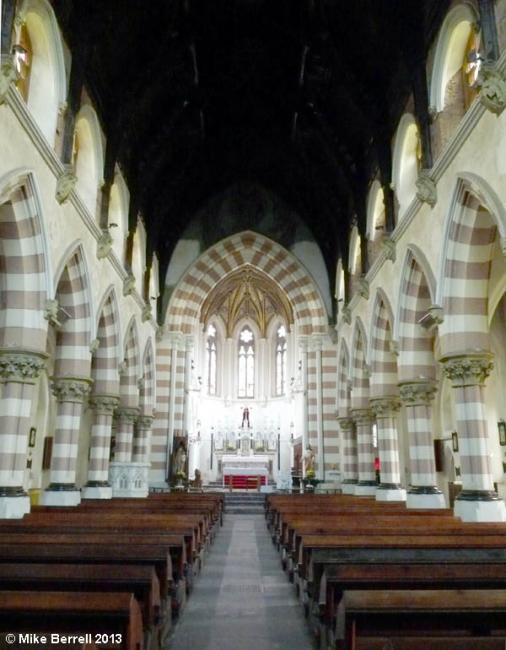
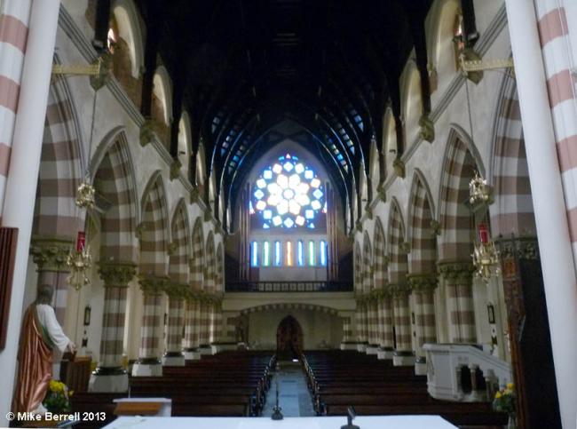
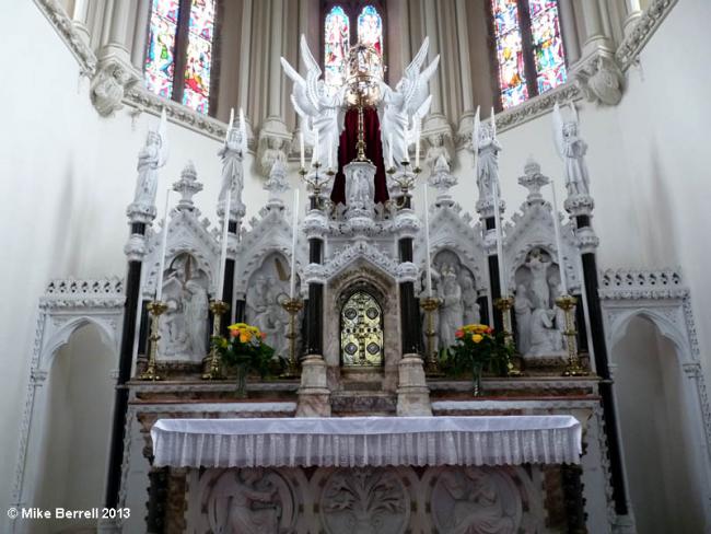
All Saints, Barton on Irwell, Roman Catholic
hide
Hide

Hide
Hide
It was founded before 1793.
This ancient parish is connected with the de Trafford family, and is really the continuation of the Mass centre established at Trafford Hall from the seventeenth century. The mission was opened at Trafford in 1798. In those days the boundaries of this parish extended from Rostherne in Cheshire to the Clifton valley, and from Pendleton to Woolston near Warrington. The following places were included in the parish: Bowdon, Altrincham, Lymm, Ashton-on-Mersey, Brooklands, Sale, Stretford, Urmston, Flixton, Barton, Patricrolt, Eccles, Worsley, Boothstown, Swinton, Pendlebury, Irlam, Cadishead, Astley, Ellenbrook, Walkden, and Chatmoss.The first priest was Fr. T. Haydock; his brother Fr. James Haydock had been chaplain to the de Traffords for some time. Fr. T. Sadler was here from 1805 until his death in 1830. He built the first chapel at Barton, which was later removed to Eccles. Father T. Irving was here for a time in 1830, and then there was a quick succession of priests until Mgr. Canon Kershaw came in 1845 and remained for 45 years. The priests between 1830 and 1845 were: 1830 Rev. H. Newsham; 1832 Rev. T. Ball; 1840 Rev. J. Westhead; 1842 Rev. J. F. Whittaker; 1843 Rev. J. Hill.
The present very fine Gothic church was built by Sir Humphrey de Trafford at a cost of £25,000. It was consecrated in 1868. Since the formation of the Salford diocese, the parishes of Stretford, Eccles, Irlam, and Urmston have been formed from Barton.
Canon James Hayes was Rector from 1890 to 1900, followed by Mgr. Gadd, Fr. Wm. Fowler, and Canon Osmund Woods.
Taken from "Salford Diocese and its Catholic past", a survey by Charles A. Bolton, a Priest of the above Diocese. Published 1950 on the First Centenary for the Diocese of Salford.
This site provides historical information about churches, other places of worship and cemeteries. It has no connection with the churches themselves. For current information you should contact them directly.
Original Registers
Baptisms
- 1793-1832 held by Lancashire Record Office DP 487
- 1793-1832 held by Lancashire Record Office DP 487
- 1793-1904 held by Lancashire Record Office RCBW
- 1793-1904 held by Lancashire Record Office RCBW
Marriages
- 1832-1898 held by Lancashire Record Office RCBW
- 1832-1898 held by Lancashire Record Office RCBW
Burials
- 1823-1854 held by Lancashire Record Office DP 487
- 1823-1854 held by Lancashire Record Office DP 487
Copies of Original Registers
Baptisms
- 1793-1904 held by Lancashire Record Office MF9/190-191 - Microfilm
- 1793-1904 held by Lancashire Record Office MF9/190-191 - Microfilm
- 1871-1941 held by Lancashire Record Office MF 1/161 - Microfilm
- 1871-1941 held by Lancashire Record Office MF 1/161 - Microfilm
- 1947-1962 held by Lancashire Record Office RCSF 2
- 1947-1962 held by Lancashire Record Office RCSF 2
Marriages
- 1832-1898 held by Lancashire Record Office MF9/190-191 - Microfilm
- 1832-1898 held by Lancashire Record Office MF9/190-191 - Microfilm
- 1856-1941 held by Lancashire Record Office MF 1/161 - Microfilm
- 1856-1941 held by Lancashire Record Office MF 1/161 - Microfilm
- 1947-1954 held by Lancashire Record Office RCSF 2
- 1947-1954 held by Lancashire Record Office RCSF 2
- 1961-1962 held by Lancashire Record Office RCSF 2
- 1961-1962 held by Lancashire Record Office RCSF 2
1793-1904
1793-1904
1871-1941
1947-1962
1832-1898
1856-1941
1947-1954
1961-1962
- OpenStreetMap
- Google Maps
- StreetMap (Current Ordnance Survey maps)
- Bing (was Multimap)
- Old Maps Online
- National Library of Scotland (Old Ordnance Survey maps)
- Vision of Britain (Click "Historical units & statistics" for administrative areas.)
- English Jurisdictions in 1851 (Unfortunately the LDS have removed the facility to enable us to specify a starting location, you will need to search yourself on their map.)
- Magic (Geographic information) (Click + on map if it doesn't show)
- GeoHack (Links to on-line maps and location specific services.)