
Hide
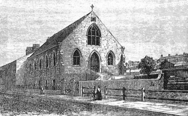
Trafalgar St, Unitarian, Burnley
hide
Hide
Hide
Unitarian church,
Trafalgar St,
Burnley
Lancashire
Trafalgar St,
Burnley
Lancashire
Hide
It was founded in 1858 and closed in 1960.
The church shown was built in 1871. The interior was re-modelled in 1894, and the space in front of the church was completely filled up with a block of Schoolrooms and a fine Hall for meetings.
This site provides historical information about churches, other places of worship and cemeteries. It has no connection with the churches etc. themselves.
Whilst every effort has been made to record exact details of record office and library holdings
you are recommended to check with them before visiting to ensure that they do hold the records and years you
wish to examine. Similarly check with transcript publishers to ensure they cover the records and years
you require before making a purchase.
Original Registers
Baptisms
- 1914-1956 held by Lancashire Record Office UBU 1
- 1914-1956 held by Lancashire Record Office UBU 1
Marriages
- 1918-1953 held by Lancashire Record Office UBU 1
- 1918-1953 held by Lancashire Record Office UBU 1
Burials
- 1918-1958 held by Lancashire Record Office UBU 1
- 1918-1958 held by Lancashire Record Office UBU 1
Copies of Original Registers
Baptisms
- 1871-1890 held by Lancashire Record Office UBU 1 - Manuscript
- 1871-1890 held by Lancashire Record Office UBU 1 - Manuscript
Marriages
- 1872-1890 held by Lancashire Record Office UBU 1 - Manuscript
- 1872-1890 held by Lancashire Record Office UBU 1 - Manuscript
Burials
- 1870-1890 held by Lancashire Record Office UBU 1 - Manuscript
- 1870-1890 held by Lancashire Record Office UBU 1 - Manuscript
It was located at SD8343332504 (Lat/Lon 53.788587, -2.252941). You can see this on maps provided by:
- OpenStreetMap
- Google Maps
- StreetMap (Current Ordnance Survey maps)
- Bing (was Multimap)
- Old Maps Online
- National Library of Scotland (Old Ordnance Survey maps)
- Vision of Britain (Click "Historical units & statistics" for administrative areas.)
- English Jurisdictions in 1851 (Unfortunately the LDS have removed the facility to enable us to specify a starting location, you will need to search yourself on their map.)
- Magic (Geographic information) (Click + on map if it doesn't show)
- GeoHack (Links to on-line maps and location specific services.)