
Hide
Carnforth
hide
Hide
hide
Hide
hide
Hide
Hide
CARNFORTH, a township in Warton parish, Lancashire; on the Lancaster and Carlisle railway, 6 miles NNE of Lancaster. It has a r. station with telegraph, a post office under Lancaster, six blast furnaces erected in 1865, and an endowed school used as a church. Acres, 1,492. Real property, £2,269. Pop., 393. Houses, 82. A subterranean brook bursts up here, after having run 2 miles under ground from a limestone cavern at Dunald-mill-hole. The Furness and Ulverston railway makes its junction with the Lancaster and Carlisle at Carnforth; and the Furness and Midland, connecting the former with the Little Northwestern, and opened in 1867, goes hence to Wennington.
John Marius Wilson, Imperial Gazetteer of England and Wales (1870-72)
Hide
| Kellet Road, Carnforth, Cemetery |
Details about the census records, and indexes for Carnforth.
| Emmanuel Congregational, Carnforth |
| Kellet Road, Carnforth, Cemetery |
| Our Lady of Lourdes Roman Catholic, Carnforth |
The Register Office covering the Carnforth area is Lancaster.
The National Gazetteer of Great Britain and Ireland - 1868
"CARNFORTH, a township in the parish of Warton, hundred of Lonsdale South of the Sands, in the county palatine of Lancaster, 7 miles to the N. of Lancaster. It is a station on the Lancaster and Carlisle railway, and the point of junction of the Ulverston and Lancaster railway with that line. The Kendal canal passes by this place. There are charitable bequests for the poor, worth about £5 a year."
- Ask for a calculation of the distance from Carnforth to another place.
In 1835 Carnforth was a township in the parish of Warton.
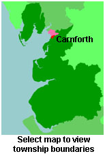
View a map of the boundaries of this town/parish.
You can see maps centred on OS grid reference SD500704 (Lat/Lon: 54.127283, -2.766135), Carnforth which are provided by:
- OpenStreetMap
- Google Maps
- StreetMap (Current Ordnance Survey maps)
- Bing (was Multimap)
- Old Maps Online
- National Library of Scotland (Old Ordnance Survey maps)
- Vision of Britain (Click "Historical units & statistics" for administrative areas.)
- English Jurisdictions in 1851 (Unfortunately the LDS have removed the facility to enable us to specify a starting location, you will need to search yourself on their map.)
- Magic (Geographic information) (Click + on map if it doesn't show)
- GeoHack (Links to on-line maps and location specific services.)
- All places within the same township/parish shown on an Openstreetmap map.
- Nearby townships/parishes shown on an Openstreetmap map.
- Nearby places shown on an Openstreetmap map.
For probate purposes prior to 1858, Carnforth was in the Archdeaconry of Richmond, in the Diocese of Chester. The original Lancashire wills for the Archdeaconry of Richmond are held at the Lancashire Record Office.
You can also see Family History Societies covering the nearby area, plotted on a map. This facility is being developed, and is awaiting societies to enter information about the places they cover.