
Hide
Hope Congregational, Denton
hide
Hide


Hide
Hide
The 1836 Building was the original Church and Sunday School. Worship took place upstairs and the class rooms were all down stairs. This building became the Sunday school from 1877 and was later extended rearwards to create a full size stage for the Operatic and Dramatic Societies and more rooms downstairs. It was demolished late 1966 and replaced by the current church hall etc.
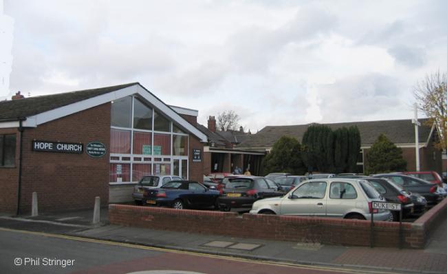
The very large 1877 church, was designed by the celebrated Manchester Architect Edward Salomons. This building was replaced in 1974 by the present church building.
The space, as viewed, to the right of the church hall and to the left of the 1877 church building was the grave yard, extending forward to the boundary wall. This was levelled and became part of the car park when the 1967 church hall was built.
In 1972 the Congregational church joined with the English Presbyterian church to become the United Reformed Church.
There are records of Baptisms, Marriages and Burials. No transcripts have been published.
This site provides historical information about churches, other places of worship and cemeteries. It has no connection with the churches themselves. For current information you should contact them directly.
- OpenStreetMap
- Google Maps
- StreetMap (Current Ordnance Survey maps)
- Bing (was Multimap)
- Old Maps Online
- National Library of Scotland (Old Ordnance Survey maps)
- Vision of Britain (Click "Historical units & statistics" for administrative areas.)
- English Jurisdictions in 1851 (Unfortunately the LDS have removed the facility to enable us to specify a starting location, you will need to search yourself on their map.)
- Magic (Geographic information) (Click + on map if it doesn't show)
- GeoHack (Links to on-line maps and location specific services.)