
Hide
Euxton
hide
Hide
hide
Hide
hide
Hide
Hide
EUXTON, a chapelry in Leland parish, Lancashire; on the Preston and Wigan and Preston and Bolton railways, near the river Yarrow, 2 miles NW by W of Chorley. It has stations on the railway, and a post office under Chorley. Acres, 2,924. Real property, £6,491. Pop., 1,491. Houses, 283. The property is much sub-divided. Euxton Hall is a chief residence. A decrease of population occurred, prior to 1861, from the burning of a cotton mill. The living is a p. curacy in the diocese of Manchester. Value, £200.* Patrons, the Heirs of J. Armetriding. The church is ancient, in tolerable condition; and has a Norman font. There are a Wesleyan chapel, a Roman Catholic chapel, an endowed school with £28, and other charities with £15.
John Marius Wilson, Imperial Gazetteer of England and Wales (1870-72)
Hide
Local studies information is held at Chorley library.
| Euxton Parish Church |
| St Mary, Euxton, Roman Catholic |
Details about the census records, and indexes for Euxton.
| Euxton Parish Church |
| Wigan Road Wesleyan Methodist, Euxton |
| St Mary, Euxton, Roman Catholic |
The registers of the parish church, have been published by the Lancashire Parish Register Society as follows.
- Volume 128 - Bap 1734-1781.
The Register Office covering the Euxton area is Chorley.
The National Gazetteer of Great Britain and Ireland - 1868
"EUXTON, a chapelry and township in the parish and hundred of Leyland, county Lancaster, 2 miles N.W. of Chorley, its post town. It is situated near the river Yarrow, and is a station on the Preston and Wigan section of the London and North-Western railway. The hamlets of Armetriding, Pincock Bridge, Runshaw, and Spout Hillock, are situated within this township. The living is a perpetual curacy in the diocese of Manchester, value £200. The church is an ancient edifice of stone, and contains a Norman font and other antiquities in good preservation. The Roman Catholics and Wesleyans have each a chapel, and there is a National school for both sexes. The parochial charities produce about £40 per annum, £28 of which are for education. The heirs of the late Mr. Longworth are lords of the manor. Euxton Hall is the principal residence."
- Ask for a calculation of the distance from Euxton to another place.
In 1835 Euxton was a township in the parish of Leyland.
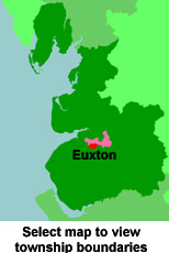
View a map of the boundaries of this town/parish.
You can see maps centred on OS grid reference SD551191 (Lat/Lon: 53.666638, -2.680418), Euxton which are provided by:
- OpenStreetMap
- Google Maps
- StreetMap (Current Ordnance Survey maps)
- Bing (was Multimap)
- Old Maps Online
- National Library of Scotland (Old Ordnance Survey maps)
- Vision of Britain (Click "Historical units & statistics" for administrative areas.)
- English Jurisdictions in 1851 (Unfortunately the LDS have removed the facility to enable us to specify a starting location, you will need to search yourself on their map.)
- Magic (Geographic information) (Click + on map if it doesn't show)
- GeoHack (Links to on-line maps and location specific services.)
- All places within the same township/parish shown on an Openstreetmap map.
- Nearby townships/parishes shown on an Openstreetmap map.
- Nearby places shown on an Openstreetmap map.
For probate purposes prior to 1858, Euxton was in the Archdeaconry of Chester, in the Diocese of Chester. The original Lancashire wills for the Archdeaconry of Chester are held at the Lancashire Record Office.
- Lancashire Family History & Heraldry Society - Chorley Branch
- Lancashire Family History & Heraldry Society - Preston Branch
- Lancashire Parish Register Society
You can also see Family History Societies covering the nearby area, plotted on a map. This facility is being developed, and is awaiting societies to enter information about the places they cover.