
Hide
St Thomas Church of England, Garstang
hide
Hide
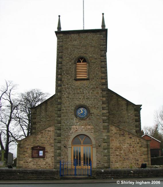
Photograph supplied by & Copyright of Shirley Ingham.
Hide
Hide
It was founded in 1327. The first Chapel of Ease was erected in 1327 on a site to the rear of the High Sreet; this was demolished and replaced by a new chapel in 1770 (illustrated). It occupies a plot in present day Church Street, which until then had been known as Tythe Barn Lane. It was first known as "All Saints Chapel,of Ease" and became St Thomas' Church in 1848. The Parish was established in 1881 as a separate entity to St Helens Church at Churchtown, some two miles to the SW of the town, and the main Anglican Church in the area for centuries. The graveyard at St Thomas's was first used in 1849, and extended in 1955.
This site provides historical information about churches, other places of worship and cemeteries. It has no connection with the churches themselves. For current information you should contact them directly.
Baptisms
1566-1678
Copy of Original Register of baptisms 1566-1678 held by Lancashire Archives - CS 104
1786-1811
Copy of Bishop's Transcript of baptisms 1786-1811 held by Lancashire Archives - DRB 2/76-82a
1824-1858
Copy of Original Register of baptisms 1824-1858 held by Lancashire Archives - PR 3240
1824-1987
Original Registers of baptisms 1824-1987 held by Lancashire Archives - PR 3240
1881-1962
Copy of Original Register of baptisms 1881-1962 held by Lancashire Archives - Searchroom
Marriages
1566-1678
Copy of Original Register of marriages 1566-1678 held by Lancashire Archives - CS 104
1881-1955
Copy of Original Register of marriages 1881-1955 held by Lancashire Archives - Searchroom
1881-2004
Original Registers of marriages 1881-2004 held by Lancashire Archives - PR 3240
Burials
1566-1678
Copy of Original Register of burials 1566-1678 held by Lancashire Archives - CS 104
1849-1856
Copy of Original Register of burials 1849-1856 held by Lancashire Archives - PR 3240
1849-1856
Original Registers of burials 1849-1856 held by Lancashire Archives - PR 3240
1881-1981
Copy of Original Register of burials 1881-1981 held by Lancashire Archives - Searchroom
1881-1982
Original Registers of burials 1881-1982 held by Lancashire Archives - PR 3240
It is located at SD4909545045 (Lat/Lon 53.89906, -2.776185). You can see this on maps provided by:
- OpenStreetMap
- Google Maps
- StreetMap (Current Ordnance Survey maps)
- Bing (was Multimap)
- Old Maps Online
- National Library of Scotland (Old Ordnance Survey maps)
- Vision of Britain (Click "Historical units & statistics" for administrative areas.)
- English Jurisdictions in 1851 (Unfortunately the LDS have removed the facility to enable us to specify a starting location, you will need to search yourself on their map.)
- Magic (Geographic information) (Click + on map if it doesn't show)
- GeoHack (Links to on-line maps and location specific services.)