
Hide
St John The Evangelist Church of England, Higham
hide
Hide
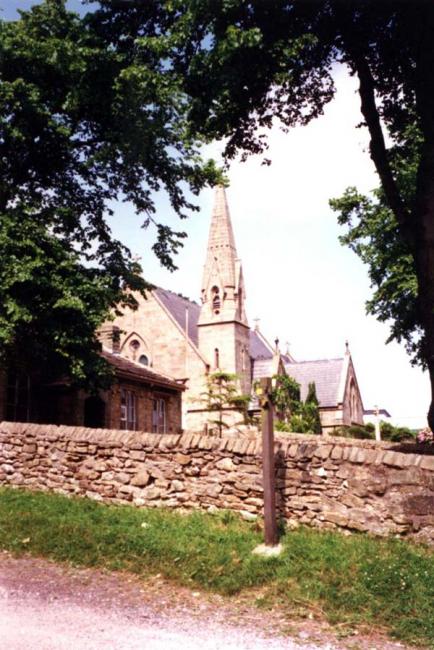
Photograph supplied by & Copyright of Pat Smit.
Hide
Hide
The corner of the building just in front is the St John's (CofE) School, licensed for worship in 1851 before the church itself was built in 1874 as part of St Leonard's Parish, Padiham. In 2002 the church became independent - the vicar was also the vicar of St Anne's, Fence.
The School in the foreground of the picture, now the village hall, was opened as a National school, in 1837. It also served as a place of worship for the established church, until 1874 when the present Church, as pictured, was opened.
This site provides historical information about churches, other places of worship and cemeteries. It has no connection with the churches etc. themselves. For current information you should contact them directly.
It is located at SD8102836625 (Lat/Lon 53.825543, -2.2897). You can see this on maps provided by:
- OpenStreetMap
- Google Maps
- StreetMap (Current Ordnance Survey maps)
- Bing (was Multimap)
- Old Maps Online
- National Library of Scotland (Old Ordnance Survey maps)
- Vision of Britain (Click "Historical units & statistics" for administrative areas.)
- English Jurisdictions in 1851 (Unfortunately the LDS have removed the facility to enable us to specify a starting location, you will need to search yourself on their map.)
- Magic (Geographic information) (Click + on map if it doesn't show)
- GeoHack (Links to on-line maps and location specific services.)