
Hide
Huyton with Roby
hide
Hide
hide
Hide
hide
Hide
Hide
HUYTON, a village, a township, a parish, and a subdistrict, in Prescot district, Lancashire. The village stands near the Manchester and Liverpool railway, 5½ miles E of Liverpool; contains, with its neighbourhood, many good houses; and has a station on the railway, and a post office under Liverpool. The township comprises 1,630 acres. Real property, £10,593; of which £369 are in quarries. Pop. m 1851, 1,295; in 1861, 1,612. Houses, 283. The parish contains also the townships of Knowsley, Roby, and Tarbock. Acres, 9,807. Real property, £32,942; of which £1,367 are in mines, and £699 in quarries. Pop. in 1861, 4,054. Houses, 724. Much of the land, with Knowsley Hall, belongs to the Earl of Derby. Tarbock is the property of the Earl of Sefton. The Hazels is the seat of Sir Thomas B. Berch, Bart. Stone is quarried; and about 200 acres are peat moss. The living is a vicarage in the diocese of Chester value, £690.* Patron, the Earl of Derby. The church is ancient; was recently restored; and has two good memorial windows, and an ancient carved oak screen. The p. curacies of Knowsley and Roby are separate benefices. There are chapels for Independents and Roman Catholics, national schools for Huyton and Knowsley, and charities £40. The Independent chapel is a recent and handsome edifice, in the pointed style. The subdistrict contains also Thingwall hamlet. Pop., 4,094. Houses, 732.
John Marius Wilson, Imperial Gazetteer of England and Wales (1870-72)
Hide
Local studies information is held at Knowsley library.
Details about the census records, and indexes for Huyton with Roby.
| Page Moss Lane, Huyton, Baptist |
| Huyton, Congregational |
| Park Hall Congregational, Huyton |
| Pinnington Place, Huyton, Congregational |
| Seel Road Congregational, Huyton |
The Register Office covering the Huyton area is Knowsley.
The National Gazetteer of Great Britain and Ireland - 1868
"HUYTON, a parish in the hundred of West Derby, county Lancaster, 6 miles E. of Liverpool. It is a station on the Manchester and Liverpool section of the London and North-Western railway. The parish contains the townships of Knowsley, Roby, and Tarbock. The township of Knowsley abounds with coal and stone. The land is chiefly arable, with a large extent of woodland and park grounds. Latham House, in this parish, sustained a siege during the Civil War. The living is a vicarage in the diocese of Chester, value £690. The church, dedicated to St. Michael, is an ancient edifice. There are also two district churches at Knowsley and Roby-the livings of both are perpetual curacies, value £300 and £200. The charities produce £40 per annum, of which £10 goes to the support of a school. There is a Roman Catholic chapel and a National school. The principal residence is Knowsley Park, a seat of the earls of Derby."
"ROBY, a township in the parish of Huyton, hundred of West Derby, county Lancaster, 2 miles S.W. of Prescot, and 1 mile from Huyton. It is a station on the Liverpool and Manchester railway. The village is irregularly built, and is chiefly agricultural. The living is a perpetual curacy in the diocese of Chester, value £200. The church is dedicated to St. Bartholomew. Roby Hall, which is the principal residence, is erected on the site of a more ancient one."
- Ask for a calculation of the distance from Huyton with Roby to another place.
In 1835 the parish of Huyton contained the townships of Huyton with Roby, Croxteth Park, Knowsley and Tarbock.
Information about boundaries and administrative areas is available from A Vision of Britain through time.
Some information about the history of Huyton and that of Roby.
View maps of Huyton and places within its boundaries.
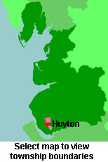
View a map of the boundaries of this town/parish.
You can see maps centred on OS grid reference SJ438910 (Lat/Lon: 53.412547, -2.846961), Huyton with Roby which are provided by:
- OpenStreetMap
- Google Maps
- StreetMap (Current Ordnance Survey maps)
- Bing (was Multimap)
- Old Maps Online
- National Library of Scotland (Old Ordnance Survey maps)
- Vision of Britain (Click "Historical units & statistics" for administrative areas.)
- English Jurisdictions in 1851 (Unfortunately the LDS have removed the facility to enable us to specify a starting location, you will need to search yourself on their map.)
- Magic (Geographic information) (Click + on map if it doesn't show)
- GeoHack (Links to on-line maps and location specific services.)
- All places within the same township/parish shown on an Openstreetmap map.
- Nearby townships/parishes shown on an Openstreetmap map.
- Nearby places shown on an Openstreetmap map.
For probate purposes prior to 1858, Huyton was in the Archdeaconry of Chester, in the Diocese of Chester. The original Lancashire wills for the Archdeaconry of Chester are held at the Lancashire Record Office.
You can also see Family History Societies covering the nearby area, plotted on a map. This facility is being developed, and is awaiting societies to enter information about the places they cover.