
Hide
Knowsley
hide
Hide
hide
Hide
hide
Hide
Hide
KNOWSLEY, a township-chapelry in Huyton parish, Lancashire; 2½ miles N by W of Huyton r. station, and 3 NW by W of Prescot. Post town, Prescot. Acres, 4, 750. Real property, £12,549; of which £1,367 are in mines, and £330 in quarries. Pop. in 1851, 1,486; in 1861, 1,349. Houses, 243. The property all belongs to the Earl of Derby. Knowsley Hall is the Earl's seat; has been enlarged from time to time: includes portions of the period of Henry VII.; was fully restored, by the tenth earl, before 1735; presents imposing fronts, surmounted by round towers; contains portraits of all the Stanleys, and a large and valuable collection of paintings by the old masters; and was visited, in November 1865, by the Prince and Princess of Wales. The grounds around it comprise upwards of 2,000 acres; are enclosed by a stone wall upwards of 8 feet high, pierced by thirteen entrances; and contain tasteful gardens, many ancient oaks, and ornamental waters nearly a mile long. The living is a p. curacy in the diocese of Chester. Value, £300.* Patron, the Earl of Derby. The church is recent, cruciform, and handsome; and has a W broach spire. There are national schools.
John Marius Wilson, Imperial Gazetteer of England and Wales (1870-72)
Hide
- Knowsley Libraries, in Huyton, Family History pages.
| St Mary Church of England, Knowsley |
Details about the census records, and indexes for Knowsley.
The Register Office covering the Knowsley area is Knowsley.
The National Gazetteer of Great Britain and Ireland - 1868
"KNOWSLEY, a township in the parish of Huyton, hundred of West Derby, county Lancaster, 3 miles N.W. of Prescot, its post town, and 22 N. of the Huyton railway station. The village is considerable. Nearly two-thirds of the parish are woodland and park ground surrounding Knowsley House, which, since the injury that Latham House sustained in the parliamentary war, has been the principal residence of the earls of Derby. The mansion is a spacious structure of stone with two circular towers, and contains a magnificent gallery of paintings by the first Italian and Flemish masters, also a fine collection of family portraits, including Thomas, the first earl, and father-in-law to Henry VII., whom he accompanied to the battle of Bosworth. It has undergone numerous additions since the visit of Henry VII. to his mother, the Countess of Derby, and was thoroughly restored in 1735 by William, the tenth earl. This noble mansion is open to visitors on certain days. The living is a perpetual curacy in the diocese of Lancaster, value £300. The church, dedicated to St. Mary, is a modern structure, with a tower crowned by a spire, and containing a clock and one bell. There are National and infant schools, wholly supported by the Earl of Derby."
- Ask for a calculation of the distance from Knowsley to another place.
In 1835 Knowsley was a township in the parish of Huyton.
Information about boundaries and administrative areas is available from A Vision of Britain through time.
Some information about the history of Knowsley.
View maps of Knowsley and places within its boundaries.
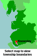
View a map of the boundaries of this town/parish.
You can see maps centred on OS grid reference SJ439949 (Lat/Lon: 53.447889, -2.846027), Knowsley which are provided by:
- OpenStreetMap
- Google Maps
- StreetMap (Current Ordnance Survey maps)
- Bing (was Multimap)
- Old Maps Online
- National Library of Scotland (Old Ordnance Survey maps)
- Vision of Britain (Click "Historical units & statistics" for administrative areas.)
- English Jurisdictions in 1851 (Unfortunately the LDS have removed the facility to enable us to specify a starting location, you will need to search yourself on their map.)
- Magic (Geographic information) (Click + on map if it doesn't show)
- GeoHack (Links to on-line maps and location specific services.)
- All places within the same township/parish shown on an Openstreetmap map.
- Nearby townships/parishes shown on an Openstreetmap map.
- Nearby places shown on an Openstreetmap map.
For probate purposes prior to 1858, Knowsley was in the Archdeaconry of Chester, in the Diocese of Chester. The original Lancashire wills for the Archdeaconry of Chester are held at the Lancashire Record Office.
You can also see Family History Societies covering the nearby area, plotted on a map. This facility is being developed, and is awaiting societies to enter information about the places they cover.