
Hide
St Michael, Liverpool, Church of England
hide
Hide
Hide
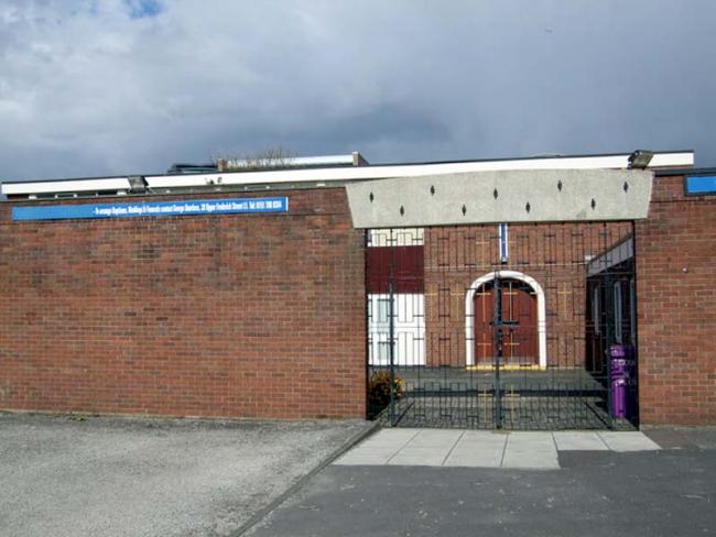
St Michael,
Upper Pitt Street,
Liverpool
Hide
1826-1879
In 1814 authority to build a church was granted under the St Michael's Church Act, 17 June 1814. The church was to stand "on a certain piece of land lying between Kent Street, Cornwallis Street, Upper Pitt Street and Granville Street". The Commissioners named in the Act raised the sum of money stated and began building the church. However, by 1823 the money had been spent and the church remained unfinished. A further Act was passed stating that the Corporation was to finish building the church within three years at its own expense.
The new church of St Michael's Church Upper Pitt Street was consecrated on 28 July 1826. In May 1941 the church was badly damaged by enemy action and the remainder of the building was demolished in 1946. The congregation remained together meeting in halls and school basements. A new church was erected and opened on 24 Sep 1960.
This site provides historical information about churches, other places of worship and cemeteries. It has no connection with the churches etc. themselves. For current information you should contact them directly.
Baptisms
1826-1863
Marriages
1826-1838
Burials
1826-1863
- OpenStreetMap
- Google Maps
- StreetMap (Current Ordnance Survey maps)
- Bing (was Multimap)
- Old Maps Online
- National Library of Scotland (Old Ordnance Survey maps)
- Vision of Britain (Click "Historical units & statistics" for administrative areas.)
- English Jurisdictions in 1851 (Unfortunately the LDS have removed the facility to enable us to specify a starting location, you will need to search yourself on their map.)
- Magic (Geographic information) (Click + on map if it doesn't show)
- GeoHack (Links to on-line maps and location specific services.)