
Hide
St Anne, St Annes, Church of England
hide
Hide
Hide
St Anne,
St Annes Rd East,
St Annes
Lancashire
Hide
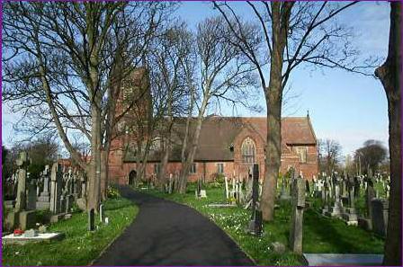
The church has a graveyard. The Monumental Inscriptions have been published by the Lancashire Family History & Heraldry Society.
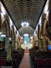
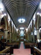
In 1872 St.Anne's church was built in the area of the parish of Lytham then known as Heyhouses, but a new town, named after the church, has grown up around it. The road that it now stands on is St.Annes Road East. In 1924 it had a mission church on Orchard Road.
It is located at SD3267529392 (Lat/Lon 53.756519, -3.022602). You can see this on maps provided by:
- OpenStreetMap
- Google Maps
- StreetMap (Current Ordnance Survey maps)
- Bing (was Multimap)
- Old Maps Online
- National Library of Scotland (Old Ordnance Survey maps)
- Vision of Britain (Click "Historical units & statistics" for administrative areas.)
- English Jurisdictions in 1851 (Unfortunately the LDS have removed the facility to enable us to specify a starting location, you will need to search yourself on their map.)
- Magic (Geographic information) (Click + on map if it doesn't show)
- GeoHack (Links to on-line maps and location specific services.)
Hide

1885
2013
2013