Hide
St John the Divine, Lytham, Church of England
hide
Hide
Hide
St John the Divine,
East Beach,
Lytham
Lancashire
Hide
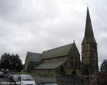
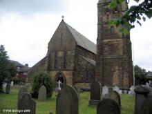
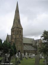
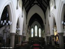
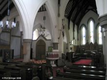
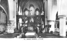
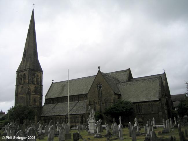
St. John's is an ecclesiastical parish, formed in 1870 from that of St. Cuthbert. The church, on the East beach, consecrated on 11th September 1850 is a building of stone in the Early English style, consisting of chancel, south transepts, clerestoried nave, aisles, south porch and a western tower with spire containing 6 bells : the principal windows are stained : there are sittings for 800 persons, of which 173 are free. The registers date from the year 1850. The living is a vicarage, gross yearly value £280, in the gift of J.T. Clifton esq. and held since 1870 by the Rev. Thomas Gregory Smart M.A. of Trinity College, Cambridge.
from Kelly's Lancashire Directory, 1895
Hide
A booklet describing the history of the church, containing many pictures, was published in December 1999.
The Lancashire Family History & Heraldry Society have transcribed and published the Monumental Inscriptions in the graveyard (1851-2001).
1851-2001
The church was erected in 1848-9, and consecrated on the 11th September 1850. It was a mission church of St Cuthbert's until it became a parish in its own right in 1870. It had St. Andrew's Mission church on Victoria Street, constructed of a wooden frame with corrugated iron cladding, but this was demolished in the 1970s.
The Lancashire Family History & Heraldry Society have published:
- Baptisms 1849-1949
1849-1949
- OpenStreetMap
- Google Maps
- StreetMap (Current Ordnance Survey maps)
- Bing (was Multimap)
- Old Maps Online
- National Library of Scotland (Old Ordnance Survey maps)
- Vision of Britain (Click "Historical units & statistics" for administrative areas.)
- English Jurisdictions in 1851 (Unfortunately the LDS have removed the facility to enable us to specify a starting location, you will need to search yourself on their map.)
- Magic (Geographic information) (Click + on map if it doesn't show)
- GeoHack (Links to on-line maps and location specific services.)
Hide