
Hide
Maghull
hide
Hide
hide
Hide
hide
Hide
Hide
MAGHULL, a township-chapelry in Halsall parish, Lancashire; on the Leeds and Liverpool canal, and on the Liverpool and Ormskirk railway, 5 miles SSW of Ormskirk. It has a station on the railway, and a postoffice under Liverpool. Acres, 2,073. Real property, £8,439. Pop., 1,144. Houses, 196. The property is much subdivided. Maghull Hall is the seat of B. French, Esq.; Manor House, of H. M'Elroy, Esq.; and Moss-Side House, of T. Harrison, Esq. The living is a p. curacy in the diocese of Chester. Value, £155. Patron, the Rector of Halsall. The church is a good plain edifice, of varions dates. There are a national school, and charities £4.
John Marius Wilson, Imperial Gazetteer of England and Wales (1870-72)
Hide
Local studies information is held at Ormskirk and Skelmersdale libraries.
Details about the census records, and indexes for Maghull.
The registers of the parish church, St Andrew, have been published by the Lancashire Parish Register Society as follows.
- Volume M2 - Bap 1663-1812, Mar 1660-1754, Bur 1663-1812.
The Register Office covering the Maghull area is Sefton South.
The National Gazetteer of Great Britain and Ireland - 1868
"MAGHULL, a township and chapelry in the parish of Halsall, hundred of West Derby, county palatine of Lancaster, 5 miles N.W. of Ormskirk, its post town. The Leeds and Liverpool canal passes through the township, as does also the western section of the Lancashire and Yorkshire railway, which has a station here. The land is nearly evenly divided between arable and pasture. The living is a perpetual curacy's in the diocese of Chester, value £155, in the patronage of the rector of the parish. The chapel, which is an ancient edifice, has been repaired and enlarged. There is a school with an endowment of £12 per annum."
- Ask for a calculation of the distance from Maghull to another place.
In 1835 Maghull was a township in the parish of Halsall.
Information about boundaries and administrative areas is available from A Vision of Britain through time.
View maps of Maghull and places within its boundaries.
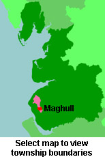
View a map of the boundaries of this town/parish.
You can see maps centred on OS grid reference SD378020 (Lat/Lon: 53.51113, -2.939412), Maghull which are provided by:
- OpenStreetMap
- Google Maps
- StreetMap (Current Ordnance Survey maps)
- Bing (was Multimap)
- Old Maps Online
- National Library of Scotland (Old Ordnance Survey maps)
- Vision of Britain (Click "Historical units & statistics" for administrative areas.)
- English Jurisdictions in 1851 (Unfortunately the LDS have removed the facility to enable us to specify a starting location, you will need to search yourself on their map.)
- Magic (Geographic information) (Click + on map if it doesn't show)
- GeoHack (Links to on-line maps and location specific services.)
- All places within the same township/parish shown on an Openstreetmap map.
- Nearby townships/parishes shown on an Openstreetmap map.
- Nearby places shown on an Openstreetmap map.
For probate purposes prior to 1858, Maghull was in the Archdeaconry of Chester, in the Diocese of Chester. The original Lancashire wills for the Archdeaconry of Chester are held at the Lancashire Record Office.
You can also see Family History Societies covering the nearby area, plotted on a map. This facility is being developed, and is awaiting societies to enter information about the places they cover.