
Hide
Mitton
hide
Hide
hide
Hide
hide
Hide
Hide
MITTON-HENTHORN AND COLDCOTES, a township in Whalley parish, Lancashire; at the confluence of the rivers Hodder and Ribble, contiguous to Great Mitton township, 2¾ miles SW of Clitheroe. Acres, 1,450. Real property, £970. Pop., 62. Houses, 10. The manor, with Mitton Hall, belongs to J. W. Aspinall, Esq. Mitton here is often called Little Mitton. A cotton mill is at Henthorn. An inn adjoins the bridge at the communication of Great Mitton, and is much frequented by anglers.
John Marius Wilson, Imperial Gazetteer of England and Wales (1870-72)
Hide
Local studies information is held at Clitheroe library.
Details about the census records, and indexes for Little Mitton.
The Register Office covering the Mitton area is Ribble Valley.
The National Gazetteer of Great Britain and Ireland - 1868
"GREAT MITTON, (or Myton), a parish, chiefly in the wapentake of Staincliff, West Riding county York, but partly in the lower division of the hundred of Blackburn, county Lancaster, 3 miles W. of Clitheroe, its post town, and 2 S.E. of Whalley. It is situated at the confluence of the rivers Hodder and Ribble. The parish, which is very extensive, contains the townships of Great Mitton, Aighton, Grindleton, Waddington, Hurst-Green, Bailey, Chaigley, Bashall-Eaves, and West Bradford. Henry VI. was betrayed in this parish by the Talbots, and in 1319 it was the scene of dreadful slaughter and devastation, committed by the Scots on their irruption into England. The village, which is small, is wholly agricultural. The soil is clay, upon a subsoil of gravel and limestone. The living is a vicarage in the diocese of Ripon, value £180. The church, dedicated to Allhallows, formerly belonged to Cockersand Abbey, and was built in the reign of Edward III. It is a stone structure with a lofty square embattled tower containing five bells. The interior of the church has an ancient cross, and on the N. side of the chancel is the sepulchral chapel of-the Sherburne family. In addition to the parish church there are the following district churches, viz: at Grindleton, Hurst-Green, and Waddington, the livings of which are all perpetual curacies, varying in value from £122 to £85. The parochial charities produce about £9 per annum. There is a day school for both sexes, in which a Sunday-school is also held. John Welchman Aspinall, Esq., is lord of the manor, and owner of a considerable portion of the surface. Stoneyhurst, now occupied as a Roman Catholic college, was anciently the seat of the Sherburnes, commenced by Sir Richard Sherburne towards the close of the 16th century.
"LITTLE MITTON, a township in the parish of Whalley, hundred of Blackburn, county Lancaster, 3 miles S.W. of Clitheroe. It is situated at the confluence of the rivers Calder and Ribble, and contains the hamlets of Henthorn and Coldcotes. The inhabitants are wholly engaged in agriculture. Mitton Hall is the principal residence.
"HENTHORN, a hamlet in the township of Little Mitton, and parish of Whalley, county Lancaster, 2 miles S.W. of Clitheroe. It is situated near the junction of the rivers Calder and Ribble."
"COLDCOTES, a hamlet in the township of Little Mitton, in the county of Lancaster, 3 miles S.W. of Clitheroe."
- Ask for a calculation of the distance from Mitton to another place.
In 1835 Mitton was a Lancashire township in the parish of Great Mitton in the West Riding of Yorkshire.
View maps of Mitton and places within its boundaries.
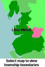
View a map of the boundaries of this town/parish.
You can see maps centred on OS grid reference SD735386 (Lat/Lon: 53.843318, -2.404601), Mitton which are provided by:
- OpenStreetMap
- Google Maps
- StreetMap (Current Ordnance Survey maps)
- Bing (was Multimap)
- Old Maps Online
- National Library of Scotland (Old Ordnance Survey maps)
- Vision of Britain (Click "Historical units & statistics" for administrative areas.)
- English Jurisdictions in 1851 (Unfortunately the LDS have removed the facility to enable us to specify a starting location, you will need to search yourself on their map.)
- Magic (Geographic information) (Click + on map if it doesn't show)
- GeoHack (Links to on-line maps and location specific services.)
- All places within the same township/parish shown on an Openstreetmap map.
- Nearby townships/parishes shown on an Openstreetmap map.
- Nearby places shown on an Openstreetmap map.
For probate purposes prior to 1858,Mitton was in the Archdeaconry of York. The original wills for the Archdeaconry of York are held at the Borthwick Institute.
You can also see Family History Societies covering the nearby area, plotted on a map. This facility is being developed, and is awaiting societies to enter information about the places they cover.