
Hide
Musbury
hide
Hide
hide
Hide
hide
Hide
Hide
MUSBURY, a township in Bury parish, Lancashire; 3 miles S W of Haslingden. Acres, 1, 170. Real property, £3,090; of which £47 are in quarries. Pop. in 1851, 1,228; in 1861, 997. Houses, 205. The decrease of pop. was caused mainly by the discontinuance of employment in a mill. The chapelry of Helmshore includes the township, and sometimes bears its name. See Helmshore.
John Marius Wilson, Imperial Gazetteer of England and Wales (1870-72)
Hide
Details about the census records, and indexes for Musbury.
The Register Office covering the Musbury area is Hyndburn and Rossendale.
The National Gazetteer of Great Britain and Ireland - 1868
"MUSBURY, a township in the parish of Bury, higher division of the hundred of Blackburn, county Lancaster, 2½ miles S.W. of Haslingden. It is a station on the East Lancashire railway. A sub-post-office was established in 1856. The township is of small extent, but the village is considerable. Many of the inhabitants are employed in cotton spinning. The river Ogden passes through the neighbourhood. The soil is light and shallow upon a subsoil of rock. The living is a perpetual curacy in the diocese of Manchester, value £150, in the patronage of the crown and bishop alternately. The church, dedicated to St. Thomas, is a neat edifice, with a square spired tower containing eight bells. The church has a memorial window to the late William Turner, Esq., of Flaxmoss House, whose tomb is in the churchyard. The church was erected in the year 1851 at an expense of £3,000, chiefly defrayed by the late W. Turner, Esq., by whom also the site was presented. Flaxmoss and Flaxmoss House are the principal residences. There are several other residences."
- Ask for a calculation of the distance from Musbury to another place.
In 1835 Musbury was a township in the parish of Bolton.
Information about boundaries and administrative areas is available from A Vision of Britain through time.
View maps of Musbury and places within its boundaries.
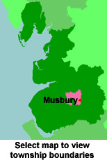
View a map of the boundaries of this town/parish.
You can see maps centred on OS grid reference SD766211 (Lat/Lon: 53.685463, -2.356106), Musbury which are provided by:
- OpenStreetMap
- Google Maps
- StreetMap (Current Ordnance Survey maps)
- Bing (was Multimap)
- Old Maps Online
- National Library of Scotland (Old Ordnance Survey maps)
- Vision of Britain (Click "Historical units & statistics" for administrative areas.)
- English Jurisdictions in 1851 (Unfortunately the LDS have removed the facility to enable us to specify a starting location, you will need to search yourself on their map.)
- Magic (Geographic information) (Click + on map if it doesn't show)
- GeoHack (Links to on-line maps and location specific services.)
- All places within the same township/parish shown on an Openstreetmap map.
- Nearby townships/parishes shown on an Openstreetmap map.
- Nearby places shown on an Openstreetmap map.
For probate purposes prior to 1858, Musbury was in the Archdeaconry of Chester, in the Diocese of Chester. The original Lancashire wills for the Archdeaconry of Chester are held at the Lancashire Record Office.
You can also see Family History Societies covering the nearby area, plotted on a map. This facility is being developed, and is awaiting societies to enter information about the places they cover.