
Hide
Parbold
hide
Hide
hide
Hide
hide
Hide
Hide
PARBOLD, a township in Eccleston parish, Lancashire; near the Leeds and Liverpool canal, 5½ miles N W by W of Wigan. It has a post-office under Ormskirk; and it contains the church of Douglas chapelry. Acres, 1,165. Real property, £3,031; of which £420 are in quarries. Pop., 474. Houses, 92. Parbold Hall is the seat of Mrs. Twining. Parbold hill commands good views to the Isle of Man, and to the mountains of Wales and Cumberland.
John Marius Wilson, Imperial Gazetteer of England and Wales (1870-72)
Hide
Local studies information is held at Ormskirk and Skelmersdale libraries.
| Our Lady and All Saints Roman Catholic, Parbold |
Details about the census records, and indexes for Parbold.
| Our Lady and All Saints Roman Catholic, Parbold |
The Register Office covering the Parbold area is Wigan and Leigh.
The National Gazetteer of Great Britain and Ireland - 1868
"PARBOLD, a township in the parish of Eccleston, hundred of Leyland, county Lancaster, 6 miles N.E. of Ormskirk, its post town, and 2 N.W. of Apley Bridge. It is situated near the Leeds and Liverpool canal, and is chiefly agricultural. There is a view from Parbold Hill of the Isle of Man and of the mountains of Wales and Cumberland. There is an excellent stone quarry in the neighbourhood. The soil consists of a clayey loam, with a subsoil of marl. The living is a perpetual curacy in the diocese of Manchester, value £137, in the patronage of the Rector of Eccleston. Douglas church is so named from its approximation to a small river of that name, a feeder of the Yarrow."
- Ask for a calculation of the distance from Parbold to another place.
In 1835 Parbold was a township in the parish of Eccleston.
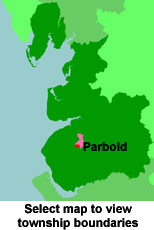
View a map of the boundaries of this town/parish.
You can see maps centred on OS grid reference SD502107 (Lat/Lon: 53.590125, -2.753948), Parbold which are provided by:
- OpenStreetMap
- Google Maps
- StreetMap (Current Ordnance Survey maps)
- Bing (was Multimap)
- Old Maps Online
- National Library of Scotland (Old Ordnance Survey maps)
- Vision of Britain (Click "Historical units & statistics" for administrative areas.)
- English Jurisdictions in 1851 (Unfortunately the LDS have removed the facility to enable us to specify a starting location, you will need to search yourself on their map.)
- Magic (Geographic information) (Click + on map if it doesn't show)
- GeoHack (Links to on-line maps and location specific services.)
- All places within the same township/parish shown on an Openstreetmap map.
- Nearby townships/parishes shown on an Openstreetmap map.
- Nearby places shown on an Openstreetmap map.
For probate purposes prior to 1858, Parbold was in the Archdeaconry of Chester, in the Diocese of Chester. The original Lancashire wills for the Archdeaconry of Chester are held at the Lancashire Record Office.
You can also see Family History Societies covering the nearby area, plotted on a map. This facility is being developed, and is awaiting societies to enter information about the places they cover.