
Hide
Pennington
hide
Hide
hide
Hide
hide
Hide
Hide
PENNINGTON, a township and a chapelry in Leigh parish, Lancashire. The township lies on the Wiganand Leigh canal, adjacent to the Bolton and Leigh railway; and contains part of the town of Leigh. Acres, 1,437. Real property, £13,666. Pop. in 1851, 4,573; in 1861, 5,015. Houses, 1,000. Pop. of the Leigh town portion, in 1861, 4,496. Houses, 901. The chapelry includes only a section of the township, and was constituted in 1846. Rated property, £8,229. Pop. in 1861, 2,803. Houses, 531. The property is much sub-divided. The living is a p. curacy in the diocese of Manchester. Value, £220.* Patrons, Trustees. The church was built in 1854, and is in the later English style.
John Marius Wilson, Imperial Gazetteer of England and Wales (1870-72)
Hide
Local studies information is held at Wigan library.
Details about the census records, and indexes for Pennington.
The Register Office covering the Pennington area is Wigan and Leigh.
The National Gazetteer of Great Britain and Ireland - 1868
"PENNINGTON, a township in the parish of Leigh, hundred of West Derby, county Lancaster, 1 mile S. of Leigh, part of which town is situated within this township The village, which is very considerable, is situated on the Bolton and Kenyon branch of the London and North Western railway. A portion of the inhabitants are employed in the cotton-mills. The neighbourhood abounds in coal and lime of a superior quality. The living is a perpetual curacy in the diocese of Manchester, value £200, in the patronage of trustees. The church is a modern structure. There are places of worship for the Wesleyans and Swedenborgians. There is a National school."
- Ask for a calculation of the distance from Pennington to another place.
In 1835 Pennington was a township in the parish of Leigh.
View maps of Pennington and places within its boundaries.
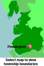
View a map of the boundaries of this town/parish.
You can see maps centred on OS grid reference SJ649988 (Lat/Lon: 53.484643, -2.530804), Pennington which are provided by:
- OpenStreetMap
- Google Maps
- StreetMap (Current Ordnance Survey maps)
- Bing (was Multimap)
- Old Maps Online
- National Library of Scotland (Old Ordnance Survey maps)
- Vision of Britain (Click "Historical units & statistics" for administrative areas.)
- English Jurisdictions in 1851 (Unfortunately the LDS have removed the facility to enable us to specify a starting location, you will need to search yourself on their map.)
- Magic (Geographic information) (Click + on map if it doesn't show)
- GeoHack (Links to on-line maps and location specific services.)
- All places within the same township/parish shown on an Openstreetmap map.
- Nearby townships/parishes shown on an Openstreetmap map.
- Nearby places shown on an Openstreetmap map.
For probate purposes prior to 1858, Pennington was in the Archdeaconry of Chester, in the Diocese of Chester. The original Lancashire wills for the Archdeaconry of Chester are held at the Lancashire Record Office.
You can also see Family History Societies covering the nearby area, plotted on a map. This facility is being developed, and is awaiting societies to enter information about the places they cover.