
Hide
Pilling
hide
Hide
hide
Hide
hide
Hide
Hide
PILLING, a village and a town ship-chapelry in Garstang parish, Lancashire. The village stands near Lancaster bay, 6½ miles W of Scorton r. station, and 6½ N W by W of Garstang; and has a post-office under Preston. The chapelry comprises 8,017 acres. Real property, £6,850. Pop. in 1851, 1,281; in 1861, 1,388. Houses, 234. Much of the land is peat-moss; and large quantities of turf are cut. The living is a p. curacy in the diocese of Manchester. Value, £124.* Patrons, E. Hornby and J. Gardner, Esqs. The church was rebuilt in 1735. There are a Wesleyan chapel and a slightly endowed national school.
John Marius Wilson, Imperial Gazetteer of England and Wales (1870-72)
Hide
| Carr Lane, Pilling, Wesleyan Methodist |
| St William of York Roman Catholic, Pilling |
Details about the census records, and indexes for Pilling.
| Carr Lane, Pilling, Wesleyan Methodist |
| St William of York Roman Catholic, Pilling |
The Register Office covering the Pilling area is Lancaster.
The National Gazetteer of Great Britain and Ireland - 1868
"PILLING, a township and chapelry in the parish of Garstang, hundred of Amounderness, county Lancaster, 6 miles N.W. of Garstang. Preston is its post town. The township, which is extensive, is situated near Lancaster Bay, and is wholly agricultural. Peat is dug at Pilling Moss, which partly burst in 1745. The village is straggling. The living is a perpetual curacy in the diocese of Manchester, value £124. The church, dedicated to St. John the Baptist, was formerly situated at some distance from the village, but was rebuilt in 1731. The present edifice is a commodious structure. There is an endowed National school, founded by Robert Carter in 1710. The Wesleyans have a place of worship."
- Ask for a calculation of the distance from Pilling to another place.
In 1835 Pilling was a township in the parish of Garstang.
View maps of Pilling and places within its boundaries.
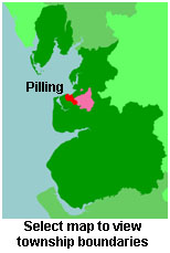
View a map of the boundaries of this town/parish.
You can see maps centred on OS grid reference SD417472 (Lat/Lon: 53.917224, -2.888803), Pilling which are provided by:
- OpenStreetMap
- Google Maps
- StreetMap (Current Ordnance Survey maps)
- Bing (was Multimap)
- Old Maps Online
- National Library of Scotland (Old Ordnance Survey maps)
- Vision of Britain (Click "Historical units & statistics" for administrative areas.)
- English Jurisdictions in 1851 (Unfortunately the LDS have removed the facility to enable us to specify a starting location, you will need to search yourself on their map.)
- Magic (Geographic information) (Click + on map if it doesn't show)
- GeoHack (Links to on-line maps and location specific services.)
- All places within the same township/parish shown on an Openstreetmap map.
- Nearby townships/parishes shown on an Openstreetmap map.
- Nearby places shown on an Openstreetmap map.
For probate purposes prior to 1858, Pilling was in the Archdeaconry of Richmond, in the Diocese of Chester. The original Lancashire wills for the Archdeaconry of Richmond are held at the Lancashire Record Office.
You can also see Family History Societies covering the nearby area, plotted on a map. This facility is being developed, and is awaiting societies to enter information about the places they cover.