
Hide
Tatham
hide
Hide
hide
Hide
hide
Hide
Hide
TATHAM, a parish in Lancaster district, Lancashire; 1 mile SE of Wennington r. station, and 4½ E of Hornby. It includes Tatham-Fell chapelry, and its Post town is Wray under Lancaster. Acres, 8,501. Real property, £5,519. Pop., 588. Houses, 115. The property is much subdivided. The living is a rectory in the diocese of Manchester. Value, £300. Patron, J. Foster, Esq. The church is later English.
John Marius Wilson, Imperial Gazetteer of England and Wales (1870-72)
Hide
Local studies information is held at Lancaster library.
Details about the census records, and indexes for Tatham.
The registers of the parish church, St James the Less, have been published by the Lancashire Parish Register Society as follows.
- Volume 59 - Bap & Mar 1558-1812, Bur 1558-1811.
- Volume 78 - Bap, Mar & Bur 1813-1837.
The Register Office covering the Tatham area is Lancaster.
The National Gazetteer of Great Britain and Ireland - 1868
"TATHAM, a parish in the hundred of Lonsdale South of the Sands, county Lancaster, 12 miles N.E. of Lancaster, its post town, and 1 mile from the Wennington railway station. The village, which is considerable, is situated on the river Lune or Weaning. The parish includes the villages of Lowgill and Tatham Fell. There are some collieries, and traces of a Roman road. The living is a rectory in the diocese of Manchester, value £300. The church, dedicated to St. James, is an ancient structure with a steeple, erected in 1722, containing three bells. In the interior is a brass to the Cansfield family. There is also the district church of Tatham Fell, the living of which is a perpetual curacy, value £125. The parochial charities produce about £28 per annum. There is an endowed school. A manor court is held in May, at Hall Barns."
John Marius Wilson, Imperial Gazetteer of England and Wales - 1870-2
- Ask for a calculation of the distance from Tatham to another place.
View maps of Tatham and places within its boundaries.
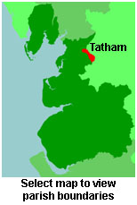
View a map of the boundaries of this town/parish.
You can see maps centred on OS grid reference SD648648 (Lat/Lon: 54.077498, -2.540127), Tatham which are provided by:
- OpenStreetMap
- Google Maps
- StreetMap (Current Ordnance Survey maps)
- Bing (was Multimap)
- Old Maps Online
- National Library of Scotland (Old Ordnance Survey maps)
- Vision of Britain (Click "Historical units & statistics" for administrative areas.)
- English Jurisdictions in 1851 (Unfortunately the LDS have removed the facility to enable us to specify a starting location, you will need to search yourself on their map.)
- Magic (Geographic information) (Click + on map if it doesn't show)
- GeoHack (Links to on-line maps and location specific services.)
- All places within the same township/parish shown on an Openstreetmap map.
- Nearby townships/parishes shown on an Openstreetmap map.
- Nearby places shown on an Openstreetmap map.
For probate purposes prior to 1858, Tatham was in the Archdeaconry of Richmond, in the Diocese of Chester. The original Lancashire wills for the Archdeaconry of Richmond are held at the Lancashire Record Office.
You can also see Family History Societies covering the nearby area, plotted on a map. This facility is being developed, and is awaiting societies to enter information about the places they cover.