
Hide
Upper Holker
hide
Hide
hide
Hide
hide
Hide
Hide
HOLKER (UPPER), a township in Cartmel parish, Lancashire; containing the chief part of Cartmel town; containing also Beckside hamlet; and extending northward to the river Leven. Acres, 6, 550. Real property, £5,726; of which £65 are in fisheries. Pop. in 1851, 1,134; in 1861, 1,035. Houses, 199. The decrease of pop. was caused by diminished employment in a reconstructed cotton mill, which required fewer hands than a previous one destroyed by fire. The manor belongs to the Duke of Devonshire. Gunpowder mills are at Low Wood. A charitable fund in this township arose from the purchase of five acres of land with 185½ guineas, found in the pocket of a travelling beggar, who died in a lodging house here in 1799.
John Marius Wilson, Imperial Gazetteer of England and Wales (1870-72)
Hide
Local studies information is held at Cumbria Record Office & Local Studies Library, Barrow and at Kendal library.
Details about the census records, and indexes for Upper Holker.
The Register Office covering the Upper Holker area is Ulverston.
- Ask for a calculation of the distance from Upper Holker to another place.
In 1835 Upper Holker was a township in the parish of Cartmel.
View maps of Upper Holker and places within its boundaries.
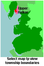
View a map of the boundaries of this town/parish.
You can see maps centred on OS grid reference SD348811 (Lat/Lon: 54.221473, -3.000834), Upper Holker which are provided by:
- OpenStreetMap
- Google Maps
- StreetMap (Current Ordnance Survey maps)
- Bing (was Multimap)
- Old Maps Online
- National Library of Scotland (Old Ordnance Survey maps)
- Vision of Britain (Click "Historical units & statistics" for administrative areas.)
- English Jurisdictions in 1851 (Unfortunately the LDS have removed the facility to enable us to specify a starting location, you will need to search yourself on their map.)
- Magic (Geographic information) (Click + on map if it doesn't show)
- GeoHack (Links to on-line maps and location specific services.)
- All places within the same township/parish shown on an Openstreetmap map.
- Nearby townships/parishes shown on an Openstreetmap map.
- Nearby places shown on an Openstreetmap map.
For probate purposes prior to 1858, Upper Holker was in the Archdeaconry of Richmond, in the Diocese of Chester. The original Lancashire wills for the Archdeaconry of Richmond are held at the Lancashire Record Office.
You can also see Family History Societies covering the nearby area, plotted on a map. This facility is being developed, and is awaiting societies to enter information about the places they cover.