
Hide
Warton
hide
Hide
This is the Warton in the parish of Kirkham. There is also another Warton near Carnforth.
Hide
hide
Hide
hide
Hide
Hide
WARTON, a township and a chapelry in Kirkham parish, Lancashire. The township lies on the river Ribble's estuary, 3 miles SW of Kirkham r. station; contains a scattered village of its own name; and has a postal wall-box, under Preston. Acres, 3,939; of which 2,405 are water. Real property, £2,960. Pop., 446. Houses, 91. The chapelry includes also Freckleton township, and comprises 6,598 acres. Pop., 1,325. Houses, 279. The property is much subdivided. Cotton spinning and the manufacture of sacking, sail-cloth, and cordage, are carried on. The living is a vicarage in the diocese of Manchester. Value, £350.* Patron, Christchurch, Oxford. There are two churches, both good. There are also two Methodist chapels and a national school.
John Marius Wilson, Imperial Gazetteer of England and Wales (1870-72)
Hide
Details about the census records, and indexes for Warton.
| Holy Family, Warton, Roman Catholic |
The Register Office covering the Warton area is Blackpool & Fylde.
The National Gazetteer of Great Britain and Ireland - 1868
"WARTON, a township in the parish of Kirkham, hundred of Amounderness, county Lancaster, 3 miles E. of Lytham, and 2 S.W. of Kirkham, its post town. It is a station on the Lytham branch of the Lancashire and Yorkshire railway. The village is situated on the river Ribble. There are a new dock and embankment being made. The living is a perpetual curacy, with that of Freckleton, in the diocese of Manchester, value £350, in the patronage of Christ Church, Oxford. The church, dedicated to St. Paul, was erected in 1724. The parochial charities produce about £104, which go to a school."
- Ask for a calculation of the distance from Warton to another place.
In 1835 Warton was a township in the parish of Kirkham.
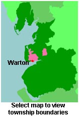
View a map of the boundaries of this town/parish.
You can see maps centred on OS grid reference SD405279 (Lat/Lon: 53.744378, -2.903613), Warton which are provided by:
- OpenStreetMap
- Google Maps
- StreetMap (Current Ordnance Survey maps)
- Bing (was Multimap)
- Old Maps Online
- National Library of Scotland (Old Ordnance Survey maps)
- Vision of Britain (Click "Historical units & statistics" for administrative areas.)
- English Jurisdictions in 1851 (Unfortunately the LDS have removed the facility to enable us to specify a starting location, you will need to search yourself on their map.)
- Magic (Geographic information) (Click + on map if it doesn't show)
- GeoHack (Links to on-line maps and location specific services.)
- All places within the same township/parish shown on an Openstreetmap map.
- Nearby townships/parishes shown on an Openstreetmap map.
- Nearby places shown on an Openstreetmap map.
For probate purposes prior to 1858, Warton was in the Archdeaconry of Richmond, in the Diocese of Chester. The original Lancashire wills for the Archdeaconry of Richmond are held at the Lancashire Record Office.
You can also see Family History Societies covering the nearby area, plotted on a map. This facility is being developed, and is awaiting societies to enter information about the places they cover.