
Hide
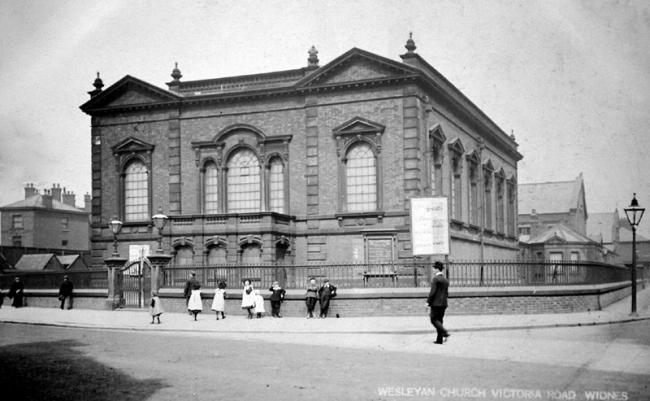
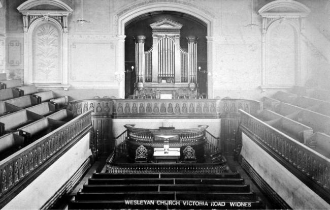
Victoria Rd Wesleyan Methodist, Widnes
hide
Hide

Hide
Victoria Rd,
Widnes
Lancashire
Hide
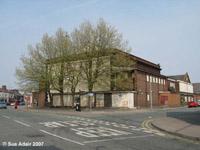
Around 1957 Victoria Road Wesylan church was bought by the council and used as a live music venue, for wrestling, for all sorts of things.. and The Beatles played there! They also 'modernised' it - vandalised it, more like. It was a beautiful building, but the council built horrible additions onto it hiding it's stone facade. The council called the church on Victoria Road "The Queens Hall". Down one side of the church on Victoria Road is Lacey Street which has a small church-like building, which was originally built in 1879 as a Sunday School. It has been put to many and varied uses over the years - a small clothing factory at one time making baby clothes and was called 'The Baby Linen' then making raincoats, then it was a sports hall, then from 1990 it was a live music venue and community centre called The Queens Hall Studio. The council closed it and the main Queens Hall (on Victoria Road)in 2004, when they opened a new Arts Centre in Runcorn called The Brindley.
The Wesleyan Methodist church was formed in the 18th century from religous societies founded by John Wesley and his preachers. It suffered many secessions, but was the largest Nonconformist denomination in the 19th century. In 1932 the Wesleyan Methodists joined with the Primitive Methodists and the United Methodists to form the Methodist Church of Great Britain.
This site provides historical information about churches, other places of worship and cemeteries. It has no connection with the churches etc. themselves.
- OpenStreetMap
- Google Maps
- StreetMap (Current Ordnance Survey maps)
- Bing (was Multimap)
- Old Maps Online
- National Library of Scotland (Old Ordnance Survey maps)
- Vision of Britain (Click "Historical units & statistics" for administrative areas.)
- English Jurisdictions in 1851 (Unfortunately the LDS have removed the facility to enable us to specify a starting location, you will need to search yourself on their map.)
- Magic (Geographic information) (Click + on map if it doesn't show)
- GeoHack (Links to on-line maps and location specific services.)