
Hide
Woodplumpton
hide
Hide
hide
Hide
hide
Hide
Hide
PLUMPTON-WOOD, a village and a parochial chapelry in St. Michael-on-Wyre parish, Lancashire. The village stands near the Lancaster and Preston canal, 1¼ mile S W of Barton r. station, and 4¼ N W by N of Preston. The chapelry also contains the hamlets of Catforth, Eaves, Higher Plumpton, and Lower Bartle; and its post town is Preston. Acres, 4,722. Real property, £9,516. Pop. in 1851, 1,574; in 1861, 1,462. Houses, 292. The property is subdivided. The manor belongs to Birley, Esq. P.-W. House, P.-W. Lodge, Swilbrook House, Barnfield House, Hollowforth, and Bartle Hall are chief residences. Extensive tile and drain-pipeworks are at Eaves and Catforth. The living is a p.curacy in the diocese of Manchester. Value, £175.* Patron, the Vicar of St. Michael-on-Wyre. The church is ancient, and was modernised in 1852. There are a Wesleyan chapel, a Primitive Methodist chapel, a Roman Catholic chapel, an endowed school with £23 a year, a small workhouse, and charities £24.
John Marius Wilson, Imperial Gazetteer of England and Wales (1870-72)
Hide
Local studies information is held at Preston library.
Details about the census records, and indexes for Woodplumpton.
The Register Office covering the Woodplumpton area is Preston.
The National Gazetteer of Great Britain and Ireland - 1868
"WOODPLUMPTON, a chapelry in the parish of St. Michael-on-Wyre, county Lancaster, 4 miles N.W. of Preston, its post town, and 3 S.W. of Garstang. It is situated on the line of the Lancaster railway and canal, near the river Wyre, the mouth of which forms a harbour. The union poorhouse is situated here. The village, which is considerable, contains many new houses. The living is a perpetual curacy in the diocese of Manchester, value £140, in the patronage of the Vicar of St. Michael-on-Wyre. The parochial charities produce about £37 per annum, of which £23 goes to Catforth school.
- Ask for a calculation of the distance from Woodplumpton to another place.
In 1835 Woodplumpton was a township in the parish of St. Michaels on Wyre.
View maps of Woodplumpton and places within its boundaries.
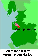
View a map of the boundaries of this town/parish.
You can see maps centred on OS grid reference SD489354 (Lat/Lon: 53.812584, -2.778242), Woodplumpton which are provided by:
- OpenStreetMap
- Google Maps
- StreetMap (Current Ordnance Survey maps)
- Bing (was Multimap)
- Old Maps Online
- National Library of Scotland (Old Ordnance Survey maps)
- Vision of Britain (Click "Historical units & statistics" for administrative areas.)
- English Jurisdictions in 1851 (Unfortunately the LDS have removed the facility to enable us to specify a starting location, you will need to search yourself on their map.)
- Magic (Geographic information) (Click + on map if it doesn't show)
- GeoHack (Links to on-line maps and location specific services.)
- All places within the same township/parish shown on an Openstreetmap map.
- Nearby townships/parishes shown on an Openstreetmap map.
- Nearby places shown on an Openstreetmap map.
For probate purposes prior to 1858, Woodplumpton was in the Archdeaconry of Richmond, in the Diocese of Chester. The original Lancashire wills for the Archdeaconry of Richmond are held at the Lancashire Record Office.
You can also see Family History Societies covering the nearby area, plotted on a map. This facility is being developed, and is awaiting societies to enter information about the places they cover.