
Hide
Yealand Conyers
hide
Hide
hide
Hide
hide
Hide
Hide
YEALAND-CONYERS, a township and a chapelry in Warton parish, Lancashire. The township lies 1½ mile SSW of Burton and Holme r. station, and 2½ N by E of Carnforth; and has a post-office under Lancaster-Acres, 1,577. Real property, £2,655. Pop., 272. Houses, 50. Leighton Hall, Prospect house , and Morecambe Lodge are chief residences. The chapelry includes Y.-Redmayne, and comprises 3,676 acres. Pop., 481. Houses, 90. The living is a p. curacy in the diocese of Manchester. Value £255.* Patrons, Hyndman's Trustees. The church is good; and there are chapels for Quakers and Roman Catholics, and a national school.
John Marius Wilson, Imperial Gazetteer of England and Wales (1870-72)
Hide
| St Mary Roman Catholic, Yealand |
| Society of Friends, Yealand Conyers |
Details about the census records, and indexes for Yealand Conyers.
| St Mary Roman Catholic, Yealand |
| Society of Friends, Yealand Conyers |
The Register Office covering the Yealand Conyers area is Lancaster.
The National Gazetteer of Great Britain and Ireland - 1868
"YEALAND CONYER, (and YEALAND REDMAYNE), townships in the parish of Warton, hundred of Lonsdale South of the Sands, county Lancaster, 1 mile N. of Warton, 2½ miles S.W. of Burton-in-Kendal, and 8 N.E. of Lancaster. They are situated on the Kendal canal and Carlisle railway. The village is surrounded by numerous seats and villas. The living is a perpetual curacy in the diocese of Manchester, value £60, in the patronage of the Hyndman Trustees. The church is dedicated to St. John. There are also a Roman Catholic chapel, dedicated to the Virgin Mary, and a meeting-house belonging to the Society of Friends, who have a school here."
- Ask for a calculation of the distance from Yealand Conyers to another place.
In 1835 Yealand Conyers was a township in the parish of Warton.
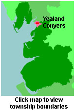
View maps of and places within its boundaries.
View a map of the boundaries of this town/parish.
You can see maps centred on OS grid reference SD498745 (Lat/Lon: 54.163488, -2.77099), Yealand Conyers which are provided by:
- OpenStreetMap
- Google Maps
- StreetMap (Current Ordnance Survey maps)
- Bing (was Multimap)
- Old Maps Online
- National Library of Scotland (Old Ordnance Survey maps)
- Vision of Britain (Click "Historical units & statistics" for administrative areas.)
- English Jurisdictions in 1851 (Unfortunately the LDS have removed the facility to enable us to specify a starting location, you will need to search yourself on their map.)
- Magic (Geographic information) (Click + on map if it doesn't show)
- GeoHack (Links to on-line maps and location specific services.)
- All places within the same township/parish shown on an Openstreetmap map.
- Nearby townships/parishes shown on an Openstreetmap map.
- Nearby places shown on an Openstreetmap map.
For probate purposes prior to 1858, Yealand Conyers was in the Archdeaconry of Richmond, in the Diocese of Chester. The original Lancashire wills for the Archdeaconry of Richmond are held at the Lancashire Record Office.
You can also see Family History Societies covering the nearby area, plotted on a map. This facility is being developed, and is awaiting societies to enter information about the places they cover.