
Hide
Bag Enderby
hide
Hide
hide
Hide
hide
Hide
Hide
Hide
- The parish was in the Tetford sub-district of the Horncastle Registration District.
- Check our Census Resource page for county-wide resources.
- The table below gives census piece numbers, where known:
| Census Year | Piece No. |
|---|---|
| 1841 | H.O. 107 / 632 |
| 1851 | H.O. 107 / 2108 |
| 1861 | R.G. 9 / 2369 |
| 1871 | R.G. 10 / 3383 |
| 1891 | R.G. 12 / 2599 |
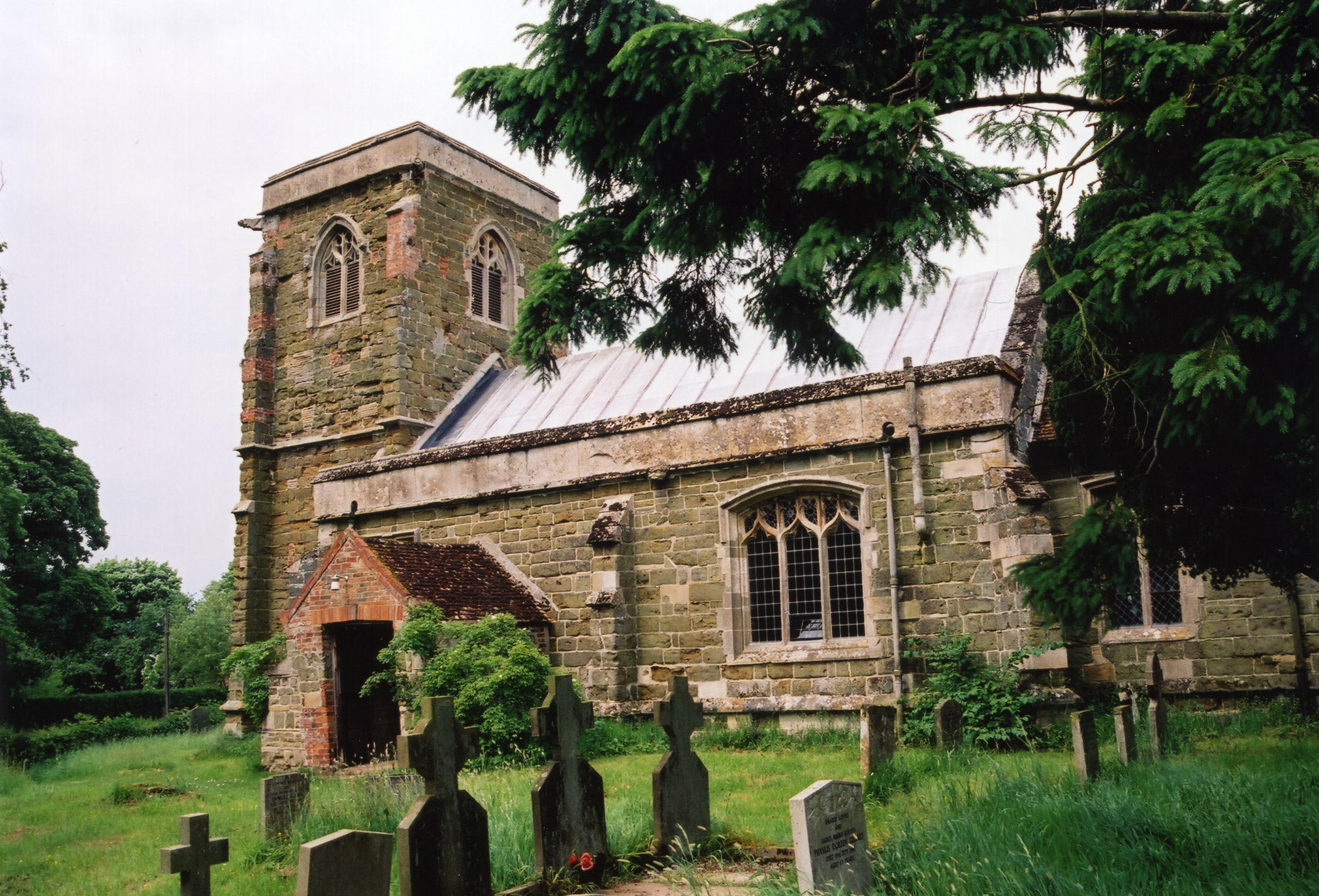
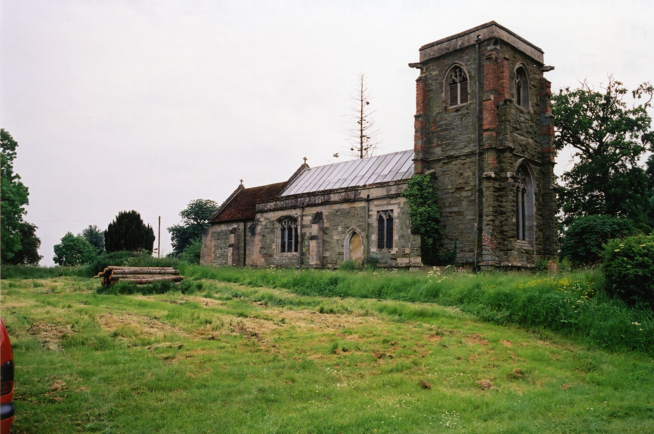
- The Anglican parish church is dedicated to Saint Margaret.
- The church was built prior to 1407 by Albini de ENDERBY.
- The church seats 100.
- A photograph of St. Margaret's church is at the Wendy PARKINSON English Church Photographs site.
- Neville DAVEY has a photograph of St. Margaret's Church on Geo-graph, taken in July, 2005.
- Here are two photos of the church, taken by Ron COLE (who retains the copyright):
- The Anglican parish register dates from 1561.
- The Society of Genealogists have the burial records for 1813 thru1900 at their library in England.
- The LFHS has published several marriage and burial indexes for the Bolingbroke Deanery to make your search easier.
- Check our Church Records page for county-wide resources.
- The parish was in the Tetford sub-district of the Horncastle Registration District.
- Check our Civil Registration page for sources and background on Civil Registration which began in July, 1837.
Six and 1/2 miles NNW of Spilsby and about 8 miles east of Horncastle, Bag Enderby is both a small village and a small parish in the Wold hills. Somersby parish lies to the north and Hagworthingham parish to the south. The parish covers only about 860 acres (in 1842), or 617 acres (in 1872), or 627 acres (in 1900).
Bag Enderby village is just a small collection of houses in a shallow valley. If you are planning a visit:
- See our touring page for more sources.
- Ask for a calculation of the distance from Bag Enderby to another place.
- In 1842, the principal landowner was W. B. BURTON, lord of the manor.
- In 1872, the principal landowner was the Rev. Langhorne B. BURTON, rector of the parish.
- See our Maps page for additional resources.
You can see maps centred on OS grid reference TF349720 (Lat/Lon: 53.227918, 0.019379), Bag Enderby which are provided by:
- OpenStreetMap
- Google Maps
- StreetMap (Current Ordnance Survey maps)
- Bing (was Multimap)
- Old Maps Online
- National Library of Scotland (Old Ordnance Survey maps)
- Vision of Britain (Click "Historical units & statistics" for administrative areas.)
- English Jurisdictions in 1851 (Unfortunately the LDS have removed the facility to enable us to specify a starting location, you will need to search yourself on their map.)
- Magic (Geographic information) (Click + on map if it doesn't show)
- GeoHack (Links to on-line maps and location specific services.)
- All places within the same township/parish shown on an Openstreetmap map.
- Nearby townships/parishes shown on an Openstreetmap map.
- Nearby places shown on an Openstreetmap map.
- Bag comes from the Medieval English "bagge" meaning "a bag". The term is used to describe the topographical shape of the village enclosing the church and off of a lane to the north.
Dictionary of Lincolnshire Place Names, Kenneth CAMERON, 1998 - Enderby is the familial name of the knight who held the manor after the Conquest in 1066.
- White's 1842 Directory lists the following people in the parish: Robert BURTON, John CLARKSON and William RICHARDSON.
- White's 1872 Directory lists the following people in the parish: James BUTTERS, Allison & William CLARKE, George HALL, John HOCKNEY, John PAYNE and Fenby WARRRENER.
- White's 1882 Directory lists the following people in the parish: John BLACKBURN, James BUTTERS, Jonathan & William CLARKE, Alfred J. DAVEY, Harry GREENWOOD and John HOCKNEY.
- This place was an ancient parish in Lincoln county and became a modern Civil Parish when those were established.
- The parish was in the ancient Hill Wapentake (Hill Hundred) in the East Lindsey district in the parts of Lindsey.
- In April, 1936, this Civil Parish was abolished and all 627 acres amalgamated into Somersby Civil Parish.
- For today's district governance, see the East Lindsey District Council.
- Bastardy cases would be heard in the Horncastle petty session hearings.
- As a result of the 1834 Poor Law Amendment Act, the parish became part of the Horncastle Poor Law Union.
- The children of this parish attended school in Brinkhill.
- For more on researching school records, see our Schools Research page.