
Hide
Bourne
hide
Hide
hide
Hide
hide
Hide
Hide
hide
Hide
Hide
The Bourne Institute on West Street had a reading Room on the Ground Floor and a Library upstairs.
Bourne is home to the South Kesteven Community Point and Library, (the old Bourne Library). It is generally open three days per week.
- SKCPL
- Corn Exchang
- 3 Abbey Road
- Bourne
- PE10 9EF
- Tele: 01522 782010
Robert HARVEY has a photograph of the South Kesteven Access Point on Geo-graph, taken in December, 2020.
- Bourne Cemetery was established in 1855 and consecrated in March, 1856. At that time, all the other burial grounds in the parish were closed for future burials. The cemetery had two mortuary chapels. The cemetery is on Thurlby Road (South Road).
- The Cemetery was extended in 1904 to 5.5 acres.
- The Cemetery was under the control of the Burial Board of the Urban Council. It is now managed by the Bourne Town Council.
- Tim HEATON has a photograph of Bourne Cemetery on Geo-graph, taken in November, 2009.
| South Road, Bourne, Cemetery |
- The parish was in the Bourne sub-district of the Bourne Registration District.
- Check our Census Resource page for county-wide resources.
- The table below gives census piece numbers, where known:
| Census Year | Piece No. |
|---|---|
| 1841 | H.O. 107 / 615 & 620 |
| 1851 | H.O. 107 / 2095 |
| 1861 | R.G. 9 / 2317 & 2318 |
| 1871 | R.G. 10 / 3314 - 3316 |
| 1881 | R.G. 11 / 3197 |
| 1891 | R.G. 12 / 2557 |
| 1901 | R.G. 13 / 3025 |
| Eastgate, Bourne, United Reformed Church |
| South Road, Bourne, Cemetery |
- An Abbey was founded here in 1138 by Baldwin FitzGILBERT or FitzGISLEBERT, for Augustine monks. It stood near the existing Anglican Church.
- The Anglican parish church is dedicated to St. Peter and St. Paul, as was the Abbey.
- The church has been dated to the 12th century.
- The church was thoroughly restored in 1840.
- The church seats 600.
- Ian YARHAM has a photograph of the Abbey on Geo-graph.
- The Anglican parish registers exist from 1562 for burials, 1563 for baptisms and 1564 for marriages.
- Please check our small parish register extract file. Your additions are welcome.
- The National Burial Index (NBI) lists 8,287 entries (1855-1995) for Bourne cemetery and another 4,238 entries (1813-1900, with duplicates) for St. Peter and St. Paul church.
- The Lincolnshire FHS has published several marriage and a burial index for the Aveland and Ness Deanery to make your search easier.
- The Baptists chapel was built on West Street in 1835 and could seat 500.
- Tim HEATON has a photograph of the Baptist Chapel on Geo-graph, taken in November, 2009.
- The Wesleyan Methodists built a chapel on Star Lane in 1841 that could also seat 500.
- The Independent Methodists built a chapel in 1847, a year after the Congregationalists buit their chapel in Eastgate.
- For more on researching these chapel records, see our non-conformist religions page.
- There was also a Baptist chapel, built in 1878, in the hamlet of Dyke, along with a small Wesleyan chapel.
- Check our Church Records page for county-wide resources.
- The parish was in the Bourne sub-district of the Bourne Registration District.
- Check our Civil Registration page for sources and background on Civil Registration which started in July, 1837.
In 1919 there was a County Police Station on North Street. Herbert BAILY was the Superintendent with 2 inspectors and 5 sergeants and 27 constables. Gaol facilities ae not recorded.
Bourne is both a town and a parish 97 miles north of London, 10 miles NNE of Stamford and 11 miles west of Spalding. It is bisected by the A15 trunk road, formerly known as the "Great Road from London to Lincoln," and part of the old Roman Road between the two cities. Bourne parish includes the hamlets of Cawthorpe and Dyke. To the west of the town of Bourne lies the hamlet of Lound, which was a parish at the time of the 1086 Domesday Book, but has never had a church. Morton parish lies to the north and Thurlby parish to the south, with Deeping Fen parish forming the southeast border. The South Forty Foot Drain completes the eastern border. The parish covers 10,100 acres and includes the hamlet of Cawthorpe 1.5 miles north of Bourne and Dyke, 1.5 miles northeast.
A spring called "Peter's Pool" arises in the west end of the town and at Eastgate becomes navigable (where it is called the "Bourne Eau") and flows southward to join the River Glen. If you are planning a visit:
- The Car Dyke, which runs along the eastern edge of the village from Peterborough to Lincoln, is said to date from 125 AD, when the Romans needed to move supplies to its army units in the north.
- See our touring page for visitor services.
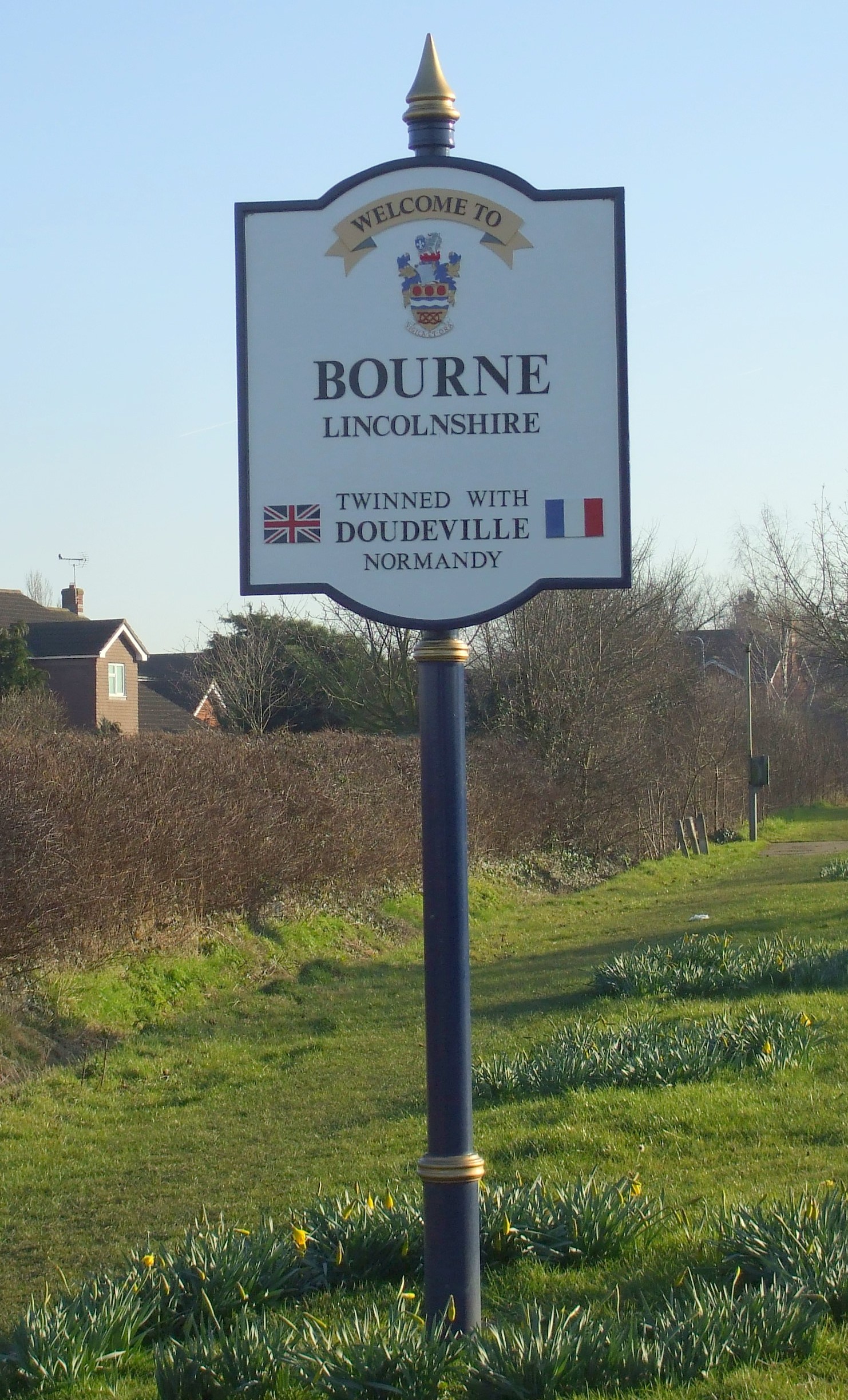
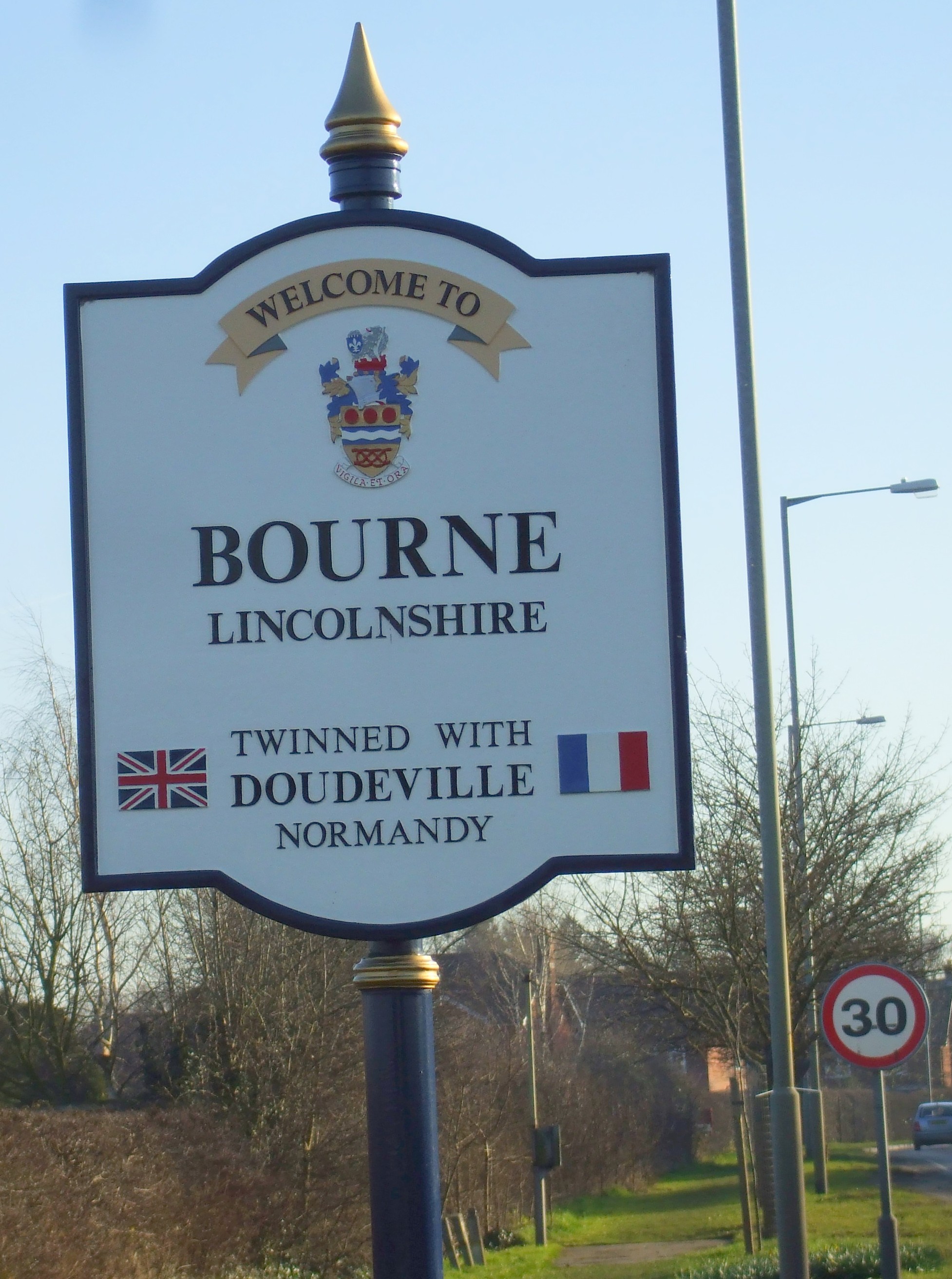
- Julian P. GUFFOGG contributes this "Welcome to Bourne" photograph on Geo-graph, taken in November, 2016.
- The Midland and Great Northern Joint railway came to town in 1893, But ceased passenger service in the 1960s
- A south-west "relief" road was built in 2005 to carry some of the east-west traffic outside the town center. Rex NEEDLE has a photograph of this Relief Road (The A151) on Geo-graph, taken in October, 2005.
- Here are two photographs of the town sign taken in 2008 by Patricia McCRORY (who retains the copyright):
- Ask for a calculation of the distance from Bourne to another place.
- Bourne is given as the birthplace of Hereward, Lord of Brun, one of the last to rebel against the Normans. Also known as "Hereward the Wake". His birth is circa 1035.
- This was the birthplace of Robert MANNYNG (or de BRUNNE) in 1270. He was a learned Austin Canon styled by Professor FREEMAN as "the Patriarch of the English language."
- Thomas HOLLAND, 2nd Earl of Kent, who died 25 Apr 1397 was buried here. He was half-brother to King Richard II.
- Lord William Cecil BURKEIGH was born in Bourne on 13 Sept. 1520. He was Lord High Treasurer under Queen Elizabeth I and the owner of a great part of the parish and built the Bull Inn here. He is buried at Stamford.
- Bourne was a thriving market town for many centuries and it has a long history.
- Roman coins have been found here, along with a tesselated pavement.
- In Edward the Confessor's time, Castle Brunn was the seat of Leofric.
- Two fires destroyed large parts of the town. One, in 1605, burned the whole of Manor Street. The second came in 1637 and destroyed the greater part of Eastgate.
- In the 19th century, Market Day was on Saturday and four annual fairs were held: April 6th, May 7th, September 30th and October 29th.
- The Town Hall was erected here in 1821 and quarter session hearings were held here, alternating with Sleaford.
- A Gas Works was erected here in 1840, owned by the Urban Council.
- The Public Hall and Corn Exchange was built in 1870 by a private company.
- In 1893 the Midland and Great Northern joint railway companies built a new branch line from Saxby to Bourne.
- In 1842, the chief landowners were the Marquis of Exeter and William POCHIN, lords of the manor, and the DUNCOMBE, ARDEN and other families.
- Red Hall, at the south entrance to the town, is a brick mansion with gardens and was the residence for many years for the DIGBY family.
- Tim HEATON has a photograph of Red Hall on Geo-graph, taken in November, 2009.
- Robert HARVEY has a photograph of Wake House, restored door case on Geo-graph, taken in November, 2020.
- See our Maps page for additional resources.
You can see maps centred on OS grid reference TF097200 (Lat/Lon: 52.766467, -0.375568), Bourne which are provided by:
- OpenStreetMap
- Google Maps
- StreetMap (Current Ordnance Survey maps)
- Bing (was Multimap)
- Old Maps Online
- National Library of Scotland (Old Ordnance Survey maps)
- Vision of Britain (Click "Historical units & statistics" for administrative areas.)
- English Jurisdictions in 1851 (Unfortunately the LDS have removed the facility to enable us to specify a starting location, you will need to search yourself on their map.)
- Magic (Geographic information) (Click + on map if it doesn't show)
- GeoHack (Links to on-line maps and location specific services.)
- All places within the same township/parish shown on an Openstreetmap map.
- Nearby townships/parishes shown on an Openstreetmap map.
- Nearby places shown on an Openstreetmap map.
- The Bourne Rural District Council Isolation Hospital was built in 1913 on South road to replace an earlier hospital on Manor lane. It was still operational in 1930. There was no requirement for archiving patient records. Miss Alice Mary MacKENZIE was the matron in 1930.
- Rex NEEDLE has a photograph of the Demolition of Bourne Hospital on Geo-graph, taken in June, 2003.
- The Bourne Nursing Association, formed in 1899, was merged into Butterfield Cottage Hospital on the death of Mr. Butterfield, whose will provided for a Cottage Hospital..
- The Butterfield Cottage Hospital was at 2 North road. The Butterfield Cottage Hospital started in 1913 with two wards of 4 beds each, but was enlarged as a war memorial shortly after World War One. It was still operational in 1942, but closed in 1983. No patient records exist. Miss Marion PILE, born Wiltshire, was the matron in 1913. Miss Florence OSBORN was the matron in 1930.
- There is a photograph of Butterfield Cottage Hospital in 1910 at Flickr taken by Peter MALECZEK.
- In 1882, Major Wm. PARKER, jnr., of the Lincolnshire Militia, resided here.
- In 1900, H Company of the 2nd Volunteer Battalion, Lincolnshire Regiment, was quartered here on North Street. Captain Cecil W. BELL, commanding; Sergeant George HIPPLE was the drill instructor.
- In 1909, F Company of the 4th Battalion, Lincolnshire Regiment, was quartered here on North Street. Major Cecil W. BELL, commanding; Lieuts. W. S. T. PARKER and H. G. DEAN; Sergeant Francis SHEPHERD was the drill instructor.
- Rex NEEDLE has a photograph of the War memorial erected in 1823 on Geo-graph, taken in November, 2009.
- Ian YARHAM has a photograph of the Fountain by the War Memorial on Geo-graph, taken in July, 2011.
- Percy James VICKERS, who was born here about 1895, is believed to be the same Lance Corporal P. J. VICKERS who was wounded at Suvla Bay in the Dardenelles Campaign in 1915. He was in the 6th Battn. Lincolnshire Regt. Here is a poem he wrote:
If across the sea I should go
Will you remember me
As one who thinks so much of you
And I know you think of me?
And if it be God's wish
That I should fall
When answering to my "Country's Call"
I hope that you are the one who is spared amongst them all.
6/11056 Lce Cpl P J VICKERS
6th Batt Lincolnshire Regt
Wounded at Suvla Bay Dardanelles 7.8.1915
- The Bourne Cenotaph shows WW1 and WW2 casualties (and a few from later conflicts) although no numbers, ranks or arms of service are mentioned. They are listed here as recorded by Michael PECK (The lists have been sorted to make searching easier and may not match the order on the cenotaph - LRM):
1914 - 1918:
|
|
|
|
|
1939 - 1945:
|
|
|
|
Malaya 1957:
- W Dodd
Borneo 1962:
- R Jennings
Northern Ireland 1975:
- J R Booth
The following 15 Commonwealth War Graves are in Bourne Cemetery. 8 are from World War I:
- W. COOK, priv., Lincolnshire Regt., died 30 Sept. 1918.
- G. COVERLEY, priv., Labor Corps, died 16 Dec. 1918.
- Cyril Humpreys LEARY, priv., Royal Army Medical Corps, died 5 Nov. 1918.
- Thomas Lancelot LLOYD, 2nd lieut., 3rd. Reserve Cavalry Regt., age 25, died 8 Apr. 1919.
- George Robert LUNN, lance corp., 4th Btn. Lincs. Regt., age 35, died 11 Dec. 1917.
- Percy Edward STEVENSON, gunner, Royal Garrison Artillery, died 15 Dec. 1918.
- Harry SWARBRICK, priv., 1st. Btn. Duke of Cornwall's light Inf., age 23, died 11 June 1917.
- Frederick James WIlliam WOOD, priv., Labour Corps, age 20, died 11 Dec. 1920.
These 7 are from World War II
- James Robert EVERETT, srgt., 1st. Btn, The Parachute Regt., age 34, died 12 Mar. 1944.
- Clarence Ernest MICHELSON, sapper, Royal Engineers, age 29, died 9 Nov. 1944.
- Dennis MILNER, lance corp., 1st. Btn. North Lancs., age 21, died 3 Oct. 1941.
- William Henry RILEY, ldg. aircraftman, RAF Vol. Rsrv., died 21 Oct. 1944.
- Reginald James SAYER, priv., 6th Btn. Lincs. Regt., age 19, died 26 Oct. 1940.
- George Albert SIBLEY, able seaman, Royal Navy, died 10 Apr. 1946.
- Robert George SQUIRES, gunner, Royal Artillery, age 43, died 14 May 1940.
- The name Bourne (often spelled "Bourn") is from the Old English Burna or Old Scandinavian Brunnr, for "spring", appearing in the 1086 Domesday Book as Brune.
A. D. Mills, "A Dictionary of English Place-Names," Oxford University Press, 1991.
- According to Pigot, there is a perennial spring "from which the town derives its name, Bourne being the Saxon word for brook". Pigot goes on to give the source of the spring as being the village of Stoke, some 16 miles away. He quotes an old manuscript as refering to the spring as "Peter's Pool." The waters from the spring ultimately join the River Glen, flowing southward toward Market Deeping.
"Directory of Lincolnshire" Pigot & Co., 1841.
- This place was an ancient parish in Lincoln county and it became a modern Civil Parish when those were established.
- The parish was in the ancient Aveland Wapentake in the South Kesteven district in the parts of Kesteven.
- The Town Hall was built in 1821.
- The town formed an Urban District Council on April 1st, 1899.
- You may contact the local Bourne Town Council regarding civic or political issues. Be aware that they can NOT assist with family history research.
- For today's district governance, contact the South Kesteven District Council.
- Bastardy cases were heard in the Bourne petty session hearings held at the Town Hall, or Session House, on Mondays.
- An Almshouse was founded in 1636 by Wm. TROLLOPE to house six poor and aged men. The almshouse was built next to the churchyard. His fund granted £30 per year for repairing the buildings and for fuel and clothing.
- The Common Lands were enclosed here in 1770.
- A second Almshouse to house six poor women was built before 1889. They were still in use in 1919.
- David HOWARD has a photograph of Bourne Almshouses on Geo-graph, taken in June, 2019, but he doesn't tell us which one.
- In 1655, Robert HARRINGTON bequeathed a yearly rent-charge from Witham-on-the-hill for weekly distribution of bread among the poor.
- As a result of the 1834 Poor Law Amendment Act reforms, this parish became the center of the Bourne Poor Law Union.
- Housing for elderly poor was built on Stanton Close in 1984. Rex NEEDLE has a photograph of Stanton Close on Geo-graph, taken in August, 2010.
John R. BLAND provides a transcript of the will of Susanna SHARMAN of Bourne.
John R. BLAND also provides a transcript of the will of Thomas WOODCOCK of Bourne.
- A Free Grammar School was founded in 1836 by Wm. TROLLOPE.
- A British School was established here and it later took over the Baptist Chapel as a schoolhouse.
- A National School was built here in 1829.
- A new school was built on Star Lane in 1877 and another that same year in North Fen.
- Rex NEEDLE has a photograph of that 1877 school, now Abbey Primary Academy, on Geo-graph, taken in November, 1999.
- See our Schools page for more information on researching school records.
The Bourne Branch of the Lincolnshire Family History Society was founded in 1990. It held its meetings at Wake House (at this time, Closed due to Covid-19) on the fourth Tuesday of the month.