
Hide
Brattleby
hide
Hide
hide
Hide
hide
Hide
Hide
hide
Hide
Hide
- The parish was in the North East sub-district of the Lincoln Registration District.
- Check our Census Resource page for county-wide resources.
- The table below gives census piece numbers, where known:
| Census Year | Piece No. |
|---|---|
| 1841 | H.O. 107 / 629 |
| 1861 | R.G. 9 / 2363 |
| 1871 | R.G. 10 / 3375 |
| 1891 | R.G. 12 / 2596 |
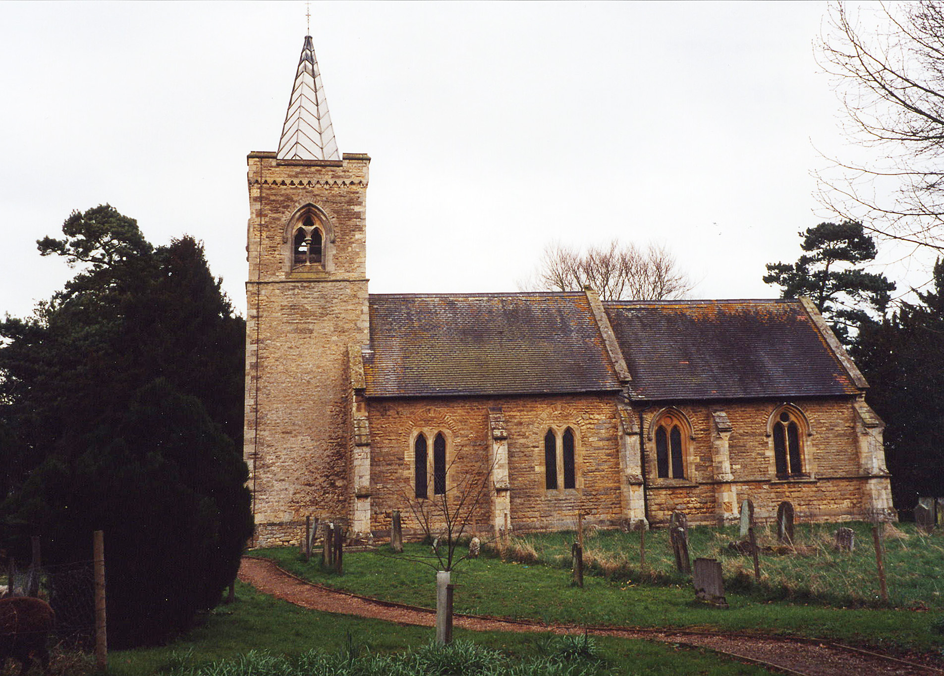
- The Anglican parish church is dedicated to Saint Cuthbert.
- The church was rebuilt in 1858.
- The church seats 110.
- Richard CROFT has a photograph of St. Cuthbert's Church on Geo-graph, taken in October, 2005.
- David HITCHBORNE also has a photograph of St. Cuthbert's Church on Geo-graph, taken in June, 2004.
- Here is a photo of St. Cuthbert's church, taken by Ron COLE (who retains the copyright):
- The Anglican parish register dates from 1685.
- The Lincolnshire FHS has a Loan Library service which has the parish registers on microfiche for Baptisms from 1685 to 1811 and Marriages from 1685 to 1812.
- The LFHS has published several marriage indexes for the Lawres Deanery to make your search easier.
- Check our Church Records page for county-wide resources.
- The parish was in the North East sub-district of the Lincoln Registration District.
- Check our Civil Registration page for sources and background on Civil Registration which began in July, 1837.
Brattleby is a parish and small town north-northwest of Lincoln. To the south is Aisthorpe parish. The parish covers just over 1,100 acres and is a long, thin band running west to east.
If you are planning a visit:
- By automobile, take the B1398 arterial road north out of Lincoln and through Scampton to get to the village.
- Ian S. has a photograph of the Village Sign on Geo-graph, taken in July, 2014.
- Visit our touring page for more sources.
- Ask for a calculation of the distance from Brattleby to another place.
- Brattleby Hall was held by the DE la HAYE family during the reign of Henry I.
- Brattleby Hall was the residence of Philip Chetwood WRIGHT in 1900.
- See our Maps page for additional resources.
You can see maps centred on OS grid reference SK949810 (Lat/Lon: 53.317435, -0.576903), Brattleby which are provided by:
- OpenStreetMap
- Google Maps
- StreetMap (Current Ordnance Survey maps)
- Bing (was Multimap)
- Old Maps Online
- National Library of Scotland (Old Ordnance Survey maps)
- Vision of Britain (Click "Historical units & statistics" for administrative areas.)
- English Jurisdictions in 1851 (Unfortunately the LDS have removed the facility to enable us to specify a starting location, you will need to search yourself on their map.)
- Magic (Geographic information) (Click + on map if it doesn't show)
- GeoHack (Links to on-line maps and location specific services.)
- All places within the same township/parish shown on an Openstreetmap map.
- Nearby townships/parishes shown on an Openstreetmap map.
- Nearby places shown on an Openstreetmap map.
- According to the Traces of War website, the St. Cuthbert's churchyard has one Commonwealth war grave from WWII.
For a photograph of the Brattleby War Memorial plaques outside the church and the names on htem, see the Roll of Honour site.
Richard CROFT has a photograph of the Captain Guy CHICHESTER memorial on Geo-graph, taken in May, 2009.
Commonweath War Grave, World War II:
- Clare Arthur CONNOR D.F.C., flying officer, RAF 83 Sqdn., age 26, died 4 Nov. 1940. Son of Arthur and Grace CONNOR, Husb. of Betty Cave CONNOR.
- This place was an ancient parish in Lincolnshire and became a modern Civil Parish when those were established.
- The parish was in the ancient Lawress Wapentake in the West Lindsey division of the county, in the parts of Lindsey.
- You can contact the local Parish Council regarding civic or political issues, but they are NOT staffed or funded to assist you with family history questions.
- Today's district governance is provided by the West Lindsey District Council.
- As a result of the 1834 Poor Law Amendment Act, the parish became part of the Lincoln Poor Law Union.
- Bastardy cases would be heard in the Bail and Close (Lincoln) petty session hearings.
Year Inhabitants 1801 123 1831 154 1851 169 1861 153 1871 122 1881 148 1891 138 1901 148 1911 127 1921 108 1931 104
- A Church of England School was built in 1871 to hold up to 40 children.
- For more on researching school records, see our Schools Research page.