
Hide
Claxby (Normanby)
hide
Hide
hide
Hide
hide
Hide
Hide
hide
Hide
Claxby, par., N. Lincolnshire, 3½ miles N. of Market Rasen, 1,689 ac., pop. 325; P.O.
From: John BARTHOLOMEW's "Gazetteer of the British Isles (1887)"
Hide
WARNING: There are three Claxby's in Lincolnshire alone. Please ensure that you are researching in the correct one.
Hide
The Caistor Library is an excellent resource with a Local History section and a Family History section.
Alternatively, the Market Rasen Library also has a Local History section.
Ian S. has a photograph of St. Mary's Churchyard graves on Geo-graph, taken in May, 2018.
Jonathan THACKER also has a photograph of the churchyard in snow on Geo-graph, taken in February, 2012.
- The parish was in the Caistor sub-district of the Caistor Registration District.
- Check our Census Resource page for county-wide resources.
- The table below gives census piece numbers, where known:
| Census Year | Piece No. |
|---|---|
| 1841 | H.O. 107 / 630 |
| 1861 | R.G. 9 / 2392 |
| 1871 | R.G. 10 / 3421 |
| 1891 | R.G. 12 / 2621 |
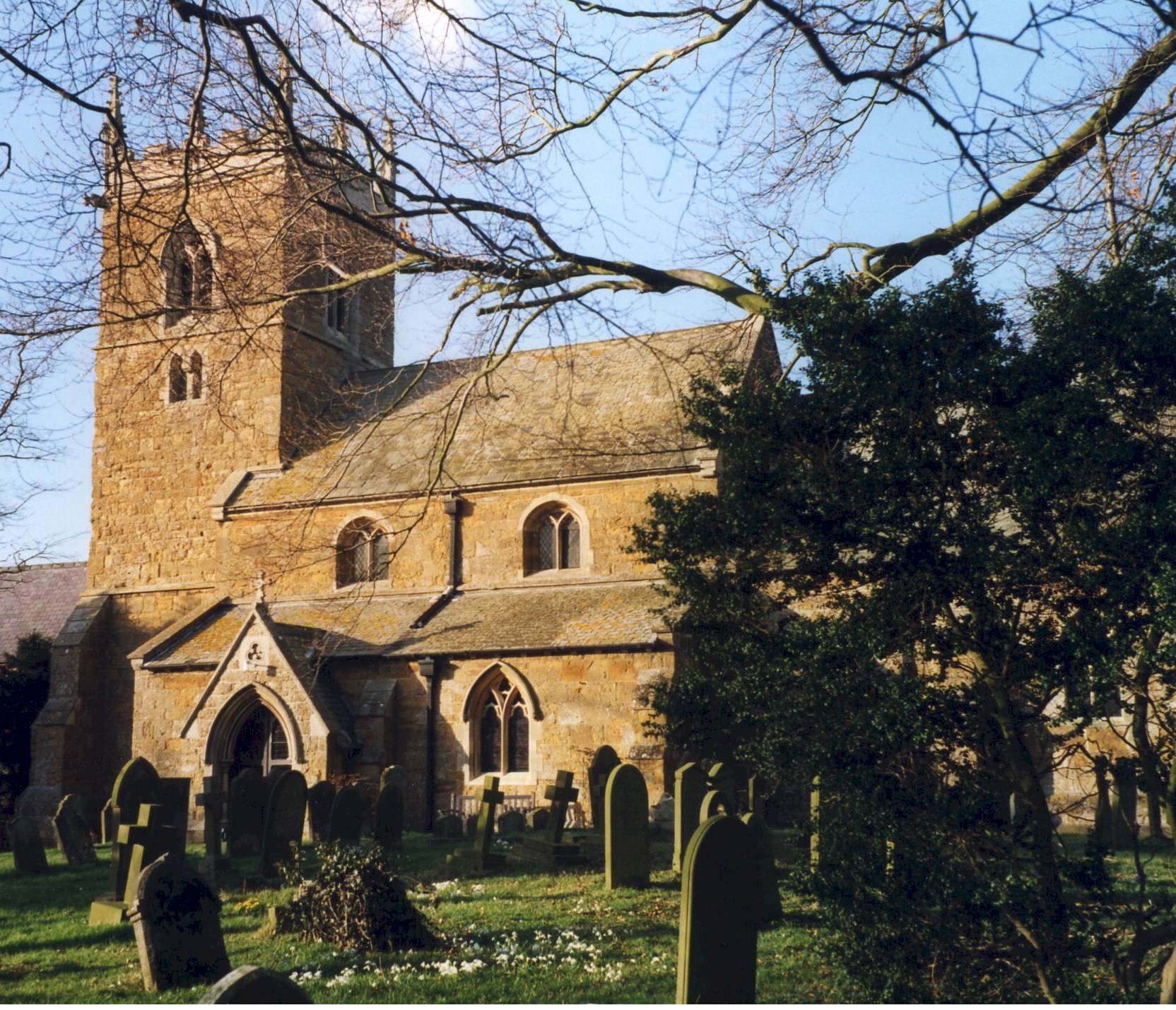
- There was a church here at the time of the Norman Conquest, but no trace of it remians.
- The Anglican parish church dates from around 1300.
- The Anglican parish church is dedicated to Saint Mary.
- The church was restored in 1870-71 and the tower rebuilt.
- The church seats 160.
- The church is a Grade I structure with English Heritage.
- David WRIGHT has a photograph of St. Mary's Church on Geo-graph, taken in March, 2006.
- Here is a photo of the church, taken by Ron COLE (who retains the copyright):
- The Anglican parish register dates from 1556.
- J. HANNAN-BRIGGS has a photograph of the Stained Glass window memorial to George OGG who died in 1973, taken in September, 2014.
- We have the beginning of a parish register extract in a text file. Your additions or corrections are welcomed.
- The Lincolnshire FHS has published several marriage indexes and a burial index for the Westwold Deanery to make your search easier.
- Check our Church Records page for county-wide resources.
- The parish was in the Caistor sub-district of the Caistor Registration District.
- Check our Civil Registration page for sources and background on Civil Registration which began in July, 1837.
Claxby (or Claxby by Normanby) sits on a slight rise about 4 miles north of Market Rasen, 5 miles south of Caistor and 155 miles north of London. Walesby parish lies to the south. The parish covers about 1,700 acres.
If you are planning a visit:
- Jonathan THACKER has a photograph of Claxy in the snow on Geo-graph, taken in February, 2012.
- By automobile, take the A46 trunk road north out of Market Rasen or south-west out of Grimsby. Claxby lies halfway between Caistor and Market Rasen, just east off of the A46.
- Visit our touring page for more sources.
- Ask for a calculation of the distance from Claxby (Normanby) to another place.
- A Roman mosaic was found near the church, along with a Roman kiln for pettery making.
- Lead was mined in Claxby from 1864 through 1882.
- Ironstone was mined in Claxby from 1869 through 1882. The village grew with mine workers from all over the Kingdom, many of whom died and are buried in the local churchyard.
- John ROBINSON of Claxby travelled to the Lincolnshire Show in July 1900 to receive a prize in a competition open to labourers having brought up and placed out to service the greatest number of children without having received parochial relief and not having occupied more than half an acre of land. He won second prize; he had seventeen children, brought up sixteen and put thirteen out to service.
- The large "egg" on a pedestal near the village is actually a National Air Traffic Radar antenna, and is a relatively new structure.
- There is a more detailed parish history at the Claby Parish History site (this is a Portable Document File, 80 pages).
- Claxby House is near the church.
- In 1900, Claxby House was the residence of Gerard Joseph YOUNG.
- See our Maps page for additional resources.
You can see maps centred on OS grid reference TF111946 (Lat/Lon: 53.436481, -0.329051), Claxby (Normanby) which are provided by:
- OpenStreetMap
- Google Maps
- StreetMap (Current Ordnance Survey maps)
- Bing (was Multimap)
- Old Maps Online
- National Library of Scotland (Old Ordnance Survey maps)
- Vision of Britain (Click "Historical units & statistics" for administrative areas.)
- English Jurisdictions in 1851 (Unfortunately the LDS have removed the facility to enable us to specify a starting location, you will need to search yourself on their map.)
- Magic (Geographic information) (Click + on map if it doesn't show)
- GeoHack (Links to on-line maps and location specific services.)
- All places within the same township/parish shown on an Openstreetmap map.
- Nearby townships/parishes shown on an Openstreetmap map.
- Nearby places shown on an Openstreetmap map.
Ian S. has a photograph of the Claxby Boy War Memorial plaque (WWII) in the parish church on Geo-graph, taken in May, 2018.
Inside the church on the right wall is a memorial to the Claxby lads who died in World War II. There is also a Roll of Honour listing all who served.
See the Rich Text File from the Lincolnshire Famiy History Society for full details.
- In the 1086 Domesday Book, the village is given as "Clackesbi", and as being in the "Hundred of Walesbi".
- Some sources give the parish name as "Claxby-by-Normanby".
- The parish is sometimes listed as "Claxby by Market Rasen" as well.
- This place was an ancient parish in Lincoln county and became a modern Civil Parish when those were established.
- The parish was in the ancient Walshcroft Wapentake in the West Lindsey district in the parts of Lindsey.
- Brian WESTLAKE has a photograph of the Village Hall on Geo-graph, taken in January, 2013. Stop in when they are open and ask to see the schedule of forth-coming events. Talks on local and family history are often given in village halls.
- Kelly's 1900 Directory of Lincolnshire places the parish (perhaps erroneously) in the East Lindsey division of the county.
- Today's district governance is provided by the West Lindsey District Council.
- Bastardy cases would be heard on the 1st Tuesday each month at the Market Rasen petty session hearings.
- As a result of the 1834 Poor Law Amendment Act, this parish became part of the Caistor Poor Law Union.
- A school was built here in 1857 by the Earl of Yarborough. It would hold up to 100 children.
- For more on researching school records, see our Schools Research page.