
Hide
Claxby (Well)
hide
Hide
hide
Hide
hide
Hide
Hide
hide
Hide
Hide
The Community Library at Alford has a local history archive that will prove useful in your research.
- The parish was in the Alford sub-district of the Spilsby Registration District.
- Check our Census Resource page for county-wide resources.
- The table below gives census piece numbers, where known:
Census
YearPiece No. 1851 H.O. 107 / 2110 1861 R.G. 9 / 2377 1871 R.G. 10 / 3395 1891 R.G. 12 / 2605
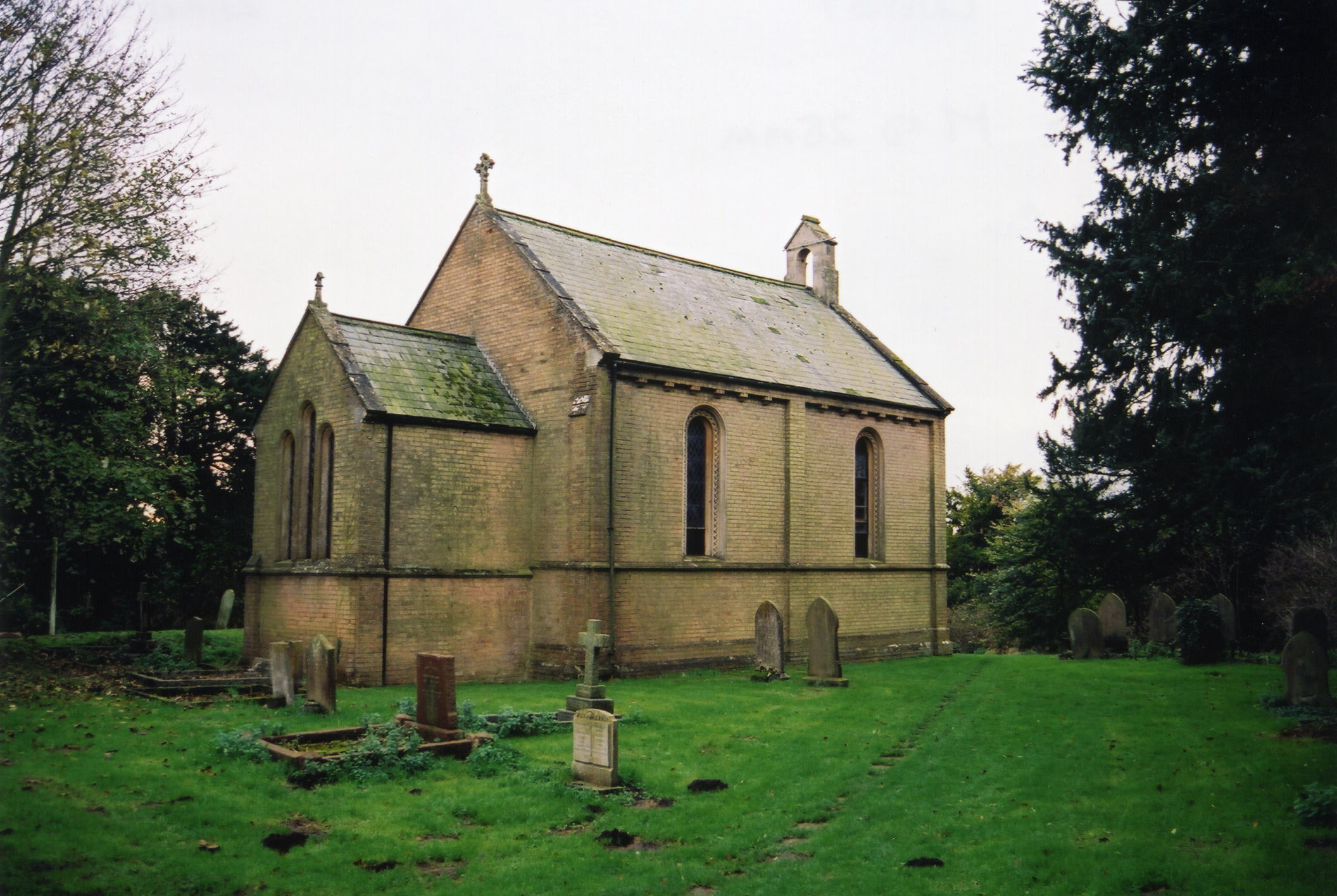
- The Anglican parish church is dedicated to Saint Andrew.
- The present white brick building replaced an older thatched structure. It was built in 1846.
- The church was restored in 1897.
- The church seated about 110 people.
- The church was declared redundant by the Diocese of Lincoln in February, 1990. In October of that same year it was sold for use as a studio/workshop.
- Here is a photo of the church, taken by Ron COLE (who retains the copyright):
- The Anglican parish register dates from 1699.
- The Lincolnshire FHS has published several marriage indexes and a burial index for the Calcewaith and Candleshoe Deanery to make your search easier.
- Check our Church Records page for county-wide resources.
- The parish was in the Alford sub-district of the Spilsby Registration District.
- Check our Civil Registration page for sources and background on Civil Registration which began in July, 1837.
Claxby is a village and a parish about 3 miles south of Alford. The parish covers about 1,000 acres. Well parish is to the north and Willoughby parish to the southeast.
If you are planning a visit:
- By automobile, take the B1196 arterial road south out of Alford to reach Claxby.
- See the Lincolnshire Touring and Holidays page on this site.
- Ask for a calculation of the distance from Claxby (Well) to another place.
- The Manor House, built in 1760, was the seat of the ancient WELL family, and was for a long time the property of the DASHWOODs. It became the vicarage house in 1830.
- See our Maps page for additional resources.
You can see maps centred on OS grid reference TF451714 (Lat/Lon: 53.219448, 0.171919), Claxby (Well) which are provided by:
- OpenStreetMap
- Google Maps
- StreetMap (Current Ordnance Survey maps)
- Bing (was Multimap)
- Old Maps Online
- National Library of Scotland (Old Ordnance Survey maps)
- Vision of Britain (Click "Historical units & statistics" for administrative areas.)
- English Jurisdictions in 1851 (Unfortunately the LDS have removed the facility to enable us to specify a starting location, you will need to search yourself on their map.)
- Magic (Geographic information) (Click + on map if it doesn't show)
- GeoHack (Links to on-line maps and location specific services.)
- All places within the same township/parish shown on an Openstreetmap map.
- Nearby townships/parishes shown on an Openstreetmap map.
- Nearby places shown on an Openstreetmap map.
For a photograph of the Claxby War Memorial and the name on it and the monument in the churchyard, see the Roll of Honour site.
- The parish was in the Wold division of the ancient Calceworth Wapentake in the East Lindsey district in the parts of Lindsey.
- Kelly's 1913 Directopry of Lincolnshire places this parish, perhaps erroneously, in the South Lindsey division of the county.
- You can contact the Claxby St. Andrew Parish Council regarding civic or political issues, but they are NOT staffed or funded to help you with family history searches.
- For today's district governance, see the East Lindsey District Council.
- Bastardy cases would be heard in the Alford petty session hearings every other Tuesday.
- After the Poor Law Amendment Act reforms of 1834, the parish was amalgamated into the Spilsby Poor Law Union.
- The children of this parish attended school in Well and Willoughby.
- See our Schools page for more information on researching school records.