
Hide
Cuxwold (Coxwold)
hide
Hide
hide
Hide
hide
Hide
Hide
hide
Hide
Cuxwold, par. and hamlet, N. Lincolnshire, 6 miles E, of Moortown ry. sta., 1,563 ac., pop. 101; contains Cuxwold Hall.
From: John BARTHOLOMEW's "Gazetteer of the British Isles (1887)"
Hide
The Caistor Library is an excellent resource with a Local History section and a Family History section.
- The parish was in the Caistor sub-district of the Caistor Registration District.
- Check our Census Resource page for county-wide resources.
- The table below gives census piece numbers, where known:
| Census Year | Piece No. |
|---|---|
| 1841 | H.O. 107 / 631 |
| 1851 | H.O. 107 / 2114 |
| 1861 | R.G. 9 / 2392 |
| 1871 | R.G. 10 / 3421 |
| 1881 | R.G. 11 / 3279 |
| 1891 | R.G. 12 / 2621 |
| 1901 | R.G. 13 / 3098 |
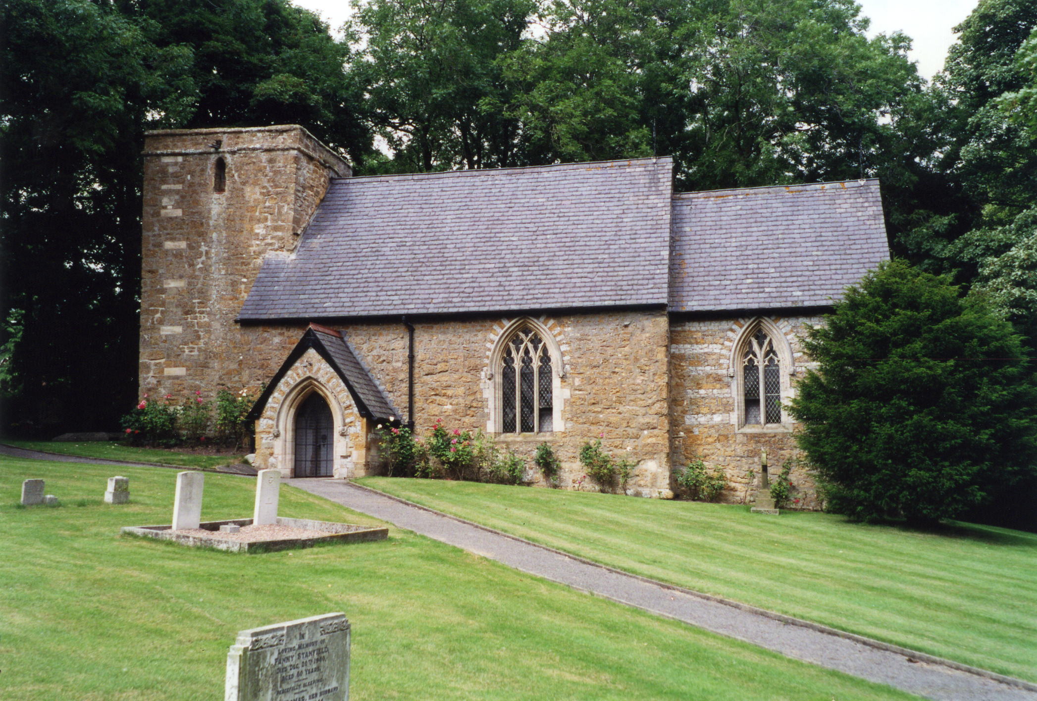
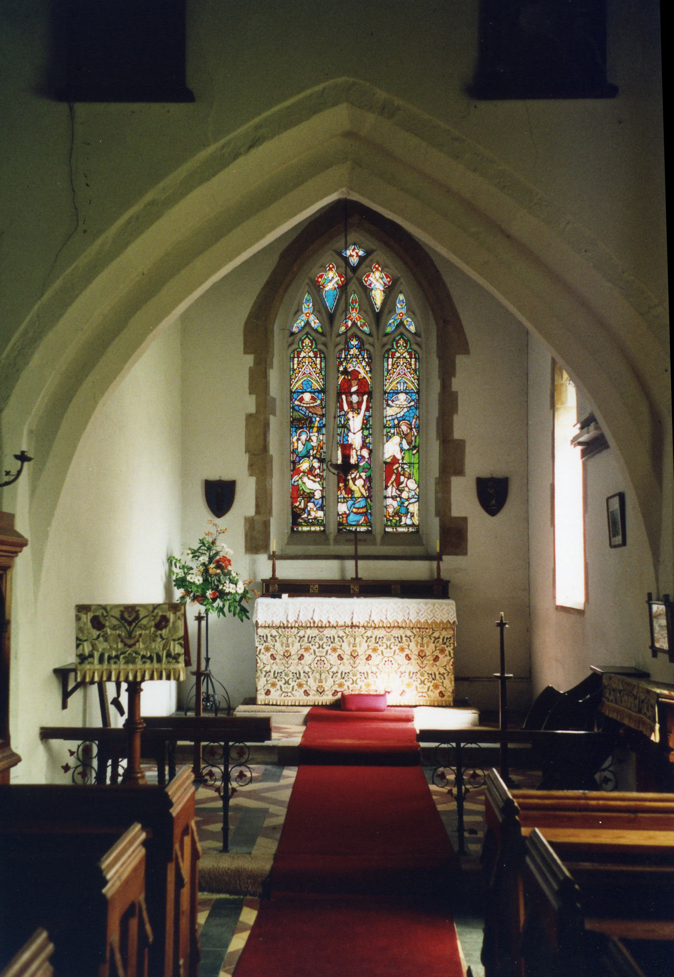
- The Anglican parish church is dedicated to Saint Nicholas.
- The church has a Saxon tower arch.
- The church was restored in 1860.
- The church is a small building, covered in ivy. It is a Grade II* structure with English Heritage.
- The church seats 86 persons.
- A photograph of the Anglican parish church is at the Wendy PARKINSON English Church Photographs site.
- Richard CROFT has a photograph of St. Nicholas Church on Geo-graph, taken in March, 2006.
- John FIRTH has a photograph of the church interior on Geo-graph, taken in July, 2010.
- Here is a photo of the church, taken by Ron COLE (who retains the copyright). followed by another photograph of the church interior (also by Ron COLE):
- The Anglican parish register dates from 1683.
- The Lincolnshire FHS has published several marriage indexes and a burial index for the Westwold Deanery to make your search easier.
- Check our Church Records page for county-wide resources.
- The parish was in the Caistor sub-district of the Caistor Registration District.
- Check our Civil Registration page for sources and background on Civil Registration which began in July, 1837.
This small village and parish lies about 10 miles southwest from Grimsby and just over 4 miles east of Caistor in the Lincolnshire Wolds. The parish covers about 1,700 acres.
If you are planning a visit:
- By automobile, take the A46 trunk road west out of Grimsby and turn south at Swallow.
- See our touring page for visitor services.
- Ask for a calculation of the distance from Cuxwold (Coxwold) to another place.
- Cuxwold Hall was erected in 1860 in the Tudor style. It is a Grade II structure with English Heritage.
- In 1919, Cuxwold Hall was the residence of John Ernest SOWERBY.
- See our Maps page for additional resources.
You can see maps centred on OS grid reference TA172010 (Lat/Lon: 53.49266, -0.234889), Cuxwold (Coxwold) which are provided by:
- OpenStreetMap
- Google Maps
- StreetMap (Current Ordnance Survey maps)
- Bing (was Multimap)
- Old Maps Online
- National Library of Scotland (Old Ordnance Survey maps)
- Vision of Britain (Click "Historical units & statistics" for administrative areas.)
- English Jurisdictions in 1851 (Unfortunately the LDS have removed the facility to enable us to specify a starting location, you will need to search yourself on their map.)
- Magic (Geographic information) (Click + on map if it doesn't show)
- GeoHack (Links to on-line maps and location specific services.)
- All places within the same township/parish shown on an Openstreetmap map.
- Nearby townships/parishes shown on an Openstreetmap map.
- Nearby places shown on an Openstreetmap map.
- Cuxwold had a Royal Flying Corps emergency landing field in World War I.
- There were no flights or missions out of this airfield.
- This place was an ancient parish in Lincoln county and became a modern Civil Parish when those were established.
- The parish was in the ancient Bradley Haverstoe Wapentake in the West Lindsey district in the parts of Lindsey.
- Kelly's 1900 Directory of Lincolnshire places the parish, perhaps erroneously, in the North Lindsey division of the county.
- In April, 1936, the Civil Parish was abolished and all 1,590 acres were amalgamated into Swallow Civil Parish.
- Today's district governance is provided by the West Lindsey District Council.
- Bastardy cases would be heard in the Caistor petty sessional hearings.
- As a result of the 1834 Poor Law Amendment Act, this parish became part of the Caistor Poor Law Union.
- A small parochial school was built here in 1862 for 41 children, but abandoned by 1910.
- The children of this parish attended school in Rothwell parish.
- For more on researching school records, see our Schools Research page.