
Hide
Dembleby
hide
Hide
hide
Hide
hide
Hide
Hide
Hide
- The parish was in the Sleaford sub-district of the Sleaford Registration District.
- Check our Census Resource page for county-wide resources.
- The table below gives census piece numbers, where known:
| Census Year | Piece No. |
|---|---|
| 1841 | H.O. 107 / 617 |
| 1851 | H.O. 107 / 2100 |
| 1861 | R.G. 9 / 2343 |
| 1871 | R.G. 10 / 3350 |
| 1891 | R.G. 12 / 2579 |
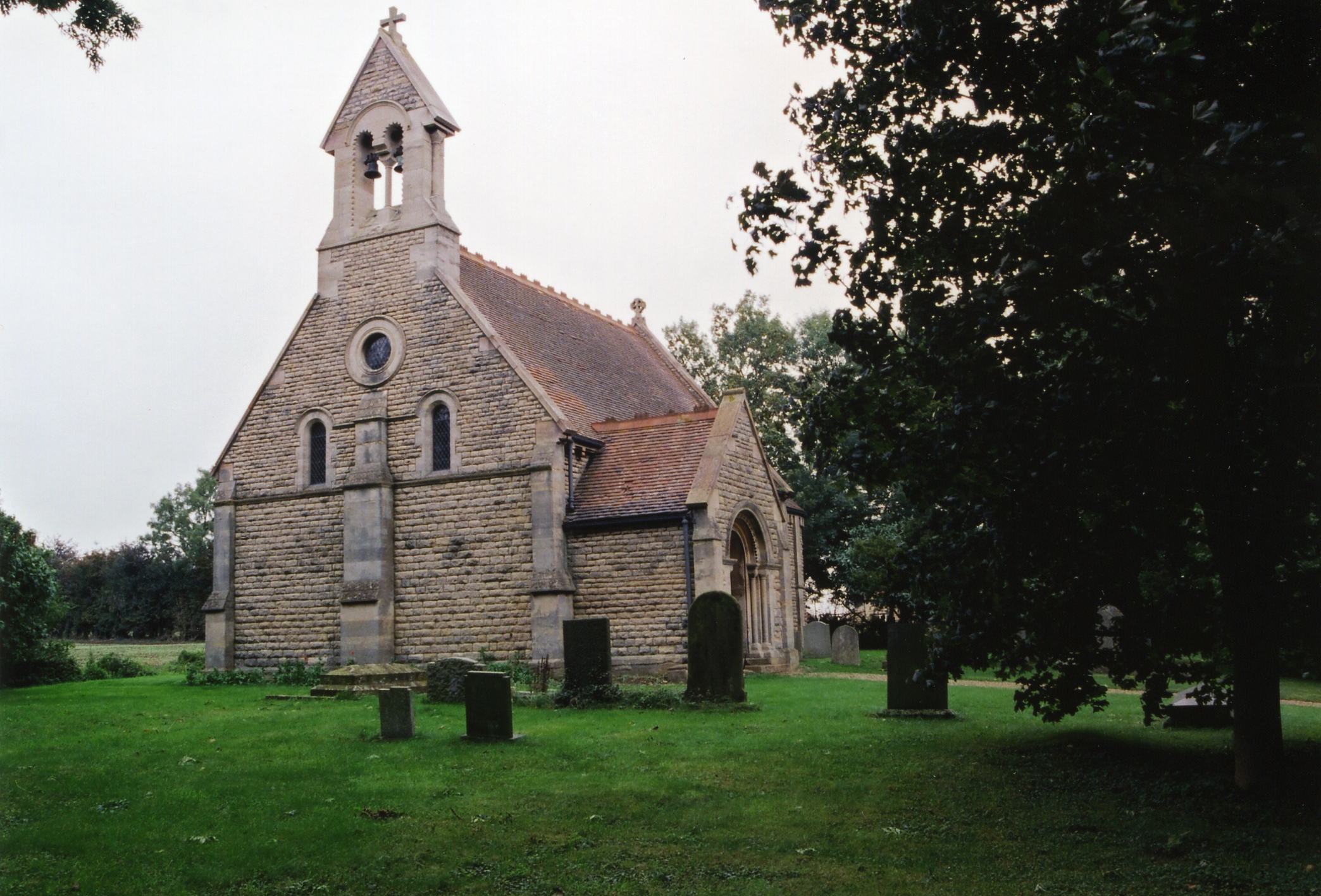
- The Anglican parish church is dedicated to St. Lucia (St. Lucy).
- The old church was taken down in 1867. The new church was built upon a better site in the Norman style. The vestry in the new church was transported from the old church.
- The new church was consecrated in January, 1868.
- The church seats 60, 1868.
- A photograph of Saint Lucia Church is at the Wendy Parkinson English Church Photographs site.
- Here is a photo of the church, taken by Ron Cole (who retains the copyright):
- The Anglican parish registers date from 1553.
- The Lincolnshire FHS has a Loan Library service which has the parish registers on microfiche for Baptisms from 1763 to 1812 and Marriages from 1767 to 1811.
- The LFHS has published several marriage and burial indexes for the Lafford Deanery to make your search easier.
- Check our Church Records page for county-wide resources.
- The parish was in the Sleaford sub-district of the Sleaford Registration District.
- Check our Civil Registration page for sources and background on Civil Registration which began in July, 1837.
Dembleby is both a village and a parish, 9 miles north-east of Grantham and just west of the A15 trunk road. The parish covers about 1,100 acres.
The village is listed as "ancient" in an 1842 White's Directory. A small rivulet runs through the village coming down from Aunsby. If you are planning a visit:
- By automobile, take either the A15 south from Sleaford or the A52 east out of Grantham.
- >See the Lincolnshire Touring and Holidays page on this site.
- Ask for a calculation of the distance from Dembleby to another place.
- Although a sparsely populated parish, Dembleby was the source of excellent limestone from a quarry in the parish.
- See our Maps page for additional resources.
You can see maps centred on OS grid reference TF042377 (Lat/Lon: 52.926343, -0.451899), Dembleby which are provided by:
- OpenStreetMap
- Google Maps
- StreetMap (Current Ordnance Survey maps)
- Bing (was Multimap)
- Old Maps Online
- National Library of Scotland (Old Ordnance Survey maps)
- Vision of Britain (Click "Historical units & statistics" for administrative areas.)
- English Jurisdictions in 1851 (Unfortunately the LDS have removed the facility to enable us to specify a starting location, you will need to search yourself on their map.)
- Magic (Geographic information) (Click + on map if it doesn't show)
- GeoHack (Links to on-line maps and location specific services.)
- All places within the same township/parish shown on an Openstreetmap map.
- Nearby townships/parishes shown on an Openstreetmap map.
- Nearby places shown on an Openstreetmap map.
- This place was an ancient parish in Lincoln county and became a modern Civil Parish when those were established.
- The parish was in the ancient Aswardhurn Wapentake in the North Kesteven district in the parts of Kesteven.
- Kelly's 1900 Directory of Lincolnshire lists the parish as being in the ancient Aveland Wapentake in the North Kesteven district.
- In April, 1931, this Civil Parish was abolished and amalgamated into the new Aunsby and Dembleby Civil Parish.
- For today's district governance, see the North Kesteven District Council.
- Bastardy cases would be heard in the Sleaford petty session hearings every Monday.
- After the 1834 Poor Law Amendment Act reforms, the parish became part of the Sleaford Poor Law Union.
- See our Schools page for more information on researching school records.