
Hide
Eagle
hide
Hide
hide
Hide
hide
Hide
Hide
hide
Hide
Hide
| All Saints, Eagle, Church of England |
- The parish was in the South West sub-district of the Lincoln Registration District.
- Check our Census Resource page for county-wide resources.
- The table below gives census piece numbers, where known:
| Census Year | Piece No. |
|---|---|
| 1841 | H.O. 107 / 618 |
| 1851 | H.O. 107 / 2104 |
| 1861 | R.G. 9 / 2355 |
| 1871 | R.G. 10 / 3365 |
| 1891 | R.G. 12 / 2587 |
- King Stephen established a Commandery of the Knights Hospitallers of St. John here. It functioned as an infirmary.
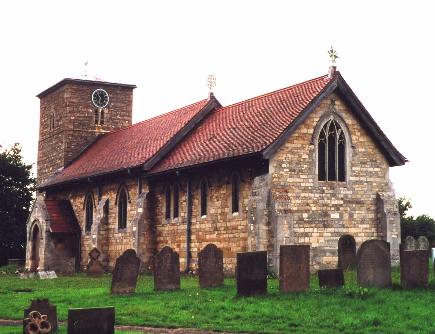
- The Anglican parish church is dedicated to All Saints.
- Some portions of the church are thought to be of Norman origin.
- The church was thoroughly restored in 1904.
- The church seats 130.
- A photograph of All Saints church is at the Wendy Parkinson English Church Photographs site.
- Here is a photo of All Saints Church, taken by Ron Cole (who retains the copyright):
- The Anglican parish register dates from 1588, but there are a few pages with earlier entries.
- The LFHS has published several indexes for the Graffoe Deanery to make your search easier.
- The Wesleyan Methodists built a chapel here, as did the Wesleyan Reformers. For information and assistance in researching these chapels, see our non-conformist religions page.
- Check our Church Records page for county-wide resources.
- The parish was in the South West sub-district of the Lincoln Registration District.
- Check our Civil Registration page for sources and background on Civil Registration which began in July, 1837.
Eagle is both a parish and a village about 8 miles southwest of Lincoln and 11 miles northeast of Newark. The parish covers about 1,470 acres. The southeast corner of the parish is called Eagle Barnsdale and the northeast portion is Eagle Moor.
The village is near the source of seveal rivulets and springs. If you are planning a visit:
- By automobile, take the A46 trunk road south out of Lincoln. Where it meats the A1434 arterial road at Thorpe, turn right and drive about 2 miles west to Eagle.
- Stop by the Eagle Village Hall and ask to see a schedule of forth-coming events.
- You might check our transport page for bus and car hire options.
- Check our Touring page for additional resources.
- Ask for a calculation of the distance from Eagle to another place.
- See our Maps page for additional resources.
You can see maps centred on OS grid reference SK877673 (Lat/Lon: 53.195184, -0.688362), Eagle which are provided by:
- OpenStreetMap
- Google Maps
- StreetMap (Current Ordnance Survey maps)
- Bing (was Multimap)
- Old Maps Online
- National Library of Scotland (Old Ordnance Survey maps)
- Vision of Britain (Click "Historical units & statistics" for administrative areas.)
- English Jurisdictions in 1851 (Unfortunately the LDS have removed the facility to enable us to specify a starting location, you will need to search yourself on their map.)
- Magic (Geographic information) (Click + on map if it doesn't show)
- GeoHack (Links to on-line maps and location specific services.)
- All places within the same township/parish shown on an Openstreetmap map.
- Nearby townships/parishes shown on an Openstreetmap map.
- Nearby places shown on an Openstreetmap map.
There is a photograph, taken by Richard Croft, of the War Memorial church gate to All Saint's Church at the Geo-graph site.
The War Memorial Arch, which dates from circa 1918, is a Grade II listed structure with British Heritage.
The Newark Great War Bulletin of 27 September, 1915 tells us that teenage soldier Anthony ("Nattie") WOODEND of Eagle Hall had died in battle in the front-line trenches. He had enlisted in the Kings' Royal Rifles just the prior November. He is remembered on the Menin Gate Memorial and his date of death is given as 9 August 1915.
Tim HEATON tells us: The village's name derives from the Anglo-Saxon 'Aycle' meaning 'oak wood'.
- This place was an ancient parish in Lincoln county and became a modern Civil Parish when those were established.
- The parish was once far larger, covering 2,450 acres.
- The parish was in the higher division of the ancient Boothby Graffoe Wapentake in the North Kesteven division of the county, in the parts of Kesteven.
- Eagle Hall, formerly extra-parochial, was a separate parish in 1881.
- In 1886, Eagle Woodhouse, formerly extra-parochial, was amalgamated with Eagle.
- On April 1st, 1931, this parish was abolished and was amalgamated into the new Eagle and Swinethorpe Civil Prish.
- You may contact the local Parish Council regarding civic or political issues, but they are NOT staffed to assist you with family history searches.
- For today's district governance, see the North Kesteven District Council.
- Bastardy cases would be heard in the Lincoln South petty session hearings.
- The Moor here was enclosed in 1841.
- As a result of the 1834 Poor Law Amendment Act, the parish became part of the Lincoln Poor Law Union.
- A 7-member schoolboard was formed on 1 May 1877. In 1878 they erected a school here for up to 100 children.
- See our Schools page for more information on researching school records.