
Hide
Faldingworth
hide
Hide
hide
Hide
hide
Hide
Hide
Hide
Ian S. has a photograph of the Churchyard on Geo-graph, taken in May, 2018.
- The parish was in the North-East sub-district of the Lincoln Registration District.
- Check our Census Resource page for county-wide resources.
- The table below gives census piece numbers, where known:
Census
YearPiece No. 1841 H.O. 107 / 633 1861 R.G. 9 / 2363 1871 R.G. 10 / 3376
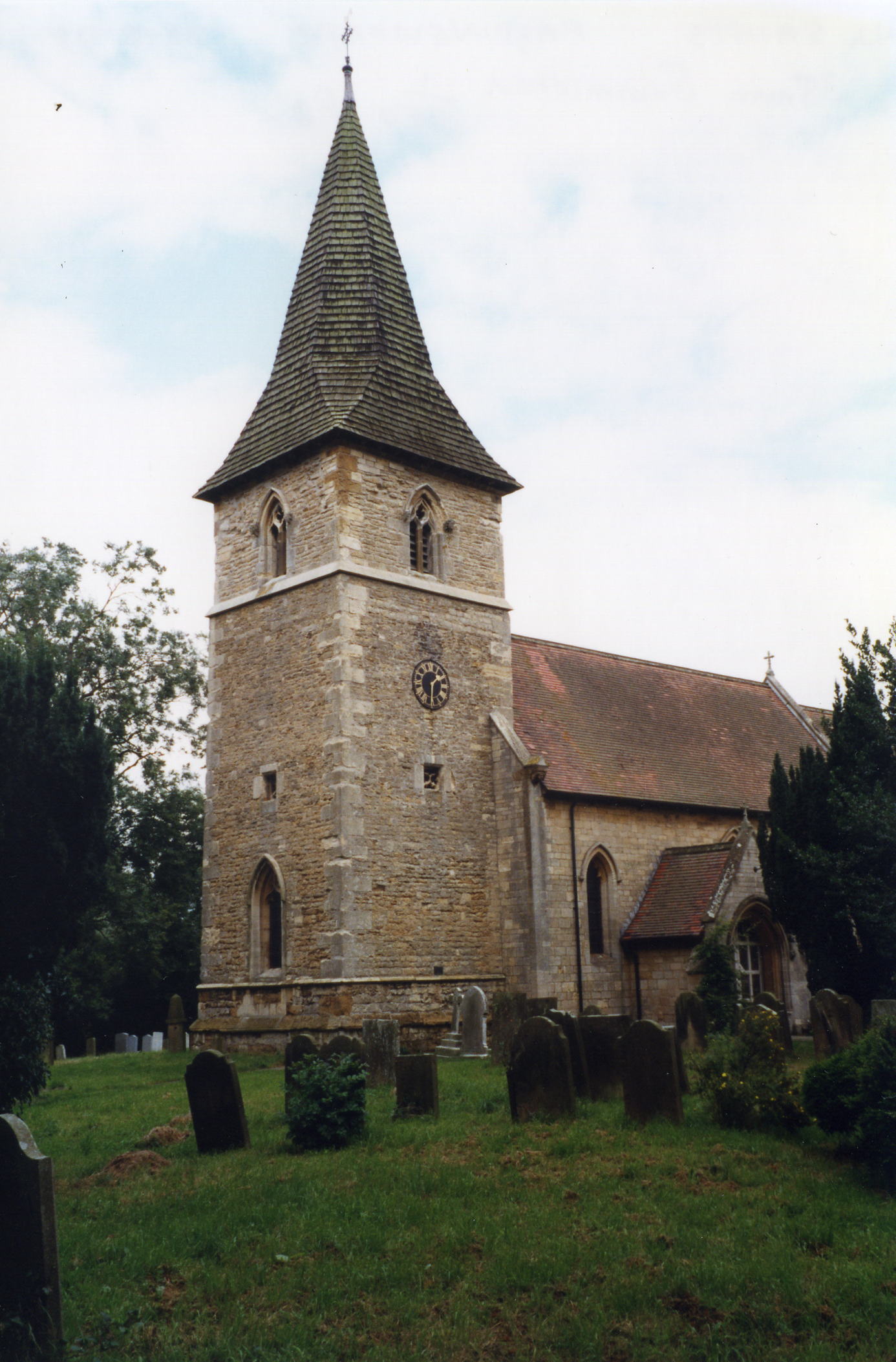
- The Anglican parish church is dedicated to All Saints.
- The church was rebuilt in 1814 and again in 1890-91.
- The church seats 150 persons.
- There is a photograph of the Anglican parish church on the Wendy PARKINSON Church Photos web site.
- David HITCHBORNE has a photograph of All Saintst Church on Geo-graph, taken in April, 2004.
- Here is a photo of All Saints Church, taken by Ron COLE (who retains the copyright):
- The Anglican parish register dates from 1549.
- We have a small Parish Register Extract text file. Your additions will be welcome.
- The LFHS has published several marriage indexes and a burial index for the Westwold Deanery to make your search easier.
- The United Methodists and the Wesleyan Methodists each had a chapel here.
- Wendy PARKINSON has a photograph of the Methodist Church on Geo-graph, taken in July, 2005.
- For information and assistance in researching these chapels, see our non-conformist religions page.
- Check our Church Records page for county-wide resources.
- The parish was in the North-East sub-district of the Lincoln Registration District.
- Check our Civil Registration page for sources and background on Civil Registration which began in July, 1837.
Faldingworth is both a village and a parish 11 miles north-east of the city of Lincoln and 5 miles south-west of Market Rasen. Spridlington parish lies to the west, Friesthorpe parish to the south-east and the village of Middle Rasen to the north. Faldingworth parish covers just over 2,500 acres.
If you are planning a visit:
- Take the A46 trunk road between Lincoln and Middle Rasen. The village is about nine miles outside of Lincoln and only three miles from Middle Rasen.
- See our touring page for more sources.
- Ask for a calculation of the distance from Faldingworth to another place.
- J. THOMAS has a photograph of the Coach and Horses Pub on High Street on Geo-graph, taken in September, 2014.
- See our Maps page for additional resources.
You can see maps centred on OS grid reference TF066847 (Lat/Lon: 53.348457, -0.4001), Faldingworth which are provided by:
- OpenStreetMap
- Google Maps
- StreetMap (Current Ordnance Survey maps)
- Bing (was Multimap)
- Old Maps Online
- National Library of Scotland (Old Ordnance Survey maps)
- Vision of Britain (Click "Historical units & statistics" for administrative areas.)
- English Jurisdictions in 1851 (Unfortunately the LDS have removed the facility to enable us to specify a starting location, you will need to search yourself on their map.)
- Magic (Geographic information) (Click + on map if it doesn't show)
- GeoHack (Links to on-line maps and location specific services.)
- All places within the same township/parish shown on an Openstreetmap map.
- Nearby townships/parishes shown on an Openstreetmap map.
- Nearby places shown on an Openstreetmap map.
- The RAF opened an airfield here in the Summer of 1943.
- Initially, the field was a decoy airfield named "Toft Grange".
- In addition to British units, the field was home to two squadrons of Free Polish units, the 300 and the 305. Both were bombing squadrons.
- J. HANNAN-BRIGGS has a photograph of the Church Window Memorial to the flying corps, taken in September, 2014.
- In 1957 the field resembeld a high-security prison. It had become host to nuclear bombers armed with the H-bomb.
- The RAF closed the field in 1972.
- There is a history of Faldingworth Airfield at the Parish Council site.
- There is a memorial to the Polish units at Faldingworth, but no names are on it.
- The church holds a memorial book with photographs of personnel who served at RAF Faldingworth.
- This place was an ancient parish in Lincolnshire and became a modern Civil Parish when those were established.
- The parish was in the ancient Lawress Wapentake in the West Lindsey district in the parts of Lindsey.
- In March, 1887, a detached portion of this parish was added to Friesthorpe parish by a Local Government Order.
- You can contact the local Parish Council about civic or political issues, but they are NOT staffed to answer family history questions.
- Consider dropping by the Village Hall and asking for a schedule of forth-coming events. Talks on local history may be shown. J. THOMAS has a photograph of the Village Hall on Geo-graph, taken in September, 2014. The Hall is on High Street.
- Today's district governance is provided by the West Lindsey District Council.
- Bastardy cases would be heard on the 1st Tuesday each month at the Market Rasen petty session hearings.
- The Earl Brownlow left a charity of £6 and 12s yearly for the parish poor.
- As a result of the Poor Law Amendment Act reforms of 1834, the parish became part of the Lincoln Poor Law Union.
- A Council School was built here in 1828, then enlarged in 1876 and again in 1889. It serves the parishes of Faldingworth, Buslingthorpe, Freisthorpe and Snarford.
- J. THOMAS has a photograph of the Village School on Geo-graph, taken in September, 2014.
- For more on researching school records, see our Schools Research page.