
Hide
Great Steeping
hide
Hide
hide
Hide
hide
Hide
Hide
Hide
- The parish was in the Spilsby sub-district of the Spilsby Registration District.
- Check our Census Resource page for county-wide resources.
- The table below gives census piece numbers, where known:
| Census Year | Piece No. |
|---|---|
| 1851 | H.O. 107 / 2109 |
| 1861 | R.G. 9 / 2374 |
| 1871 | R.G. 10 / 3391 |
| 1891 | R.G. 12 / 2603 |
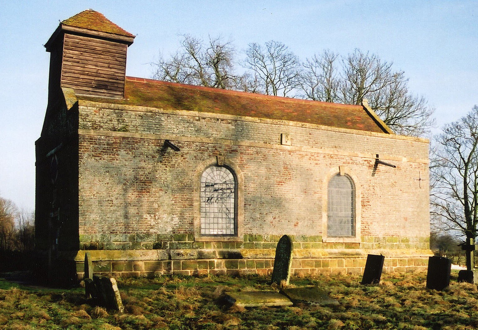
- The Anglican parish church is dedicated to All Saints.
- The church was partially rebuilt in 1748 and restored in 1908.
- A new All Saints Church was built in 1891 of red brick with stone facings.
- The Diocese of Lincoln declared this church redundant in August, 1973.
- There is a photograph of All Saints church on the Wendy PARKINSON Church Photos web site.
- Here is a photo of All Saints Church, taken by Ron COLE (who retains the copyright):

- Here is a photo of the old All Saints Church, taken by Ron COLE (who retains the copyright):
- The Anglican parish register dates from 1711.
- The Lincolnshire FHS has published several marriage indexes and a burial index for the Bolingbroke Deanery to make your search easier.
- A Wesleyan Methodist chapel and a Baptist chapel were built here in the hamlet of Monksthorpe.
- David HITCHBORNE has a photograph of the Wesleyan Chapel on Geo-graph, taken in 2007.
- There is a list of Baptist ministers and burials for Monksthorpe.
- Richard CROFT has a photograph of the Baptist Chapel in Monksthorpe on Geo-graph, taken in 2009.
- For information and assistance in researching these chapels, see our non-conformist religions page.
- Check our Church Records page for county-wide resources.
- The parish was in the Spilsby sub-district of the Spilsby Registration District.
- Check our Civil Registration page for sources and background on Civil Registration which started in July, 1837.
Great Steeping is a parish 123 miles north of London, 3 miles east-south-east of Spilsby and west of Skegness. Halton Holgate parish lies to the west. The parish includes the hamlet of Monksthorpe and covers about 1,750 acres.
Great Steeping village lies north and east of the Steeping River (also known as The River Limb). If you are considering a visit to the parish:
- Take the B1195 trunk road east out of Spilsby.
- See our touring page for more sources.
- Ask for a calculation of the distance from Great Steeping to another place.
- See our "Maps" page for additional resources.
You can see maps centred on OS grid reference TF440644 (Lat/Lon: 53.157168, 0.151663), Great Steeping which are provided by:
- OpenStreetMap
- Google Maps
- StreetMap (Current Ordnance Survey maps)
- Bing (was Multimap)
- Old Maps Online
- National Library of Scotland (Old Ordnance Survey maps)
- Vision of Britain (Click "Historical units & statistics" for administrative areas.)
- English Jurisdictions in 1851 (Unfortunately the LDS have removed the facility to enable us to specify a starting location, you will need to search yourself on their map.)
- Magic (Geographic information) (Click + on map if it doesn't show)
- GeoHack (Links to on-line maps and location specific services.)
- All places within the same township/parish shown on an Openstreetmap map.
- Nearby townships/parishes shown on an Openstreetmap map.
- Nearby places shown on an Openstreetmap map.
- David HITCHBORNE has a photograph of the War Memorial for World War I in the churchyard on Geo-graph, taken in 2004.
- The RAF built an airfield here during World War II and it opened for action on 20 Sept. 1943 as a satellite airfield to RAF East Kirkby. It soon became a full station in its own right under the name "RAF Spilsby".
- Wikipedia tells us that "In 1944 a Spilsby based 207 Squadron airman, Flying Officer Denys Street was one of the real escapees from the German prisoner of war camp Stalag Luft III and was one of the fifty executed by the Gestapo in the aftermath of the mass escape that was later filmed as The Great Escape."
- On the 10th of April, 1944, an accident in a fusing shed caused a 1,000 lb bomb to explode, killing 10 men. This incident is memorialized in the RAF Spilsby Memorial.
- Peter SKYNNER has a photograph of the RAF Spilsby Memorial on Geo-graph, taken in 2012. The memorial is located in Great Steeping at the site of a bomb dump.
- He also has a photograph of the Memorial plaque on Geo-graph, taken in 2012.
- The airfield was closed in 1946 and placed on "care and maintenance." The airfield saw some use in the Cold War period after the Korean War, but was eventually torn up in the late 1970s.
For a close-up of the Great Steeping War Memorial and a list of the names from WWI, see the Roll of Honour site.
- The parish was in the Wold division of the ancient Candleshoe Wapentake in the East Lindsey district in the parts of Lindsey.
- Kelly's 1900 Directory of Lincolnshire lists the parish, perhaps erroneously, as being in the South Lindsey division of the county.
- For today's district governance, see the East Lindsey District Council.
- Bastardy cases would be heard in the Spilsby petty session hearings every other Monday.
- As a result of the 1834 Poor Law Amendment Act, the parish became part of the Spilsby Poor Law Union.
- A Public Elementary School was built here in 1859 to hold 60 students.
- The parish formed a school board in August, 1876.
- For more on researching school records, see our Schools Research page.