
Hide
Grimoldby
hide
Hide
hide
Hide
hide
Hide
Hide
Hide
The Library at Louth will prove useful in your research.
Richard CROFT has a photograph of the 19th century lychgate on Geo-graph, taken in October, 2010.
Ian S. has a photograph of The graveyard at St. Edith's on Geo-graph, taken in November, 2013.
- The parish was in the Saltfleet sub-district of the Louth Registration District.
- Check our Census Resource page for county-wide resources.
- The table below gives census piece numbers, where known:
Census
YearPiece No. 1841 H.O. 107 / 635 1851 H.O. 107 / 2112 1861 R.G. 9 / 2385 1871 R.G. 10 / 3407 1891 R.G. 12 / 2610
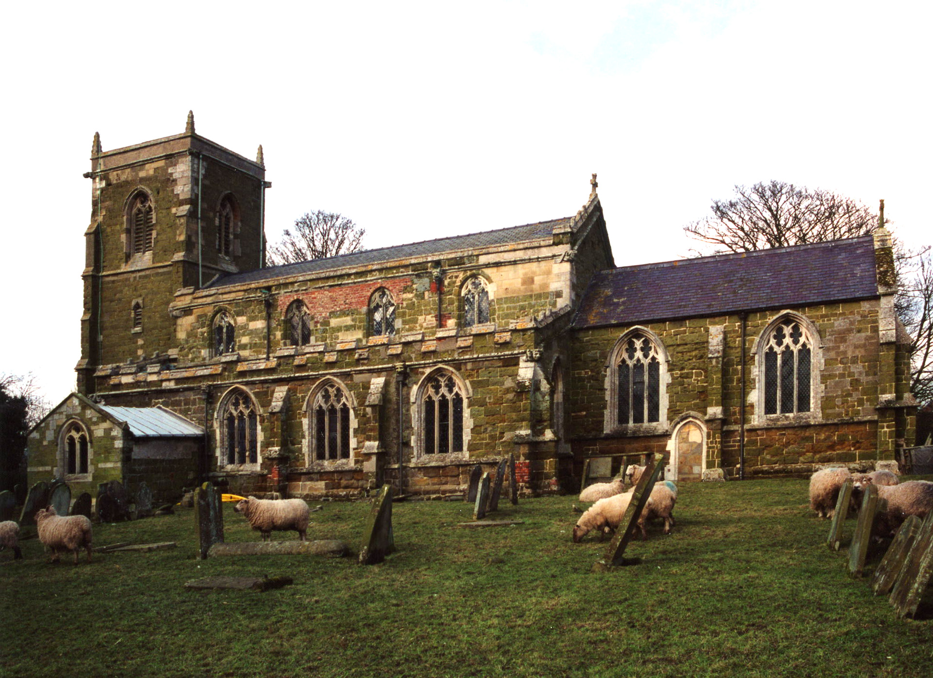
- The Anglican parish church is dedicated to Saint Edith.
- The church was built of stone around 1300.
- In 1876 the chancel was restored.
- The church is a Grade I listed building with British Heritage.
- The church seats about 220.
- A photograph of the Anglican parish church is at the Wendy PARKINSON English Church Photographs site.
- Another photograph of St. Edith's church is at the FLICKR site.
- Here is a photo of St. Edith's church, taken by Ron COLE (who retains the copyright):
- The Anglican parish register dates from 1558.
- The Lincolnshire FHS has published several Marriage indexes and a Burial index for the Louthesk Deanery to make your search easier.
- A Weslyean Methodist chapel was built here, along with the Primitive Methodists and the United Methodists.
- Ian S. has a photograph of the Former Methodist Church on Geo-graph, taken in November, 2013. At that time, the building was "For Sale".
- For information and assistance in researching these chapels, see our non-conformist religions page.
- Check our Church Records page for county-wide resources.
- The parish was in the Saltfleet sub-district of the Louth Registration District.
- Check our Civil Registration page for sources and background on Civil Registration which began in July, 1837.
Grimoldby is a village and a parish 5 miles east of Louth in Lincolnshire. The parish of covers over 1,800 acres.
If you are planning a visit:
- By automobile, take the B1200 arterial road south and east out of Louth toward Saltfleetby. Grimoldby is just north off of the roadway about halfway to Saltfleetby.
- Grimoldby used to have a railway station and train service.
- There is a caravan park just west of the village.
- John FIRTH has a photograph of the Road through Whispering Trees at Grimoldby Grange (just north of the village) on Geo-graph, taken in June, 2012.
- Visit our touring page for visitor services.
- Ask for a calculation of the distance from Grimoldby to another place.
- See our Maps page for additional resources.
You can see maps centred on OS grid reference TF391884 (Lat/Lon: 53.374266, 0.089951), Grimoldby which are provided by:
- OpenStreetMap
- Google Maps
- StreetMap (Current Ordnance Survey maps)
- Bing (was Multimap)
- Old Maps Online
- National Library of Scotland (Old Ordnance Survey maps)
- Vision of Britain (Click "Historical units & statistics" for administrative areas.)
- English Jurisdictions in 1851 (Unfortunately the LDS have removed the facility to enable us to specify a starting location, you will need to search yourself on their map.)
- Magic (Geographic information) (Click + on map if it doesn't show)
- GeoHack (Links to on-line maps and location specific services.)
- All places within the same township/parish shown on an Openstreetmap map.
- Nearby townships/parishes shown on an Openstreetmap map.
- Nearby places shown on an Openstreetmap map.
- There is a plaque in St. Edith's church to Pilot Officer Peter Fox who died in World War II.
- There is a War Memorial column standing outside St. Edith's church. John READMAN has a photograph of the War Memorial at Geo-graph, taken in 2005.
- Ian S. also has a photograph of the War Memorial plaque on Geo-graph, taken in November, 2013.
These ten names are on the War Memorial:
G. BRUMBY R. SMITH
G. ENDERBY J. SMITH
G. PARRISH W. TURNER
A. SIMPSON A. TURNER
A. SMITH E. VAMPLEW
- In the 1086 Domesday Book the village is given as Grimalbi.
[A. D. Mills, "A Dictionary of English Place-Names," Oxford University Press, 1991].
- This place was an ancient parish in Lincolnshire and became a modern Civil Parish when those were established.
- The parish was in the Middle Marsh division of the ancient Louth Eske Wapentake in the East Lindsey district in the parts of Lindsey.
- The parish has joined with Manby to form a united Parish Council. You are welcome to contact them regarding civil or political matters, but they are NOT staffed to assist with family history research.
- Grimoldby and Manby share a Village Hall, Steve FAREHAM has a photograph of the Village Hall on Geo-graph, taken in May, 2016.
- For today's district governance, see the East Lindsey District Council.
- Bastardy cases would be heard in the Louth Eske Petty Session Court every other Wednesday.
- The Common Lands were enclosed here in 1767.
- After the Poor Law Amedment Act of 1834, this parish became part of the Louth Poor Law Union.
- A Public Elementary School for both Grimoldby and Manby was built here in 1871 to hold 114 children.
- For more on researching school records, see our Schools Research page.