
Hide
Hatton
hide
Hide
hide
Hide
hide
Hide
Hide
Hide
- The parish was in the Wragby sub-district of the Horncastle Registration District.
- Check our Census Resource page for county-wide resources.
- The table below gives census piece numbers, where known:
| Census Year | Piece No. |
|---|---|
| 1841 | H.O. 107 / 636 |
| 1861 | R.G. 9 / 2365 |
| 1871 | R.G. 10 / 3379 |
| 1881 | R.G. 11 / 3247 |
| 1891 | R.G. 12 / 2597 |
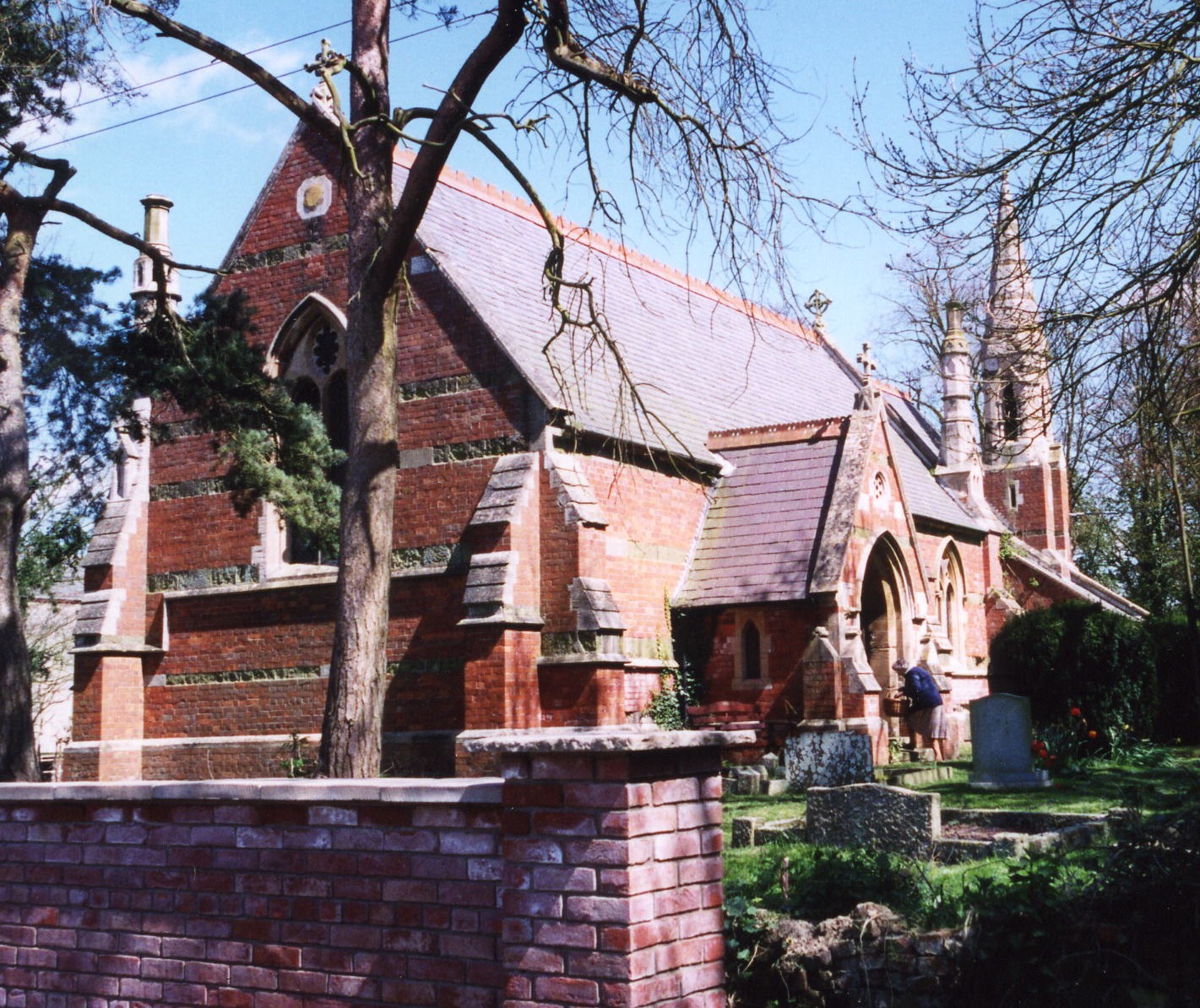
- The Anglican parish church is dedicated to Saint Stephen.
- The current church was built in 1870 of red brick.
- The old church at Hatton was demolished in 1870, and there is a picture of the old church building inside the present one.
- The church seats 150.
- Richard CROFT has a photograph of St. Stephen's Church on Geo-graph, taken in 2006.
- Here is a photo of Saint Stephen's Church, taken by (and copyright of) Ron COLE.
- The Anglican parish register dates from the year 1552.
- There are also register entries for this parish in Baumber for 1695-1799.
- The LFHS has published several marriage indexes for the Horncastle Deanery to make your search easier.
- Check our Church Records page for county-wide resources.
- The parish was in the Wragby sub-district of the Horncastle Registration District.
- Check our Civil Registration page for sources and background on Civil Registration which began in July, 1837.
Hatton is both a village and a parish in the Wolds, six miles north-west of Horncastle and about two and half miles west of Wragby. Panton parish lies to the north and Minting to the south. The parish covers about 1,800 acres.
If you are planning a visit:
- The National Transmission System has one of its twenty six compressor stations just off the A158 west of the village at Hatton Bridge driven by three gas turbines.
- Visit our touring page for more sources.
- Ask for a calculation of the distance from Hatton to another place.
- The New Midge Inn, south of the village on the A158, was a great place to exchange gossip and catch up on the latest news. It is now closed. The web page author has a report that it has been sold recently.
- Richard CROFT has a photograph of the New Midge Inn on Geo-graph, taken in 2007.
- These are the names associated with the New Midge (Often listed as just the "Midge Inn") in various directories):
| Year | Person |
|---|---|
| 1842 | Thomas HATTER, vict. |
| 1861 | Richardson MARSHALL |
| 1868 | John WINN, brewer |
| 1872 | -- not listed -- |
| 1882 | William CONEY |
| 1885 | Walker BOULTON |
| 1900 | Walter BOULTON, carrier |
| 1913 | Frank HOULDEN |
| 1930 | Geo. HARRISON |
William CONEY, listed above, was born in Benniworth, LIN, circa 1824. He was married to Charlotte.
- See our Maps page for additional resources.
You can see maps centred on OS grid reference TF178768 (Lat/Lon: 53.27553, -0.235262), Hatton which are provided by:
- OpenStreetMap
- Google Maps
- StreetMap (Current Ordnance Survey maps)
- Bing (was Multimap)
- Old Maps Online
- National Library of Scotland (Old Ordnance Survey maps)
- Vision of Britain (Click "Historical units & statistics" for administrative areas.)
- English Jurisdictions in 1851 (Unfortunately the LDS have removed the facility to enable us to specify a starting location, you will need to search yourself on their map.)
- Magic (Geographic information) (Click + on map if it doesn't show)
- GeoHack (Links to on-line maps and location specific services.)
- All places within the same township/parish shown on an Openstreetmap map.
- Nearby townships/parishes shown on an Openstreetmap map.
- Nearby places shown on an Openstreetmap map.
For a photograph of the Hatton War Memorial plaque and a list of the names on it, see the Roll of Honour site.
The village was fortunate to have lost only one person in each war.
- This place was an ancient parish in Lincolnshire and became a modern Civil Parish when those were established.
- The parish was in the ancient Wraggoe Wapentake in the East Lindsey district and in the parts of Lindsey.
- For today's district governance, see the East Lindsey District Council.
- As a result of the 1834 Poor Law Amendment Act reforms, the parish became part of the Horncastle Poor Law Union.
- Bastardy cases would be heard in the Wragby petty session hearings.
Year Inhabitants 1801 104 1811 133 1821 165 1831 165 1841 203 1851 197 1871 207 1881 178 1891 157 1901 156 1911 166 1921 144 1931 130
- A "mixed" Public Elementary School was built here prior to 1900.
- For more on researching school records, see our Schools Research page.